We had a lot of rain in the overnight hours through this morning. As of this writing our area has had about 1-2″ of rain. Some locations over North Carolina had over 3″.
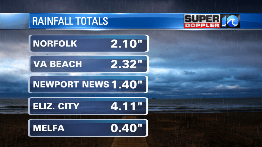
My weather watcher (Greg in Currituck, NC) said that the crops were hurting recently due to the drought. Then this morning he said there was some flooding in the fields. I feel for him and the other farmers out there. It’s gotta be tough. Anyway, he reported 5.5″ of rain over the last 48 hours, and more rain was falling.
Rain showers will become more scattered today. The sun may even pop out for a bit. The wind will be out of the south again. So more deep moisture will stream into the region. Dew points are near 70. High temperatures will rise to the low 80s this afternoon. There is a cool front to the west that is slowly creeping east, but it is losing the coolness behind it.
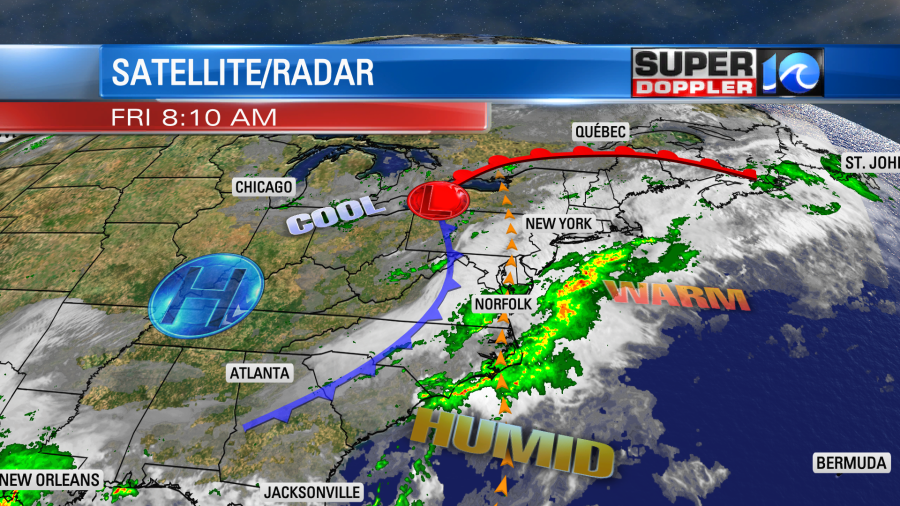
In fact. The heat is actually starting to bounce back behind the front over the north/central U.S.
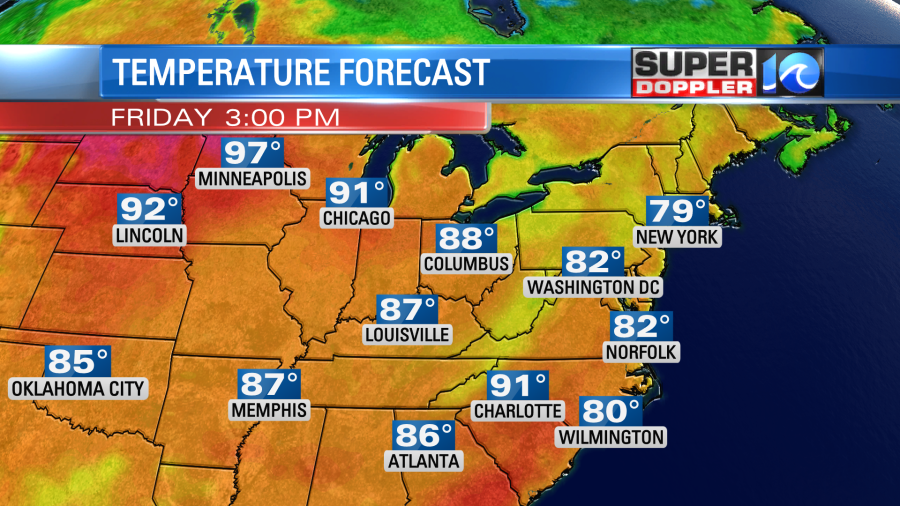
There will be some record heat between the Dakotas and Minnesota. They may hit 100 degrees up there between today and tomorrow. We won’t be that hot today, but the heat and humidity that we will have will create some instability in the region. Also, there is an upper level low overhead. So we’ll have some scattered showers and storms redeveloping this afternoon. Some of those could be strong to severe.
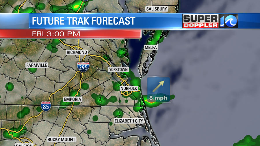
Brief heavy rain and strong gusty winds will be the main threats. There could be some small hail as well. The showers and storms will continue into the evening. The front will be moving into the area during that time. However, it will be more of a wind-shift than a cold front. So it will only dry us out a bit going into the weekend.
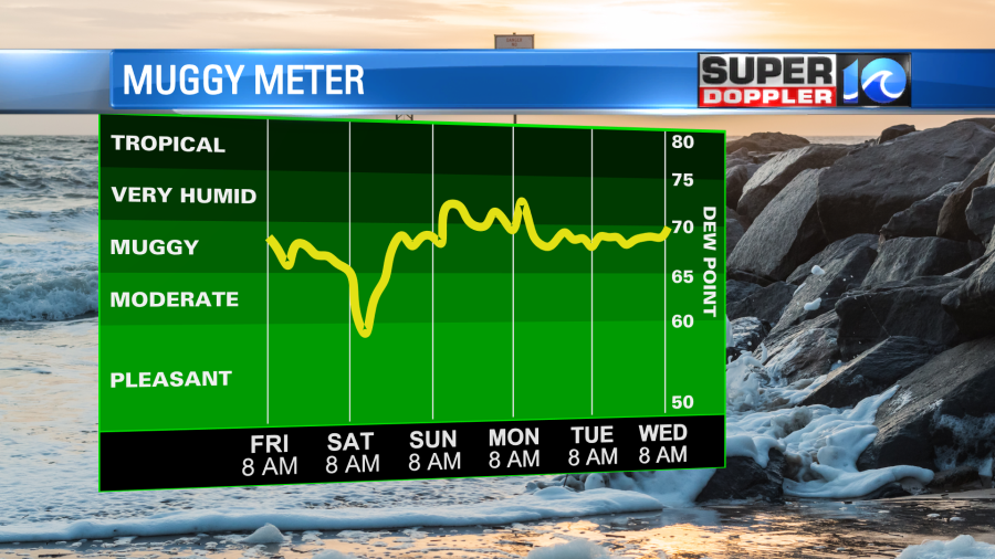
We should dry out enough that the chance for rain will drop out this weekend. Our Future Trak model hints at some isolated showers tomorrow, but I think it’s overdone and that they would be mainly to the south. I am calling for a stray shower or storm over northeast North Carolina, but it’s a low chance. Temps are going to heat up. We’ll be in the upper 80s to low 90s both days. It should be some great beach weather! The rip current threat should be low.
Early next week we’ll have some very Summery weather even though Summer officially starts on September 22nd. We’ll be partly cloudy with isolated pop-up showers and storms in the afternoons. High temps will be in the upper 80s to low 90s.
Meteorologist: Jeremy Wheeler


