In the short-term the weather looks quiet, hot, and humid. We’ve had some nice dry weather in the area lately. Yesterday, the humidity went up a bit, but it still wasn’t too bad. However, it will be hotter and more humid today and tomorrow. High pressure is in the area today.
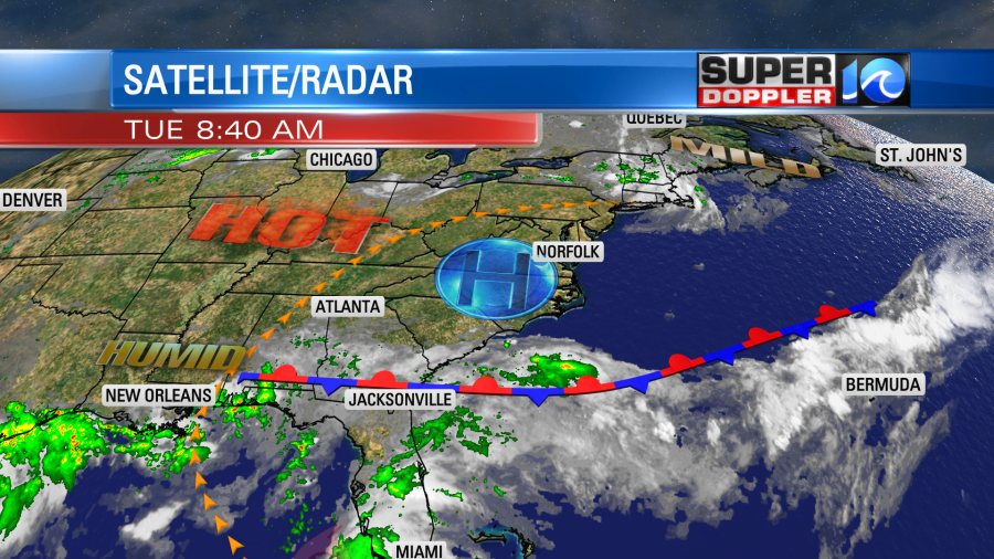
We’ll be partly cloudy with high temps in the low-mid 90s. The heat index will be in the mid-upper 90s. Tomorrow we we’ll have similar weather. However, the high temps will be more in the mid 90s.
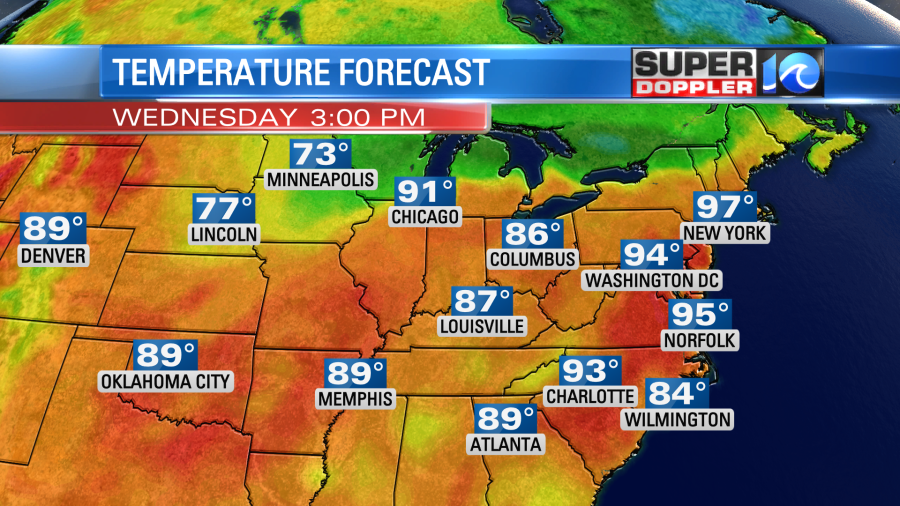
The heat index will be near 100. There may be some isolated showers or storms later in the day.
On Thursday we’ll have more clouds, and rain will be moving in from Elsa.
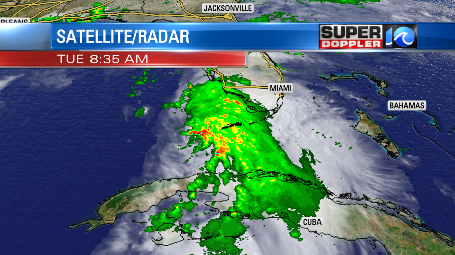
Elsa moved over Cuba last night, but it was only over land for a little bit. So the storm hardly weakened at all.
As of 2 p.m. Tuesday, Elsa was nearing hurricane strength again, with a hurricane warning issued for a portion of the Florida gulf coast. The storm was located about 95 miles to the northwest of Key West. Maximum sustained winds around the center were 70 mph.
Rain and gusty winds are moving over those islands, but the center will miss the Keys. Through the day Elsa will move generally to the north. The rain will extend over southern Florida, but the strongest winds should stay offshore.
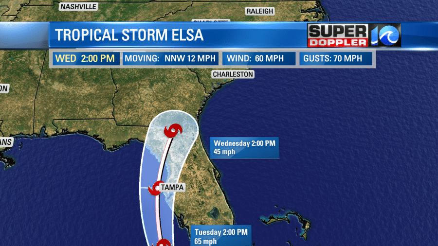
There is some dry air just to the west of the system. Plus, there is also some moderate wind shear. However, it is over some fairly warm water with temps just above 80 degrees. So the system could strengthen a bit more which could allow it to become a minimal hurricane for a time, but it shouldn’t strengthen much more than that. The forecast track is very close to Tampa, but the most likely path is just offshore. Keep in mind that the strongest winds are usually to the right of the path.
During the day Wednesday, Elsa is expected to move into north Florida. It will then move northeast as a tropical storm. By Thursday the system will be crossing a lot of land as it crosses the Carolinas and heads towards eastern Virginia. The track is becoming more and more likely to move over our viewing area. This will be probably be some time late Thursday into Thursday night. Then the official track has it moving offshore early Friday morning.
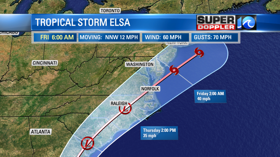
The models are in pretty good agreement over the next 2 days. They are also in fair agreement that Elsa will pass over Eastern Virginia.

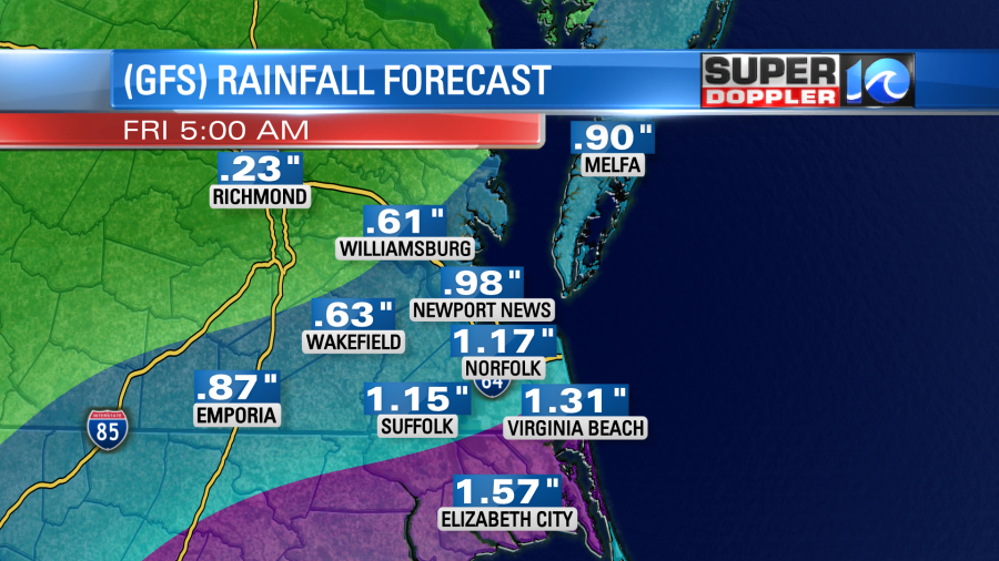
However, there is still some disagreement on the timing and the strength of the storm. The GFS has been very consistent over the last couple of days. It has the system moving through our viewing area late Thursday into Thursday night.
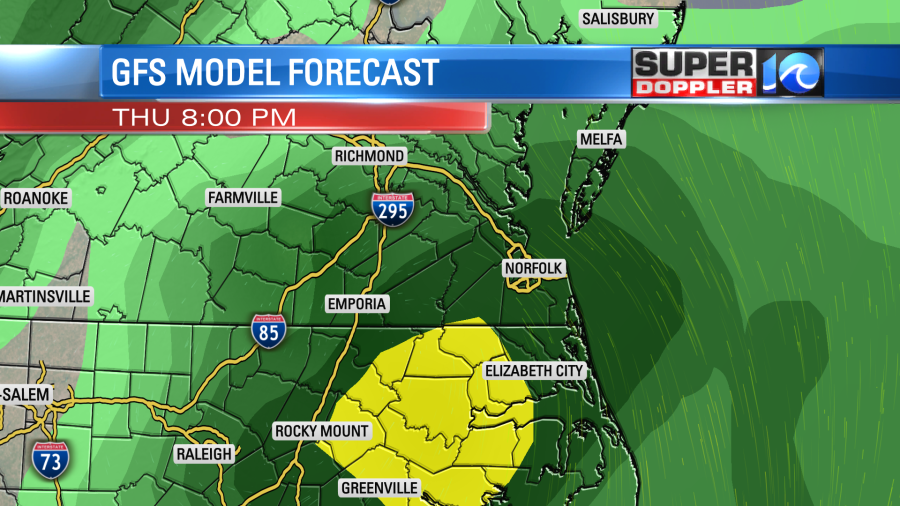
It has a band of heavy rain over our region, but it has been shifting that band north and south a bit during the last couple of model runs.
Meanwhile the European model is actually following suit now towards the GFS. Remember, a few days ago the Euro had Elsa falling apart after Cuba. That did not happen. It does have it moving through our area now, but it is later. It takes it through here early Friday morning.
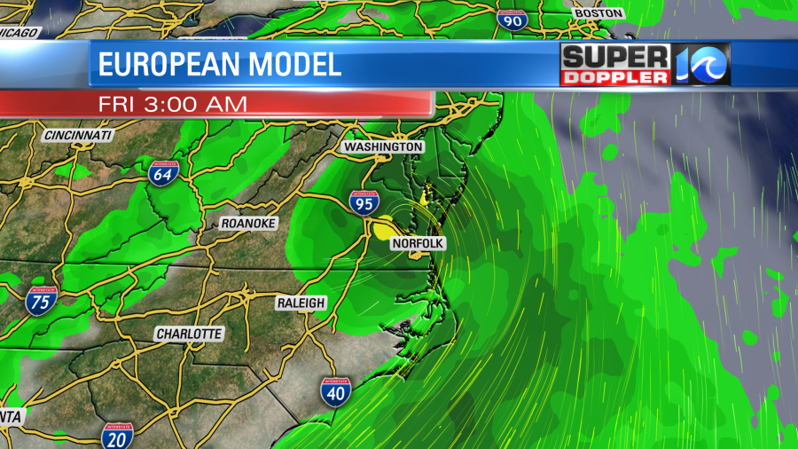
So things are generally coming together with the forecast for this storm. We are likely to get some heavy rain for at least part of the region either late Thursday or Thursday night into early Friday. We will have a threat for isolated tornadoes, but the highest chance for that will depend on the track. Tidal flooding shouldn’t be an issue, but I can’t rule out some nuisance tidal flooding. Elsa will either be a top-end tropical depression or a low-end tropical storm as it move through our area.
So we’ll work on the finer details over the next 24 hours. Stay tuned for updates.
Meteorologist: Jeremy Wheeler


