We’re in the middle of a heat wave that won’t break any time soon. However, there is a light at the end of the tunnel. It’s just a ways away.
Yesterday high temps were in the low 90s with some mid 90s inland. The heat index was over 100 for many. Today we still have a big area of high pressure offshore.
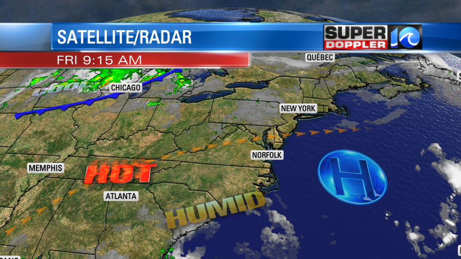
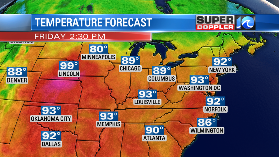
However, there is just a little bit more of a breeze today, and it is out of the southwest. We also have a lot of sunshine. So high temperatures may rise just a bit higher than yesterday. That puts our forecast high temperatures this afternoon into the low-mid 90s with a couple of upper 90s possible inland.
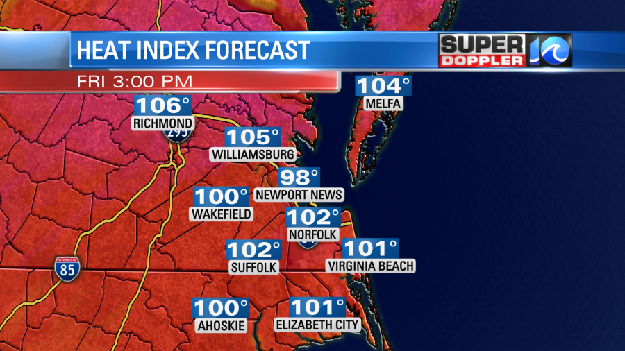
The heat index will also be a little higher. So we will probably have numbers between 100 and 104 degrees in the metro. It will probably be higher in some inland locations.
We’ll be mostly sunny to partly sunny this afternoon. There will only be a stray shower or storm in the whole region.
Over the weekend we’ll have similar weather. High temps will be in the low 90s. The heat index will be near or over 100. We’ll be partly cloudy with some isolated pm showers and storms.
A cool down is in sight in the long-range. We’ll hopefully get back to some 80s later next week. However, the clouds and rain chances will go up during that time. This could be from some of the leftover moisture form the remnants of Ida. More on that in a moment.
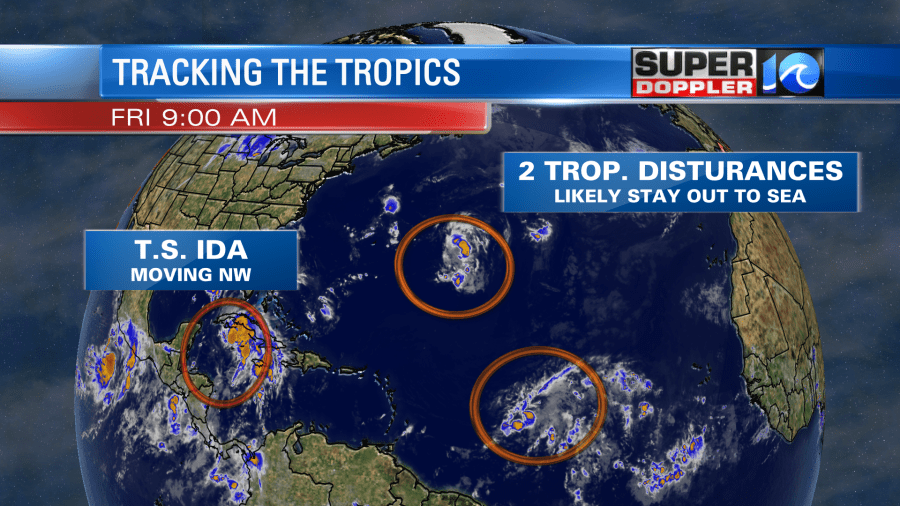
Right now the tropics are busy. There are 2 tropical disturbances in the Atlantic that have a decent chance of formation over the next few days. However, they will stay out to sea.
I was hoping that there might be some small waves coming in this weekend from the more northern disturbance. They will run about 2 ft today and tomorrow for the ECSC. However, they may pick up a bit more on Sunday.

The big storm is going to be Ida.
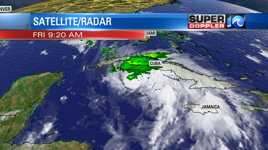
This morning it was a tropical storm south of Cuba. It is on a northwest track. So it will move over western Cuba later today. It had winds of 60mph as of this writing. It could briefly weaken as it moves over the island, but it probably won’t effect it that much. Once it gets into the Gulf Of Mexico, then it will be in an environment of high strengthening potential.
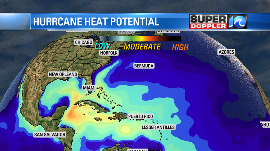
The water temps are in the upper 80s down there. There also won’t be much wind shear. The latest forecast has Ida becoming a category 3 hurricane before landfall by the late part of the weekend.
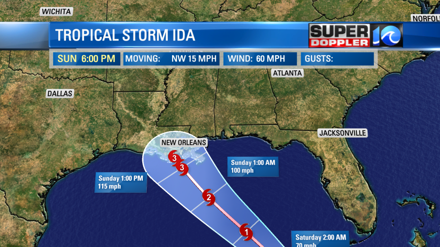
There is a pretty high confidence in the track as many of the models are clustered on a Louisiana landfall.
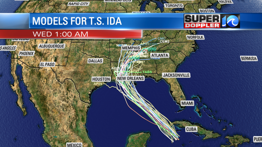
After landfall it will weaken and move north. Then it will become a depression by the middle of next week over the Tennessee River Valley.

Again, we may get some of the moisture from the remnants of of Ida later next week.
It’s bad enough that this could be a major hurricane affecting Louisiana this weekend. However, it’s worse when you look at the big picture. Last year that area got hit by a few hurricanes and tropical storms.
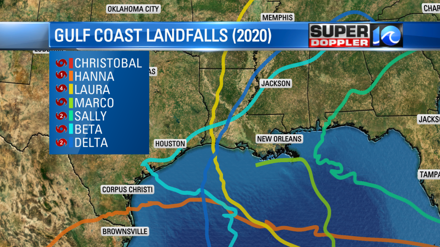
So they are still recovering down there. Also, there are many gas and well sites in the Gulf of Mexico. With the current forecast I imagine that many of them will have to shut down. At least briefly.
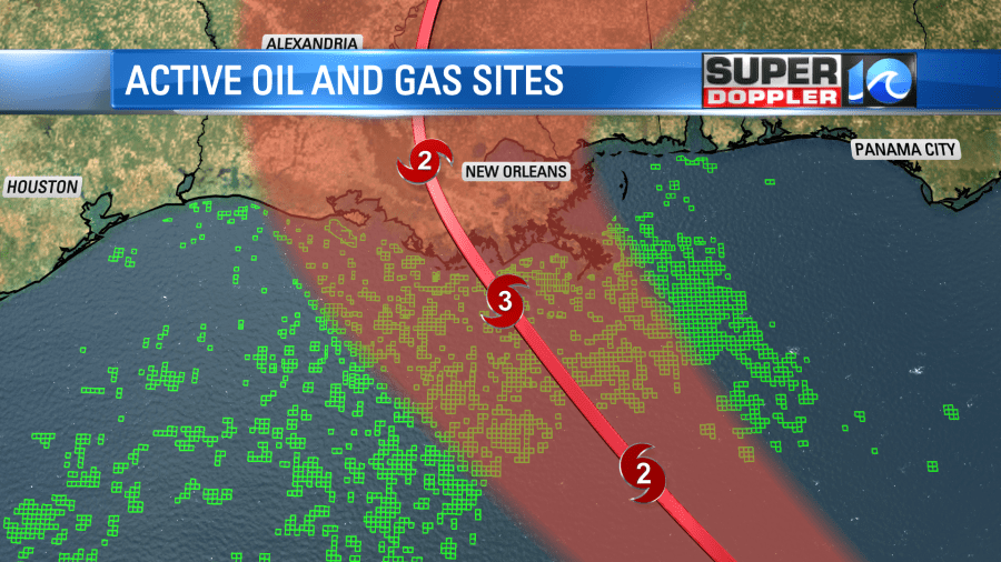
This could impact gas prices for a time. Hopefully, something slows down Ida. If the name sounds familiar, then you may be thinking back to 2009. A weaker system called Ida that year moved offshore of the east coast and merged with a non-tropical low. That low become what as know as Nor’Ida or the Nor’easter of 2009.
Stay tuned for updates over the weekend.
Meteorologist: Jeremy Wheeler


