Tropical depression Ida was slowly churning over the Tennessee River Valley this morning. It was a much weaker storm than 24 hours ago. Sustained winds were around 30 mph.
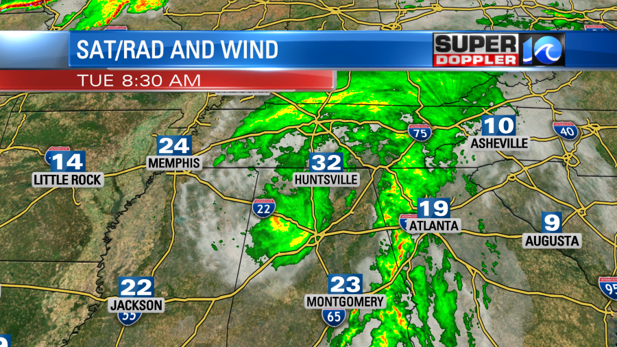
There is a lot of rain around the center of the storm, but there is also a band of heavy rain to the east of it. Ida will slowly move northeast today. By tomorrow it will start to turn into a post tropical system. It will be mainly a rainmaker by that time. The widespread rain will stay to our west, but we’ll have a few scattered storms in the region. They will start up here by the afternoon.
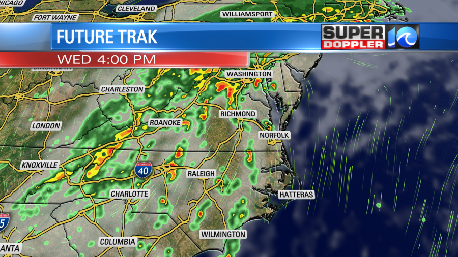
The center of post-tropical Ida will pass to our north Wednesday night into Thursday morning. It will be wrapped up in a cold front at the time.
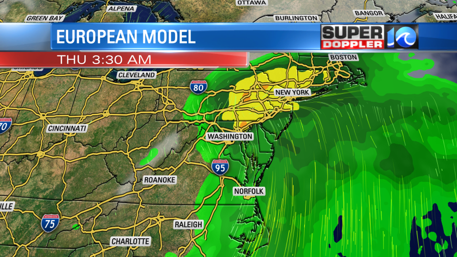
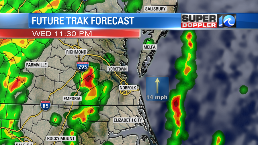
We’ll have a large area of rain and storms in the region with the heaviest rain forecast to fall to our north and northwest. Some locations to our west and northwest could get 3-5″ of rainfall. Locally, I think we’ll see more in the way of an inch to an inch and a half.
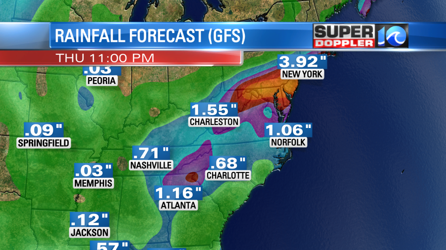
The storm will steadily move offshore during the day on Thursday, and the cool front will drop south. Cooler/drier air will then rush in for the weekend.
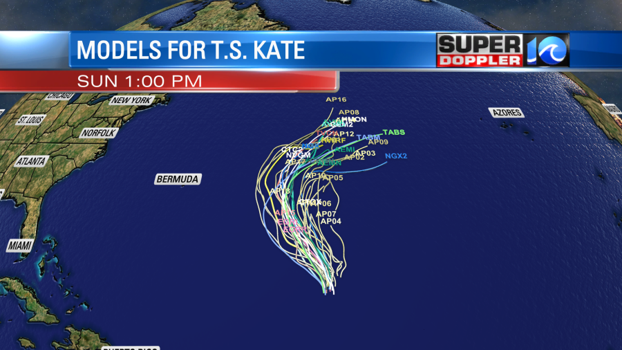
There is another named system in the tropics (so far). Tropical storm Kate is over the central Atlantic.
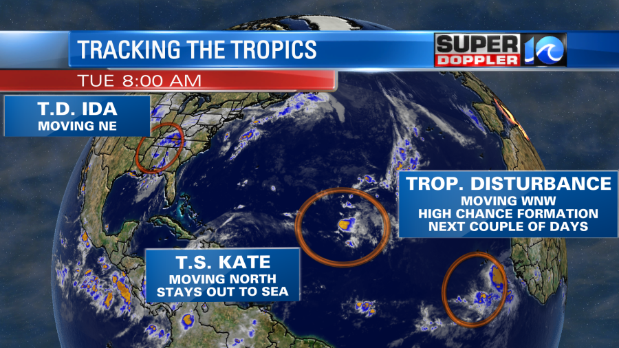
It is a pretty small and weak system. It will move north and then northeast over the next few days. So it is definitely going to stay out to sea, and it should have no impact on any landmasses.
There is also a tropical disturbance coming off of Africa that has a high chance of formation over the next couple of days. This will be moving to the west/northwest. So we’ll watch it carefully.
Locally today we have Ida well to our west. High pressure is to our east.
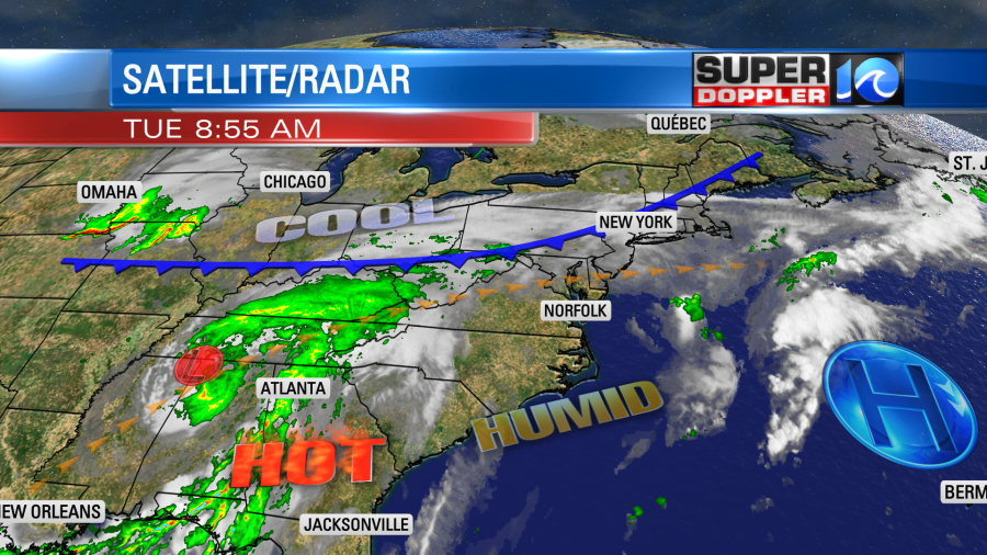
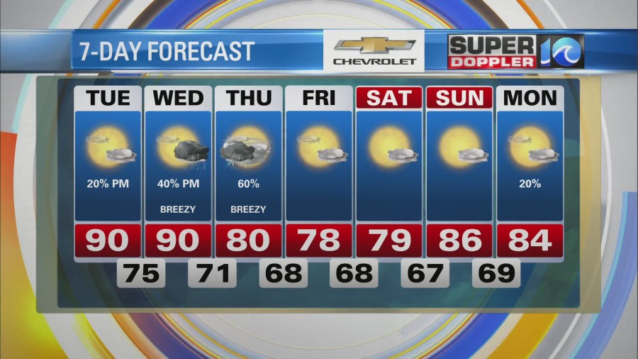
We’ll have more typical summer weather in the region. Skies will be partly sunny. We’ll have some isolated pm showers or storms. High temps will be near 90 again, but the heat index will be in the upper 90s to around 100.
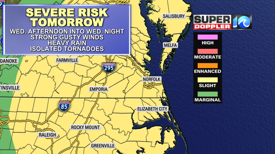
Tomorrow we’ll have a mix of sun and clouds. It will still be hot and humid with high temperatures near 90 degrees. However…Tomorrow there will be a strong breeze out of the south. This will help out with how the mugginess feels, but the overall humidity will stay high. We’ll have some scattered thunderstorms forming during the afternoon. Some of these could be strong to possibly severe. Especially later in the day.
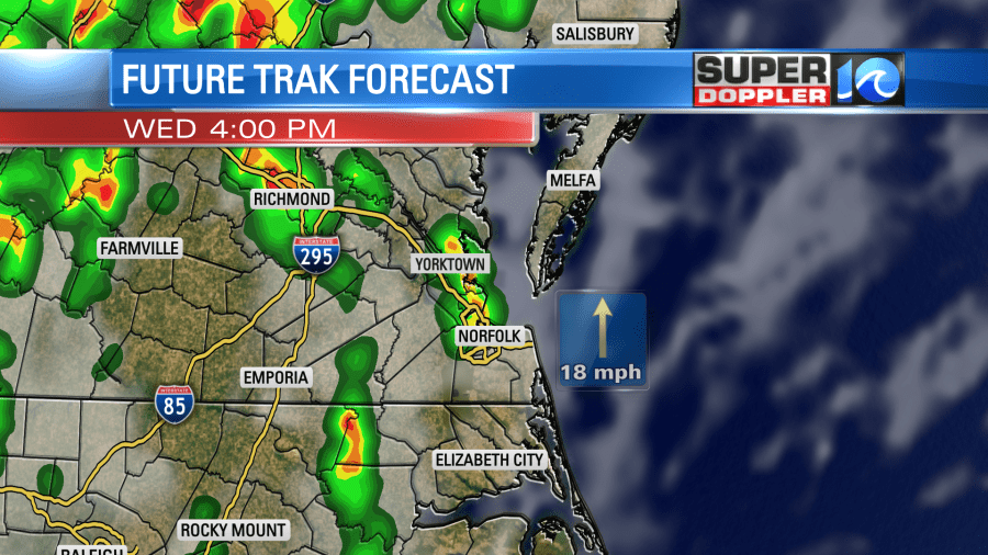
There is a slight risk for severe weather tomorrow into tomorrow night.
The widespread and heavier rain will stay to our west. However, the coverage will increase going into the evening. Some isolated to scattered downpours will be possible in the early evening and more likely Wednesday night.
We’ll have a mix of sun and clouds on Thursday. There will be some scattered showers with a few storms in the morning. Then we’ll have another round of showers later in the day. The cold front will be sinking to the south. So the wind will turn to out of the north, and high temps will only be near 80 degrees. Behind that front the weather turns great! We’ll be dry and cool Friday and Saturday with highs in the upper 70s. Then we’ll be in the 80s and dry Sunday and Labor Day.
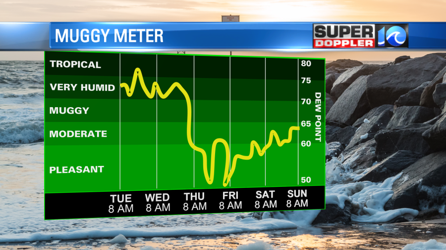
The A.C. units will get a break, and better hair days will lie ahead. It will be awesome!
Meteorologist: Jeremy Wheeler
