The tropics are still busy, but really there aren’t any official systems as I write this. It actually makes me wonder if talking about tropical disturbances (non-organized clusters of thunderstorms in a lower pressure area) is helping to numb people to taking in other important tropical information. Hmmm. Having said that… Nicholas has fallen apart. It is no longer a tropical system, but rain showers are continuing to fall across the deep south. There are 2 tropical disturbances in the eastern Atlantic that could form over the next few days. (One is likely to do that).
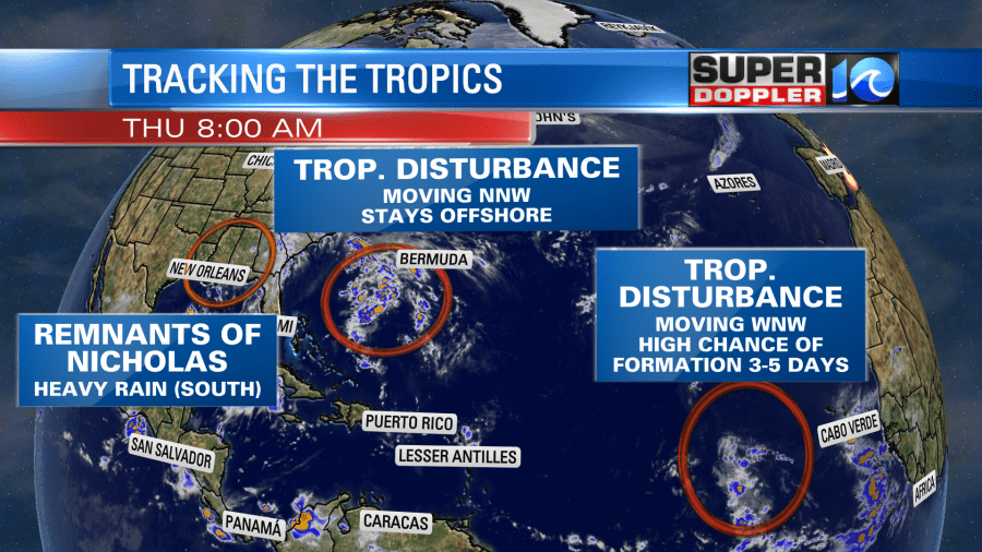
Then there is the tropical disturbance that is a couple hundred miles to our southeast. This is the feature that we will be watching closely over the next 24-36 hours. It is likely to stay offshore, but it will probably throw a few showers back our way during that time. It is also going to elevate our risk for rip currents. As I write this the disturbance is still basically just a disorganized cluster of thunderstorms.
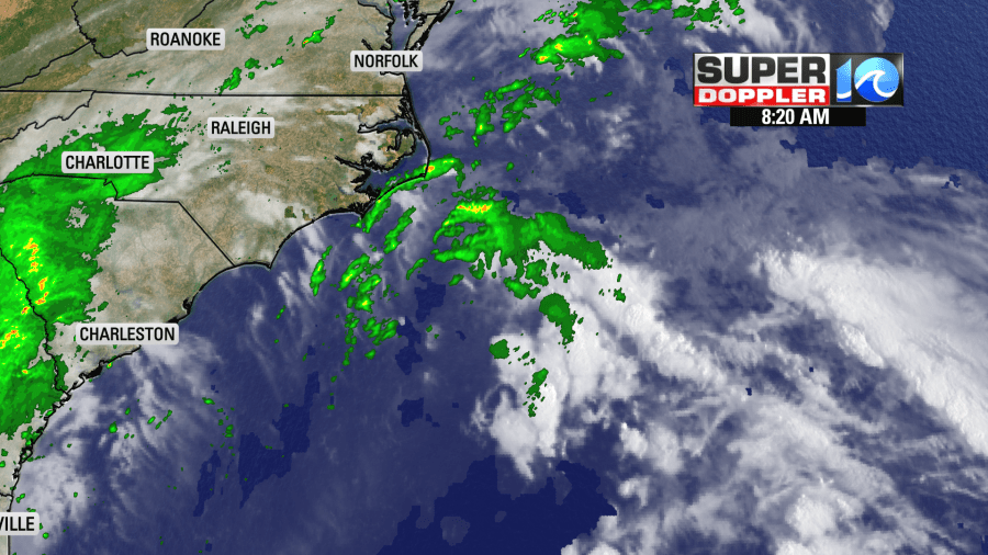
The weak low will move northward today. It will throw a few showers up our way. We’ve already had a few over the Outer Banks. There is also a cool front falling apart just to our west.
There will be a few showers and storms in the western sections of the viewing area this afternoon closer to the front. There will also be scattered rain showers along the Outer Banks closer to the low. In Hampton Roads (between these features) we’ll have a handful of rain showers.
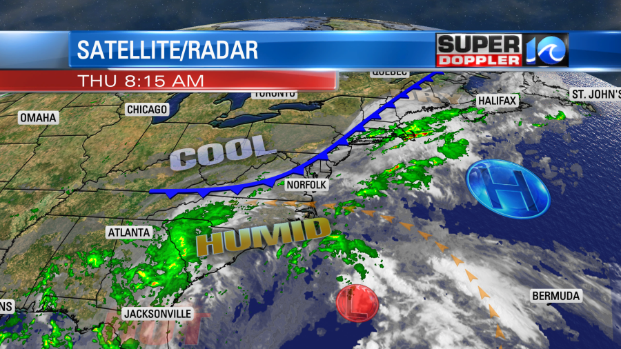
The forecast track models all keep the center of the low offshore.
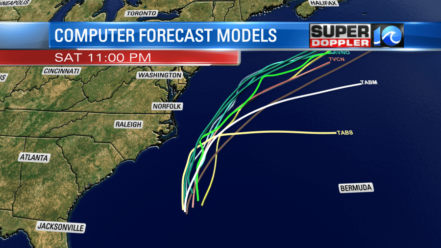
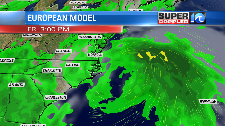
The Euro does have it to our east/northeast tomorrow. It does have some rain coming in from the ocean, but the stronger winds are definitely offshore.
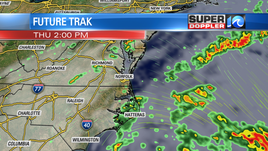
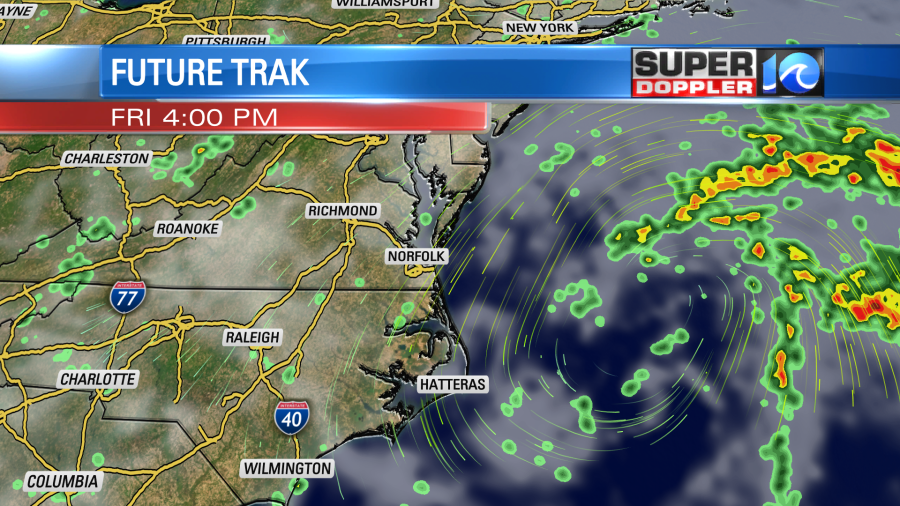
Our Future Trak model is leaner with the rain tomorrow, but it does have a few showers.
For now I’m calling for mostly cloudy skies Friday with some scattered showers and isolated t’storms. Also, the wind will be out of the north at 10-15mph. That will be a cool breeze. So I’m going with high temps in the upper 70s to near 80. The low will move away from our region during the day Friday. Then we’ll have nice weather next weekend. Highs will be in the 80s with less humidity.
There are 2 tropical disturbances in the eastern Atlantic. One still has a high chance of formation over the next few days as it moves to the west/northwest. The other one (more easterly disturbance) has a low chance in the next couple of days.
Meteorologist: Jeremy Wheeler