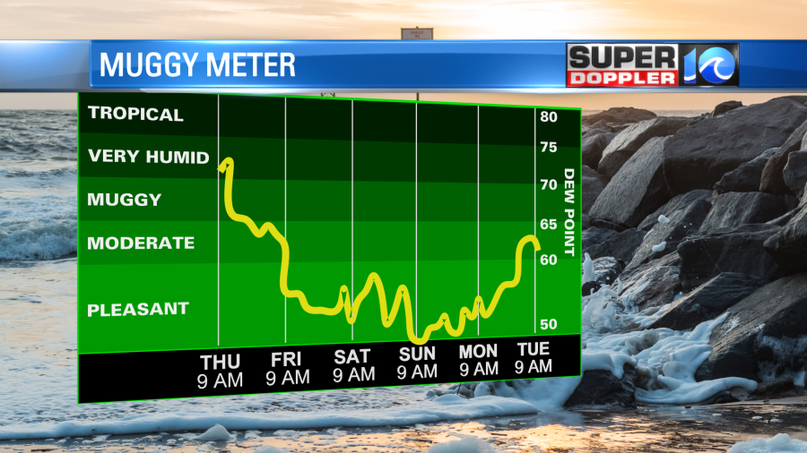
This morning when I came in it didn’t feel like fall weather. It was muggy and in the 70s. However, there is a strong cold front that will move in today, and it will change all of that. Yesterday, was the first day of fall, so this front is just in time.
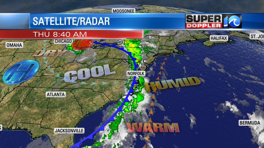
There are a lot of showers along the front. We had some heavy rain this morning in a few places.
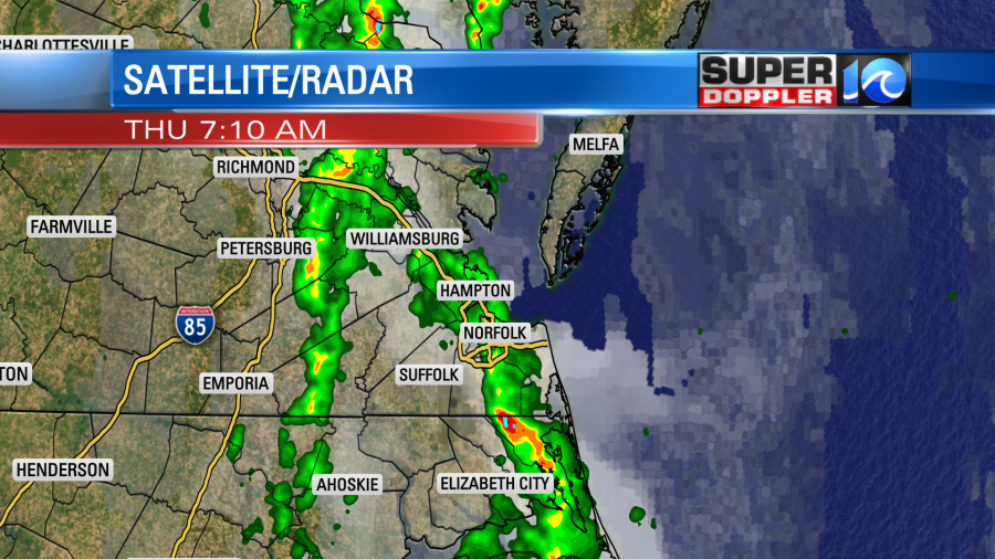
Today won’t be a washout, but there will be scattered showers on and off through the day. This morning will be see a couple lines of showers with pockets of heavy rain. Then as the front slowly pushes to the coast early this afternoon the showers will become lighter and more scattered. It may even be drizzly for the evening commute.
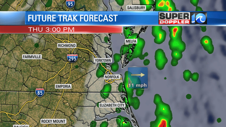
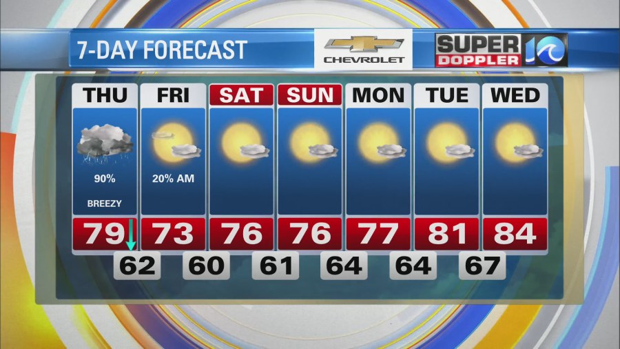
Temps will cool as we go through the day. We’ll be in the low 70s this afternoon with a few spots in the 60s to near 70 degrees. Winds will be out of the south through about 11 a.m. Then they will turn out of the west.
We’ll have a few showers overnight with mostly cloudy skies. This will continue into Friday morning. However, we should dry out as we go through the day. The front will move very slowly offshore. So that could allow for some clouds to hang on near the coast. We will definitely have clearing skies inland, and I’m hopeful that it makes it to the metro during the day. High temps will be in the low 70s, and the humidity will drop. Then….. We’ll have great weather this weekend! We’ll be mostly sunny both days with highs in the 70s. Dew points will drop to the 50s and maybe even the 40s.
In the tropics… There is some good news and some not so good news. The good news is that tropical depression Peter and Rose have fallen apart. Luckily they stayed out to sea before dying out.
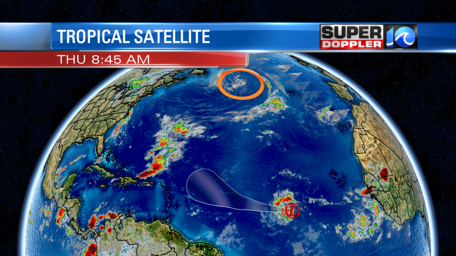
However, tropical depression 18 (soon to be Sam) is the one to watch. It is over the central Atlantic and moving generally to the west. It is forecast to strengthen over the next couple of days. It will steadily head to the west/northwest as it becomes a hurricane. It is even forecast to be a major hurricane in a few days.
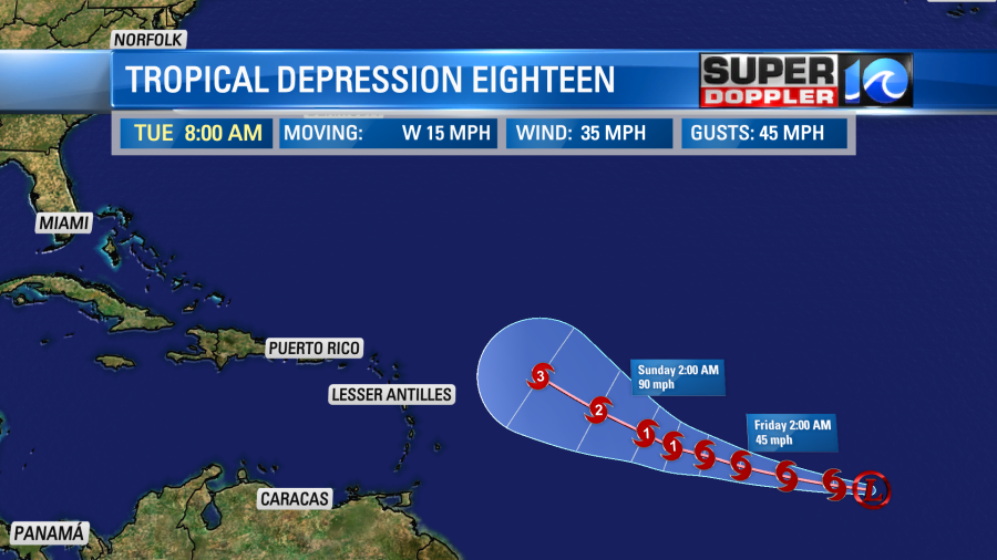
After 5 days the models are pretty split. Some models have it bending north and staying out to sea, but there are a few that keep it on a west/northwest track towards the U.S. coast.
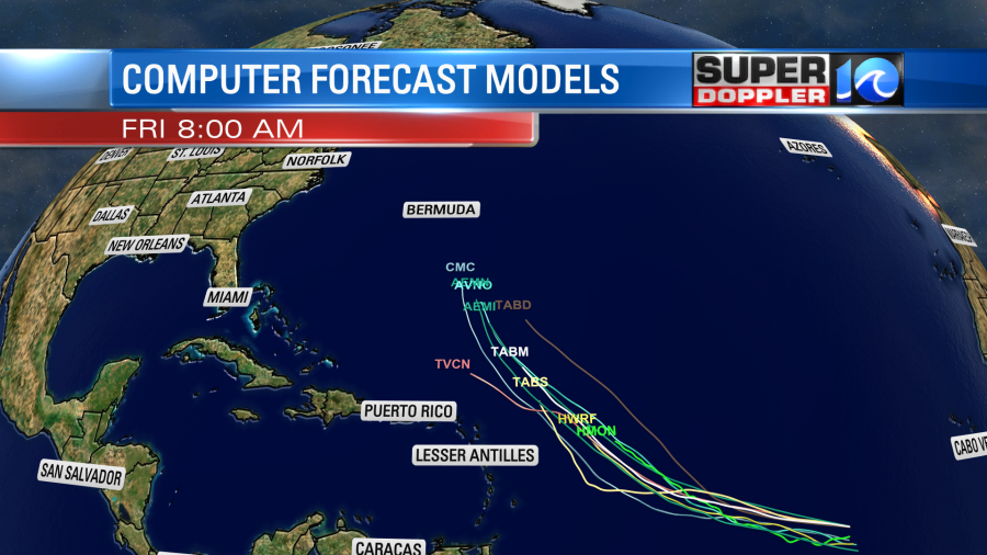
The GFS and Euro models are very split. In the next 6-10 days one model takes it well out to sea (GFS) while the Euro takes it towards the southeast U.S. coast.
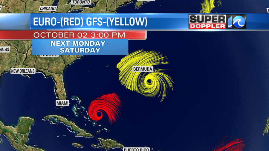
We have a lot of time to track this system and see where it’s going to go. So stay tuned for updates.
Meteorologist: Jeremy Wheeler
