Many have been asking for fall temps, fall colors, pumpkin spiced candles … hmmm, well, maybe not the last one so much. But yes … it’s been warm lately. Outside of a few cooler days, October was a warm month. It ended up about 2.9 degrees above average.
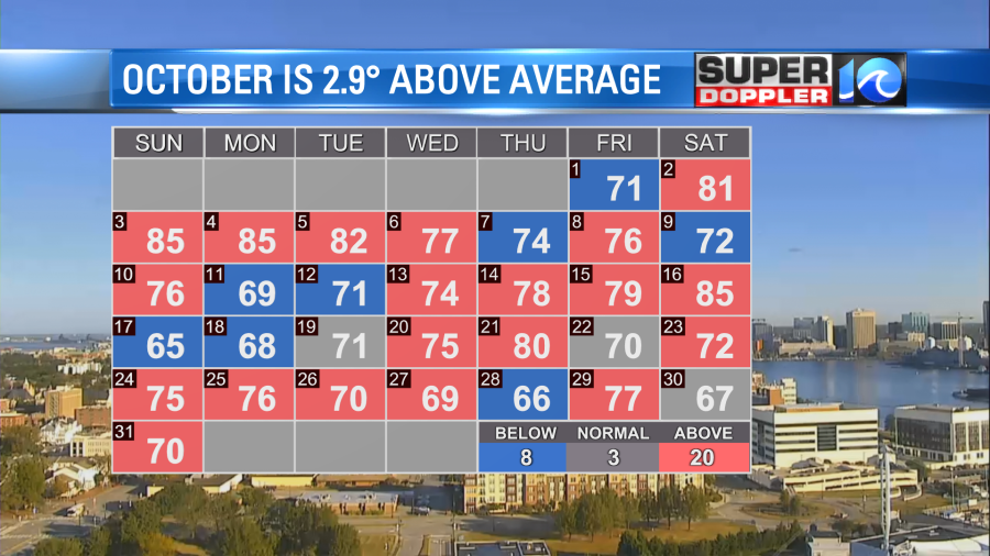
It was also pretty dry. While we did manage to get some rain later in the month, we still ended up below average.

Now going forward we’ll start to cool things down. A cool front is moving into the region today.
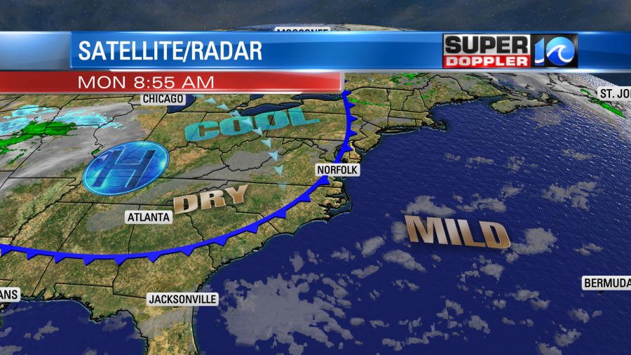
While it is a “cool front” it is also a dry front as there is no rain along the boundary. We’ll have a lot of sunshine today, but we’ll also have a north breeze. So high temps will cool down a bit. They will be in the upper 60s this afternoon. The air is very dry as our dew points have dropped to the 40s. Tomorrow the front will stall out to our south, and a weak area of low pressure will form along the boundary. This will increase the clouds. Also, an upper level disturbance will move in from the west. These will work to create some isolated showers by the late afternoon. Especially north of the metro.
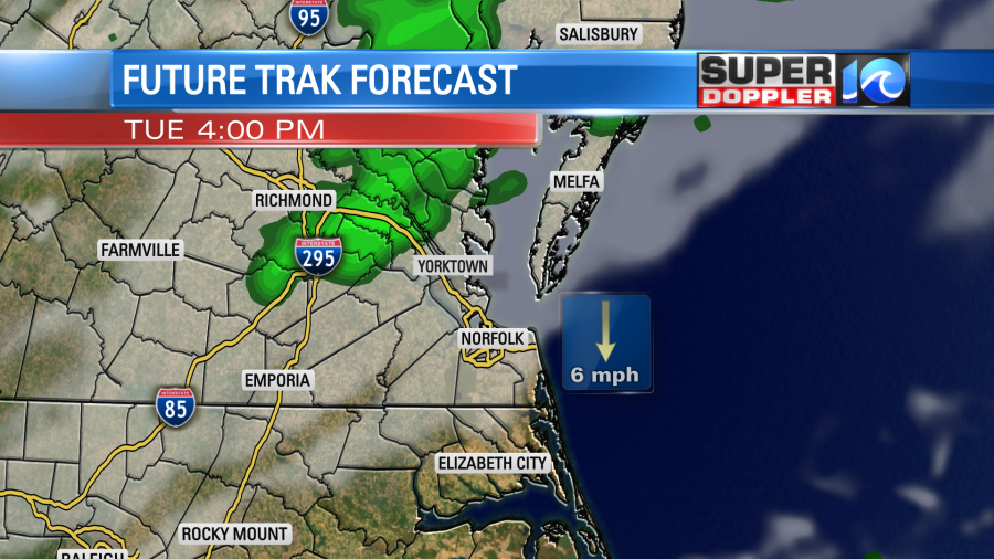
The showers will likely pick up a bit towards the evening, but they should be light and scattered. So the bulk of the day should be dry for Election Day, but if you may want to take the umbrella if you vote late. Low temps will drop to the 40s Tuesday night with some clearing.
By Wednesday high temps will only be in the 50s. It’s been a long time since we had that happen. Skies will be partly cloudy. By Thursday a bigger upper level low will move in from the west. This will help to develop a surface low near the shore. We’ll have a higher chance for rain during the day, but it won’t be a washout. I’ll have more details on that part of the forecast tomorrow.
Meteorologist: Jeremy Wheeler