If you are doing some travel in the region today, then you will encounter lots of rain in the area.
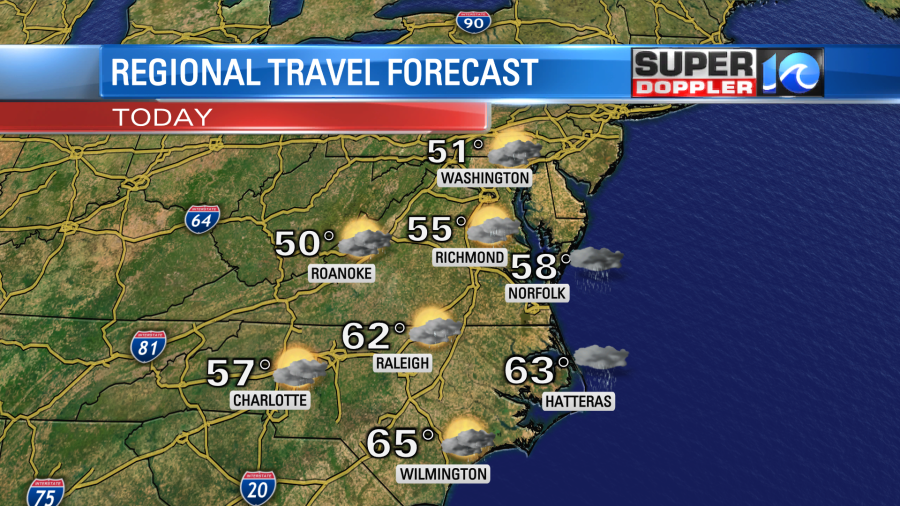
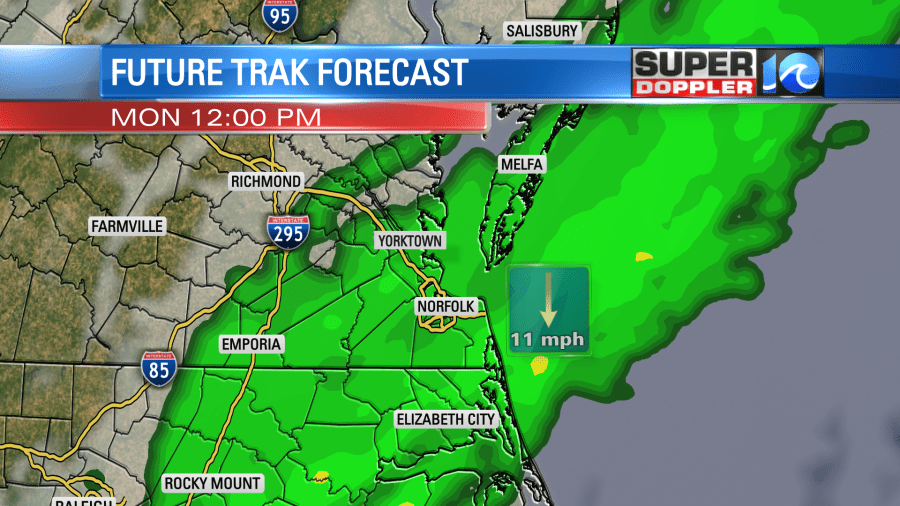
A strong cold front is sliding east into the region, and there is a lot of moisture building ahead of it.
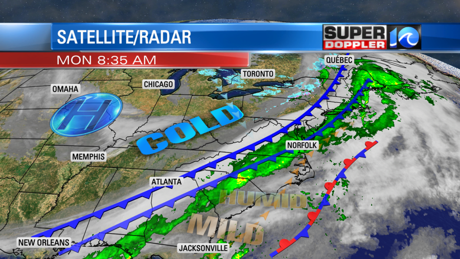
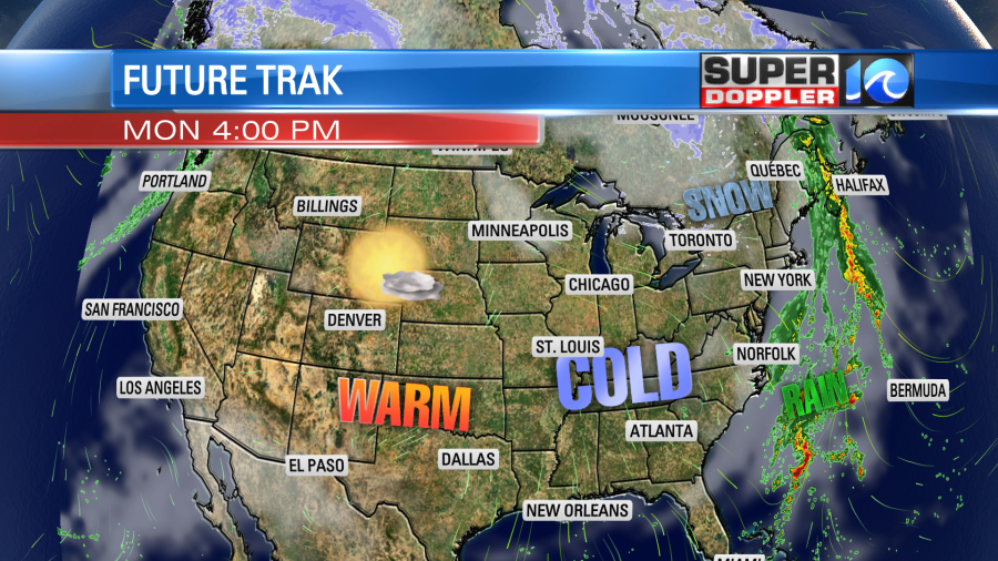
There are actually 2 cold fronts, but they are merging. So it will be a double whammy today. While we will have some rain locally, keep in mind that a large portion of the country will be dry this afternoon.
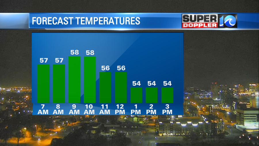
Our local winds are light and out of the west this morning, but winds will increase out of the north by midday. They will gust up to 20 mph later this afternoon. This will act to drop the temperatures from the upper 50s around mid morning to the low 50s this afternoon.
The rain will be pretty widespread around midday, but showers will taper off later this afternoon into the evening.
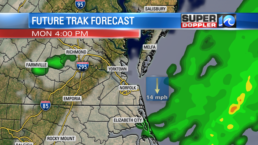
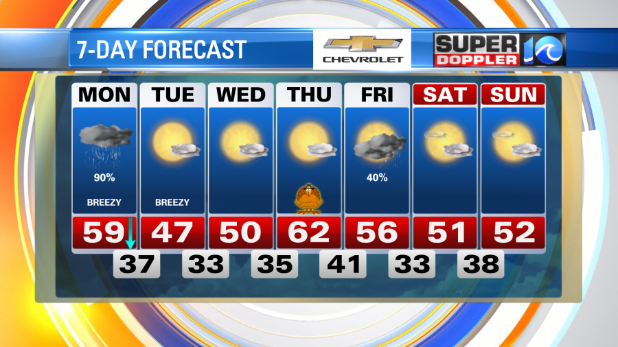
The rain will be light for most of the time. It shouldn’t add up to much. We could get about a quarter of an inch….If we are lucky there could be a half inch in a few locations.
Behind the front tonight we’ll clear out gradually, but temps will drop fast once the clearing arrives. Low temperatures tonight will be mainly in the 30s. There will be some 40s near the shore. Tomorrow, we are only going to top out in the upper 40s during the afternoon.
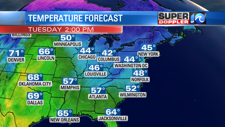
We’ll have a lot of sunshine, but winds will be strong and persistent out of the north. Gusts will be up to 25mph. Temps will drop even more Tuesday night as the winds lighten up. Lows will be in the low 30s in the metro. We’ll probably be in the 20s inland. We’ll be cool and dry on Wednesday. Then the weather looks good for Thanksgiving day. High temps will be in the low 60s with lots of sunshine. However, there will be some rain on Friday. That could impact travel and shopping. I’ll have more details on that in tomorrow’s weather blog.
Meteorologist: Jeremy Wheeler