Today’s weather is looking pretty good. We haven’t had a lot of good days lately for just going out for a walk and getting some fresh air. Today should be a decent day to do that. We started off with some beautiful weather.
Temps started off mainly in the 40s with a few 30s inland. We’ll be dry today even though a cool front is going to move-in and stall-out over the region. High pressure is just to our south.

We’ll be partly cloudy through the day. High temps will rise to the upper 40s to low 50s. The wind will change direction (west-north-northeast-east), but it won’t be too strong. It should only be about 5-10mph. Again … all-in-all it should be a nice day.
You’ll notice on the map above that there is a weak area of low pressure over the Tennessee River Valley. This will ride east/northeast along the front tonight into tomorrow. There will also be an upper level low riding east ahead of the surface feature.
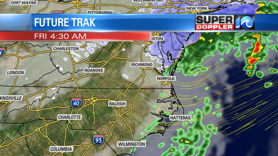
In our region we’ll have cloudy skies overnight with scattered rain showers after midnight. Temps will be in the 40s for most at that time.
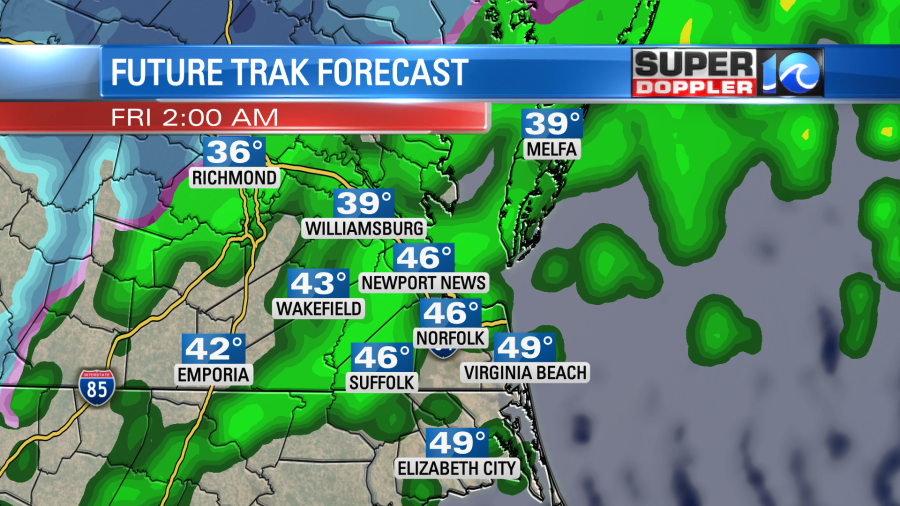
The models have really dried up the 24 hour forecast compared to yesterday. So our model now shows a brief wintry mix Friday morning for a time, but it has the bulk of the precip north of Hampton Roads.
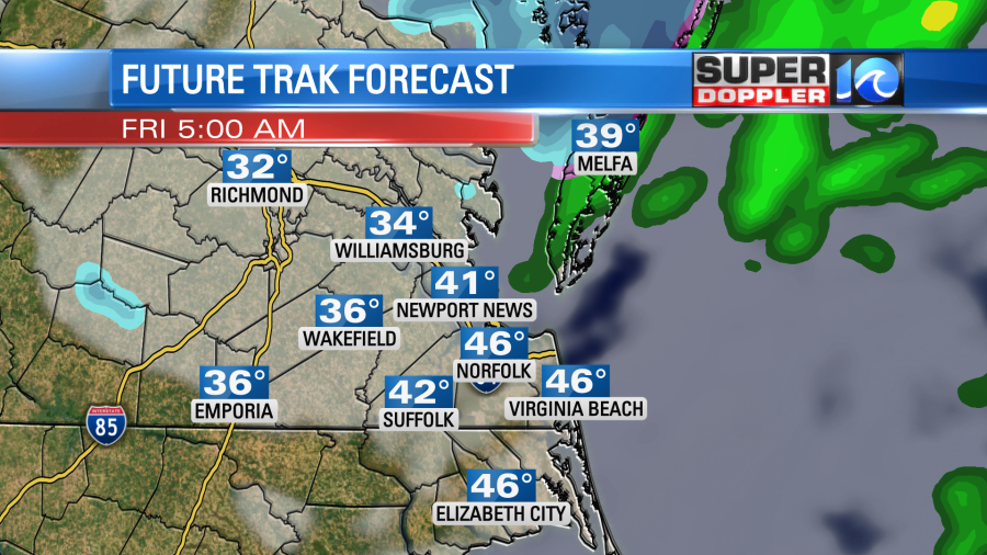
I think the model went a little too dry. So I think there will be a scattered wintry mix in the morning. However, temps should be above freezing. So this will all melt. It might stick a bit to some grass and decks well north of Hampton Roads. After 5-7am we’ll dry out. Then it will be cold, dry, and windy! A few flurries may continue until the late morning. High temps will only be in the upper 30s Friday afternoon. Winds could gust up to 30mph out of the northwest.
As far as accumulations… The models are coming in with meager amounts this morning. Here are 4 of the models that we use:
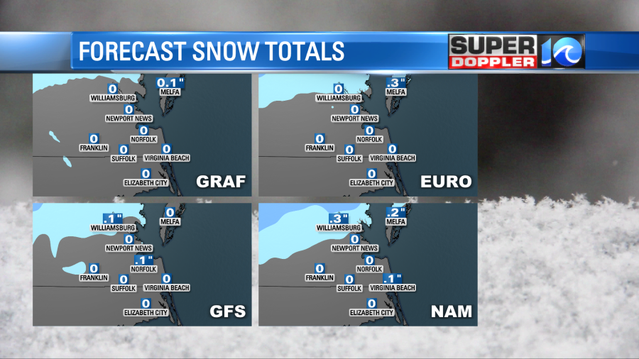
They show a little bit north of the metro. Possibly some up between Williamsburg, Gloucester, and the Northern Neck. Here is my latest snow forecast:

The forecast could still change a little. Remember, we aren’t as dry as we used to be. Plus, the ground isn’t as warm as it was about a week ago. However, it’s the speed of the system and the atmospheric moisture that are in question this round. So check back for updates.
Tomorrow afternoon cold air will blow into the region. High temps will only run in the upper 30s.

Wind chills will even be in the 20s in the afternoon. At least we’ll dry out. Then low temps will be in the 20s and possibly in the teens Friday night into Saturday morning. We’ll be dry and cold on Saturday with high temps near 40. Then we’ll warm up to the 50s on Sunday. There will be another round of precip on Monday, but I’ll talk more about that in tomorrow’s weather blog.
Meteorologist: Jeremy Wheeler


