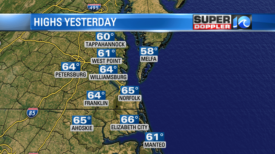
Yesterday was very nice outside! We had a mix of sun and clouds with mild temps. Highs topped out in the mid 60s over the region.
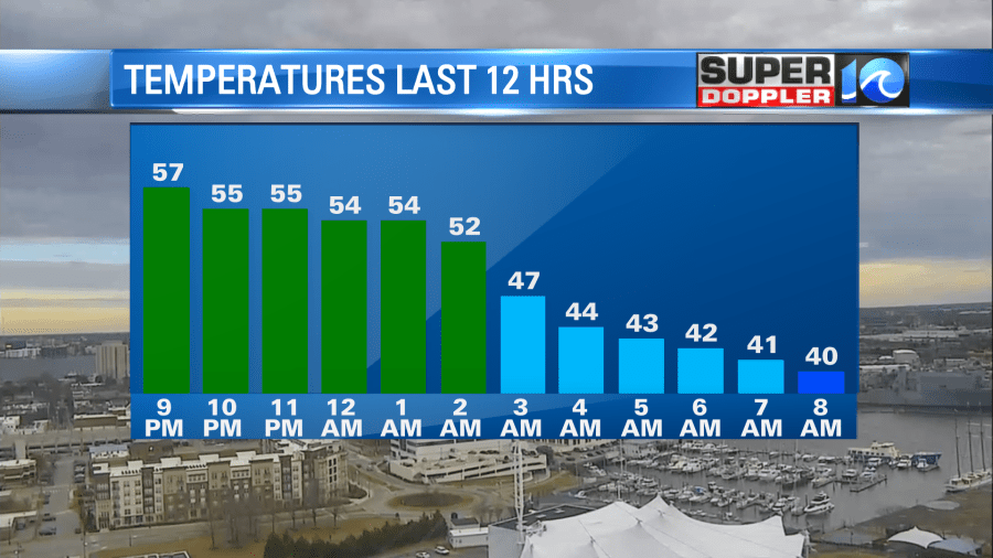
I took advantage of the situation and trimmed a few of my crepe myrtle trees. A strong cold front moved in overnight and produced a line of light rain showers. Now the rain and the front have dropped to our south.

Temperatures were dropping through the morning, then they may drop a bit more before noon.
There will be gradual clearing today, but the wind will stay up out of the north. It will run at 10-15mph with gusts up to 25mph. This will hold the temps down. We’ll only rise to the upper 30s to low 40s this afternoon.
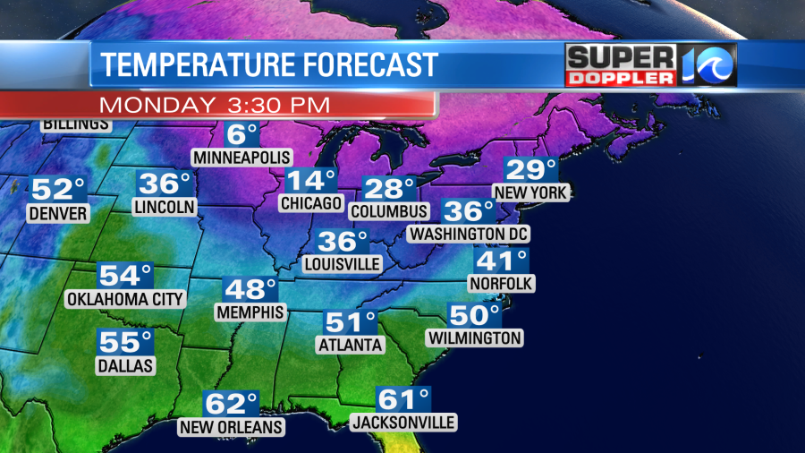
Think that’s cold? Well, it will get colder soon. This evening a little wind-shift will swing through the region. This could prompt some scattered clouds and an isolated flurry or two. Then the wind will pick up again out of the north. We’ll have mostly clear skies overnight with temperatures dropping down into the mid 20s. It will be in the low 20s inland. There will be a light north wind at 5-15mph with a few higher gusts. That will put our wind chills in the teens and single digits, and those will continue into early tomorrow morning. Folks may want to slow-drip the faucets overnight. Tomorrow we’ll start off in the 20s. We’ll only end up in the lower 30s.

Skies will be sunny, but the wind will stay up out of the north. Wind chills will be in the teens and single digits in the morning at the bus stops. They will be in the 20s during the afternoon. So be prepared for the deep freeze! It will get colder! Yes….colder! As the winds die down Tuesday night low temps will drop down to the teens and 20s. This time frame will be more important to slow-drip the faucets as temps won’t climb above freezing for about 36 hours. Be sure to cover faucets, and be sure to winterize your home. Cover cracks under doors and around windows with plastic film or towels/cloths. Keep sink cabinets open. I’ll remind folks of this tomorrow.
We’ll warm up a bit on Wednesday. High temps will rise to the mid-upper 40s. We’ll have fair skies. We’ll have a mix of sun and clouds Thursday and Friday with high temps closer to 50 degrees. There may be some isolated showers on either day. A quick moving system (clipper) may swing through the area next weekend. It’s still way out, and the models are in a big disagreement about it. For now I have a low chance for a wintry mix (at least) on Sunday. I’ll talk more about that in tomorrow’s weather blog. Until then…try to stay warm!
Meteorologist: Jeremy Wheeler


