
Get ready for some big bounces in the temperature department. We will have some wild swings in temperatures over the next few days, and we will literally have to try and avoid whiplash!
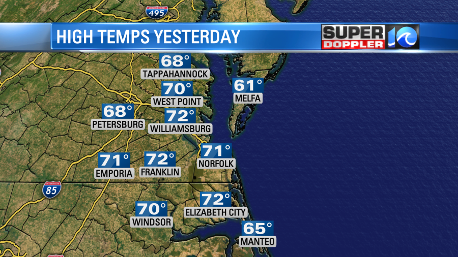
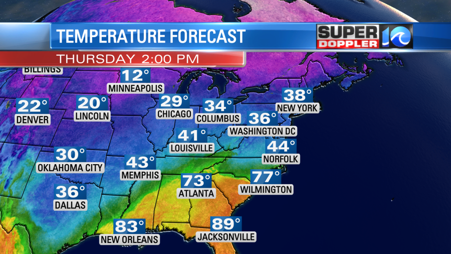
Yesterday was warm, and the bulk of the day was dry. We had high temps in the 70s.
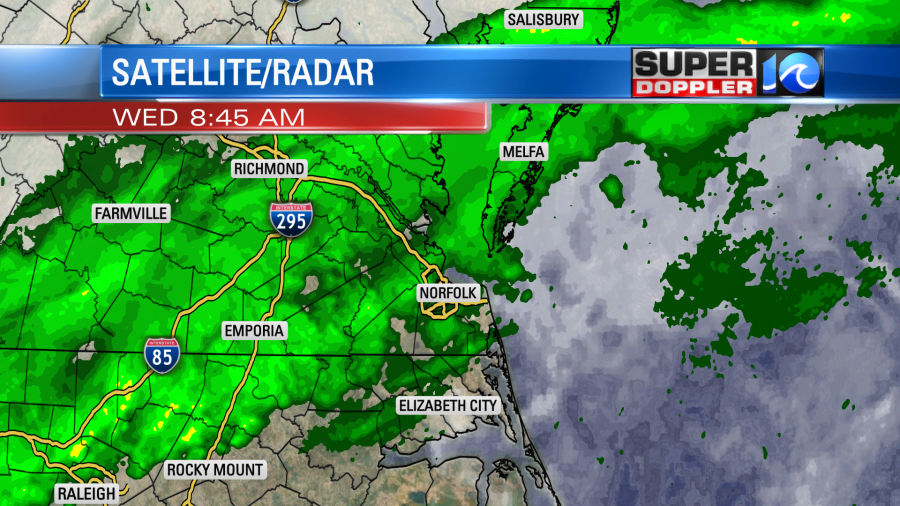
We’ll still be unseasonably warm today. Average high temperatures are in the mid 50s this time of year. Today our high temps will rise up in the 70s again. However, we started off with lots of clouds and scattered rain showers unlike yesterday.
We have a lot of warm/moist air coming up out of the southwest. This is ahead of a very strong cold front that lies to the west.
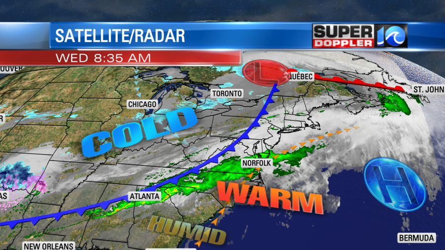
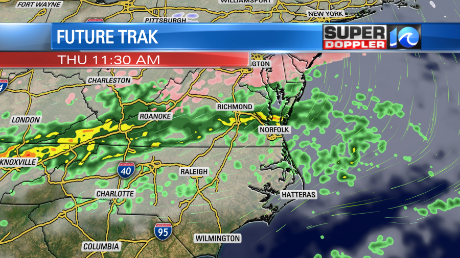
That front will march eastward today. We’ll be on the warm side of it all day. Winds will stay out of the southwest at 10-15mph. Rain showers will continue through the morning, but they should break up some by midday.
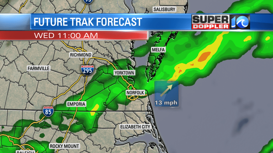
The models are suggesting that we’ll have a small dry pocket arriving this afternoon. So we’ll have a brief mix of sun and clouds for a time. However, the cold front will drop in during the evening. A cluster of showers will move in with the front as temperatures drop. We’ll drop to the 50s quickly, and then we’ll have low temps near 40 degrees overnight.
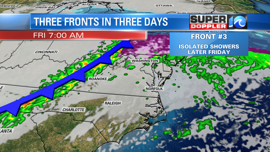
The front will stall out to our south tomorrow. It is going to be a shot of Winter. High temps will only be in the mid 40s. We might reach the upper 40s if we’re lucky.
We’ll have a northeast wind at 10-15mph with a few higher gusts near the shore. This is going to make for a nasty day. We’ll also have scattered rain showers on-and-off from the mid morning through the afternoon.
The front will rise back north as a warm front on Friday. We will warm up fast. High temps will rise to the upper 60s. There could be a few 70s in North Carolina. We’ll have mostly cloudy skies with more scattered showers. Another cold front will be closing in from the west.
We’ll dry out and drop temperatures again on Saturday. High temps will return to the 40s. Then we’ll be near 50 degrees on Sunday with a few showers in the afternoon. Yesterday, the GFS model had rain and then a wintry mix in the evening on Sunday. Now the models show either just a few rain showers or they keep most of the precip just to our south. Stay tuned for updates on that.
Meteorologist: Jeremy Wheeler


