
We are coming off of a nice Sunday. It was mostly sunny yesterday with high temps mainly in the 60s. There were a few more clouds in the evening, but no rain. Today we are going to have a lot of sunshine in the region through the entire day. High pressure has built in behind a cold front. That front is well to our south now.
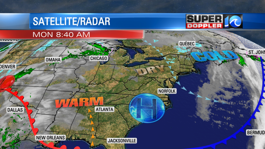
We’ll have lots of sun with a light northwest breeze. High temps will be in the mid-upper 60s. While it will be nice here today, they will have some strong to severe storms near the warm front to our southwest this afternoon.
Our region will be dry tomorrow as well. It will be even better as temps will start in the 40s and end in the low 70s. We’ll be mostly sunny with a little more clouds by the end of the day. Winds will be light and out of the southwest.
We’ll be dry for the next 2 days. However, the humidity will increase fast on Wednesday. Then it will be downright muggy by Thursday.
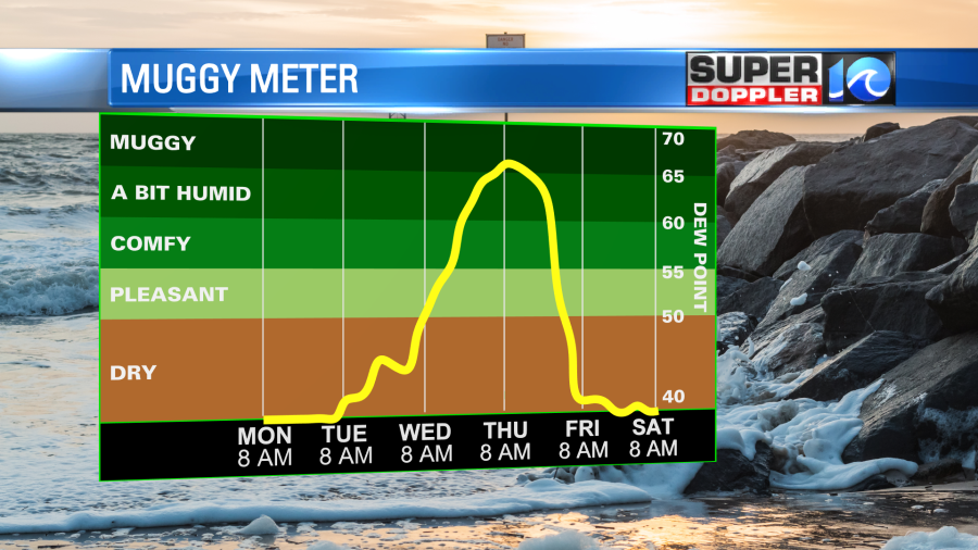
A couple of fronts will be moving into the region on Wednesday. The most dominant one will be a warm front. That will keep the temps up into the upper 60s to near 70 degrees despite lots of clouds and rain showers moving in. The rain will likely come in later in the day.
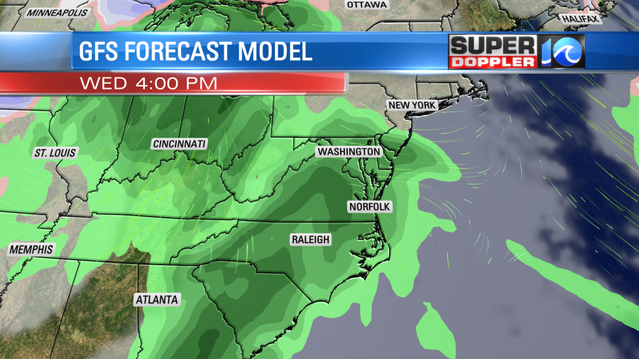
Then we’ll have a lot of rain Wednesday night into Thursday. It will be warm and breezy on Thursday with highs in the 70s. We’ll have more rain into Friday with temps dropping into the 60s. There may be some thunderstorms at times between late Wednesday and Friday morning, but I’ll have more details on that in tomorrow’s weather blog. Until then enjoy the nice weather!
Meteorologist; Jeremy Wheeler


