Yesterday, we had a few showers and storms pop up during the afternoon, but there wasn’t much. A few strong storms formed inland later in the day, but a lot of the metro got missed.
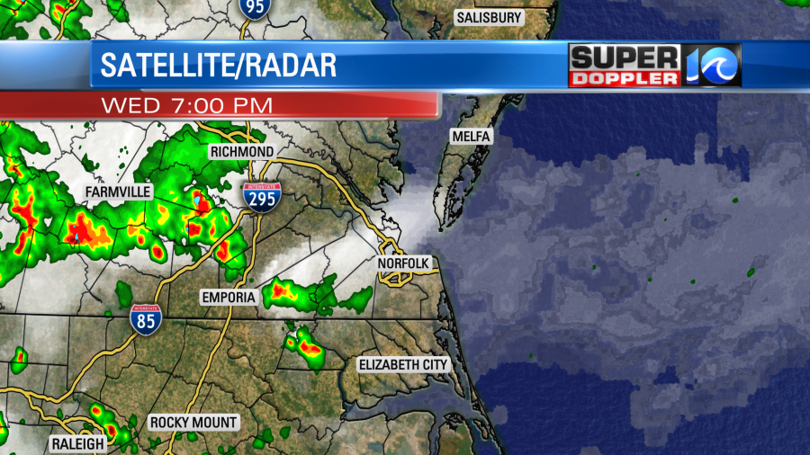
Then last night we had some light rain just north of the state line down into northeast North Carolina.
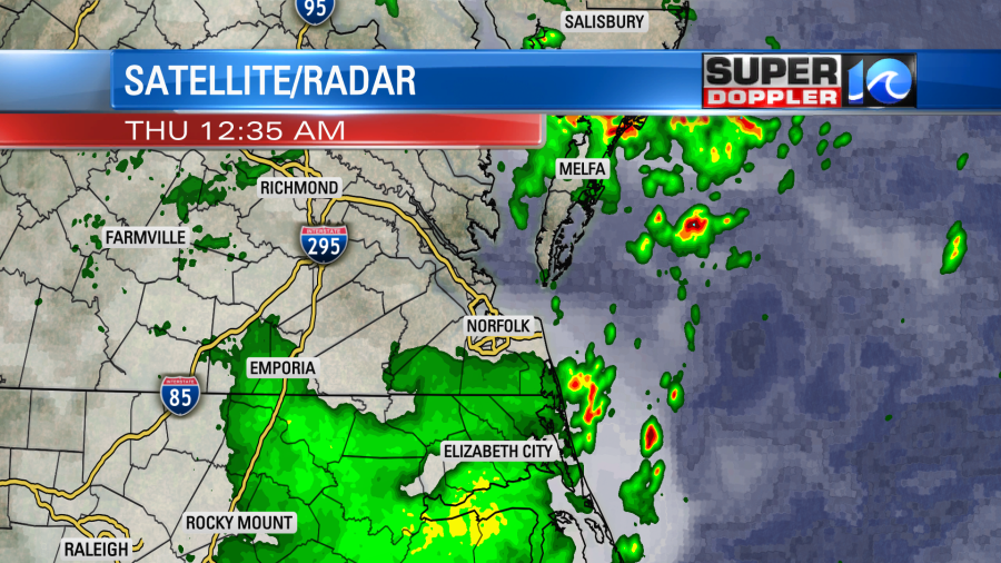
A few isolated showers continued early this morning, but they weren’t enough to add up in the rain gauge. Speaking of rain gauges…We need some in ours. We are down about an inch for the month, and we are down about 1.7″ for the year so far.
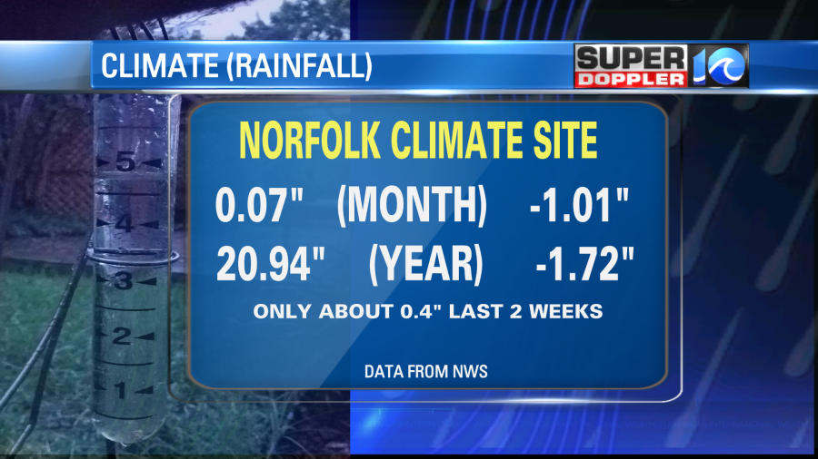
Norfolk has only had about 0.4″ of rain over the last 2 weeks. I know we had over an inch a few days ago in Elizabeth City, but we all need much more.
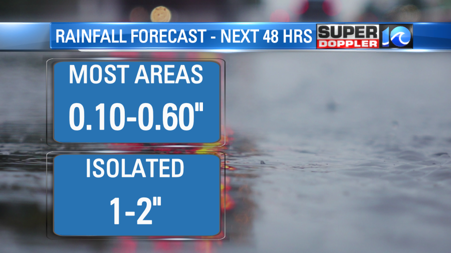
Today we’ll have some scattered showers and storms firing up during the afternoon. Amounts will vary quite a bit. Most of the “scattered” showers and storms will put down about 0.1″ to 0.6″. However a few locations will pick up 1-2″.
There is a cool front that has drifted a little closer to us to the north, but it has also stalled out.
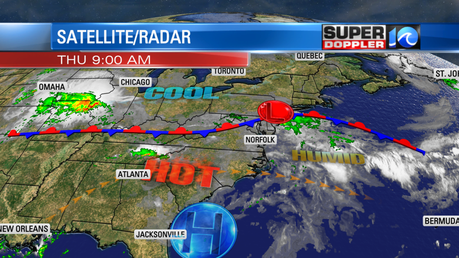
High pressure is to the south. There is also a weak area of low pressure to our northeast. We are still on the hot side of the front today, but we’ll have clouds building this afternoon. So high temps will rise to the upper 80s to low 90s. There will be a few mid 90s inland and south. However, the heat index will still be in the upper 90s to lower 100s.

If we’re lucky then some rain and storms will cool down lots of the area later today. We’ll see. We’ll have isolated showers this morning through the early afternoon. Then we’ll have scattered showers and storms firing up later today.
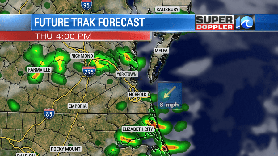
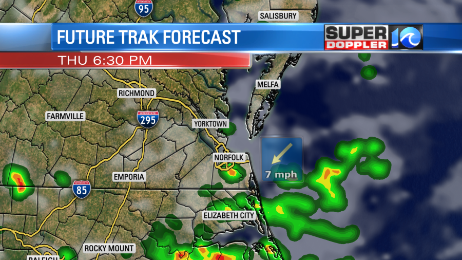
These scattered showers and storms will continue into the evening.
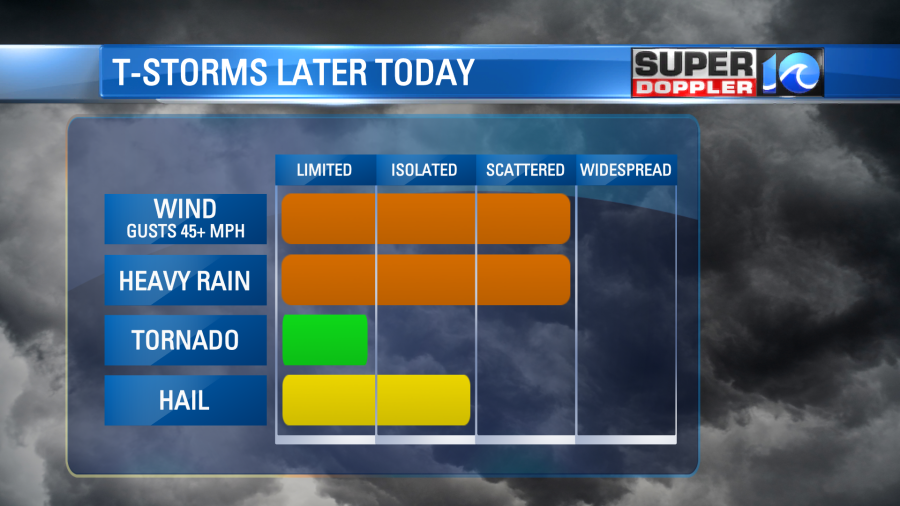
We do have a slight risk for severe weather between the late afternoon and early evening. We’ll have a lot of instability, but like yesterday we won’t have a lot of upper level winds (shear). So some isolated downpours and brief gusty winds will be possible in any storms, but there’s a lower threat from hail and tornadoes.
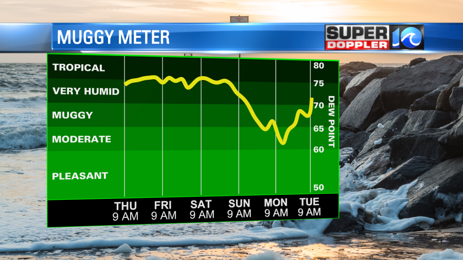
Tomorrow the front should sink just a little more to the south. Hopefully, we’ll be slightly cooler. However, we’ll still be just as humid. High temps will be in the 80s. The heat index will be in the low-mid 90s. We’ll have a light northeast wind. The models have less rain tomorrow and more sunshine overall. However, a second stronger cool front will move through on Saturday. This will increase the clouds and the rain again. We’ll have scattered showers and a few storms. Highs will be in the 80s. Then after a couple of showers Sunday morning we’ll cool down and dry out Sunday afternoon into Monday.
Stay tuned for updates on the storms. Cross your fingers that we get some rain.
Meteorologist: Jeremy Wheeler


