
This morning as the kids headed back to school some of them were greeted by a few scattered rain showers.
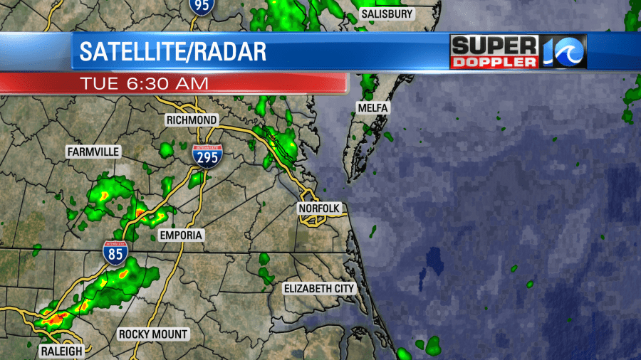
The rain was both scattered and light, but there were still a few problems on the roads. The sun did pop out a little bit, and the bulk of the rain stayed out of metro during the morning commute.
We have high pressure moving away from the region. There is a cool front moving closer to our from the northwest.
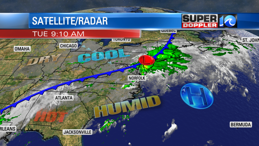
There is a large band of deep moisture that runs along and south of the front. That deep moisture pushed up into the northeast states yesterday, and that helped to cause some major flooding up into Rhode Island.
This will give us lots of clouds through the day with some peeks of sun today. There will be some more scattered showers this morning. Then there will be some scattered showers and a few thunderstorms during the afternoon. There could be a few heavy downpours.
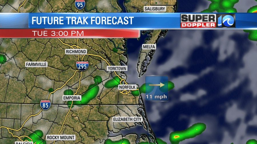
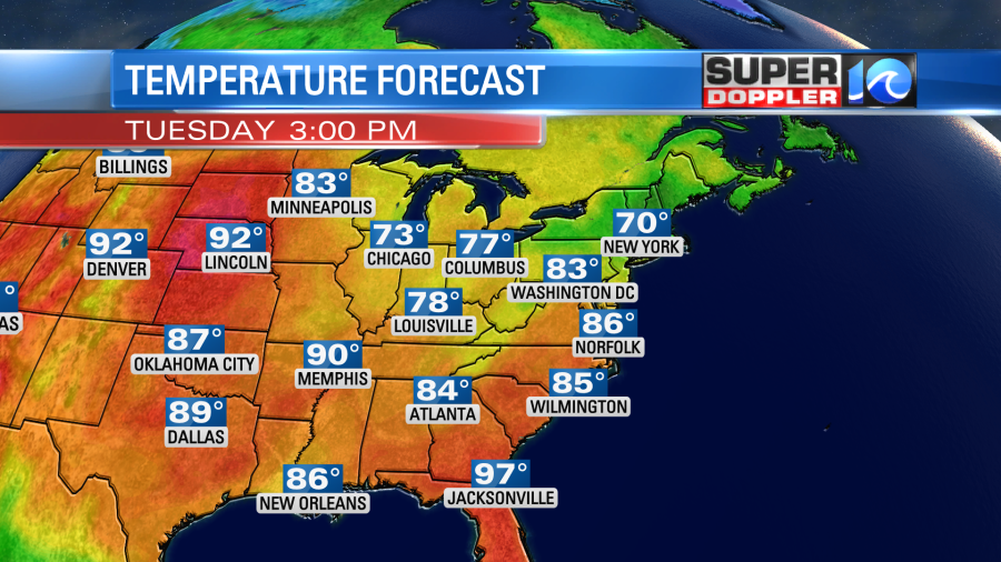
I will say that the models have backed off the rain coverage a little bit this afternoon compared to yesterday’s forecast. However, the thick moisture isn’t going anywhere. So I think we’ll have a little more coverage than our model shows. The scattered showers will taper off into the evening. Regardless, it will be warm and humid today. High temps will rise to the mid-upper 80s.
We’ll have a light southwest wind at 5-10mph. The showers will be spotty overnight. Low temps will be in the low 70s. The cool front will slip through overnight, and that will cool us down a little tomorrow. High temps will run in the lower 80s. The front will sink southward. However, there will also be an area of low pressure forming just to our northeast. This will create a few more showers later Wednesday. There could also be a few isolated thunderstorms. Otherwise, we’ll have a mix of sun and clouds through the day.
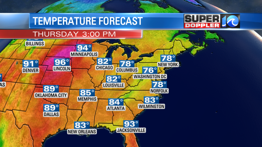
We’ll have another mix of sun and clouds on Thursday with some much cooler air. High temps are aiming for the upper 70s.
Not only will that be nice, but the humidity will also drop quite a bit. Take a look at the dew point forecast:
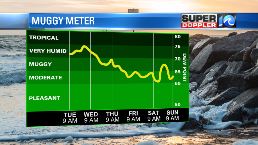
The lower humidity will continue into Friday and Saturday. Again, it’s a later Summer type of dry, not an early Fall one. We’ll be partly cloudy on Thursday with a few showers possible. However, showers should be very spotty Friday and Saturday. It should be some pretty nice weather Thursday through Saturday.
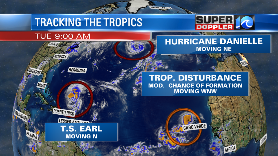
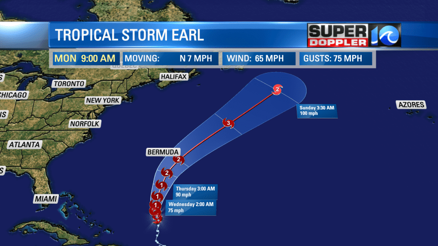
Meanwhile there are 2 tropical systems in the Atlantic. Tropical storm Earl has gained some strength since yesterday, but it looked a bit more ragged on satellite this morning.
The system is forecast to move north and strengthen over the next couple of days. It will then move a little more to the northeast. It should miss Bermuda, but it may get close enough to bring them some rain and gusty winds. That will depend on how large the system gets. The forecast calls for Earl to become a major hurricane in a few days.
Hurricane Danielle, on the other hand, is forecast to weaken over the next few days over the north Atlantic.
It will also become extra-tropical by that time. Neither system should be a threat to land. Finally, there is a tropical disturbance in the eastern Atlantic. It has a medium chance of formation, but it will probably stay out to sea.
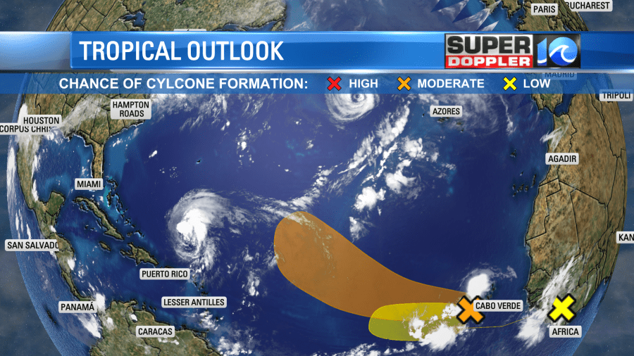
There is a 4th feature over Africa that is moving west. However, it hasn’t even moved over the water yet. So we’ll focus on that tomorrow.
Meteorologist: Jeremy Wheeler


