Ian will bring rain and some windy conditions to our area Friday, with periods of rain and isolated flooding from the heavy rain. Tidal flooding will also be a concern.
TIMING: Friday morning into Friday night
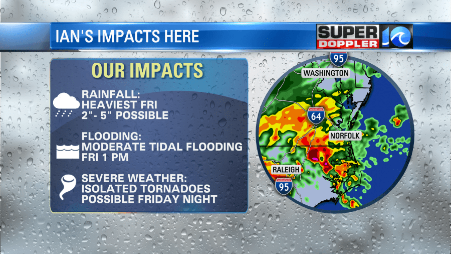
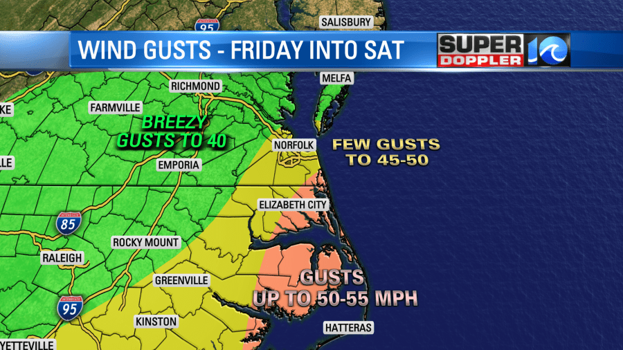
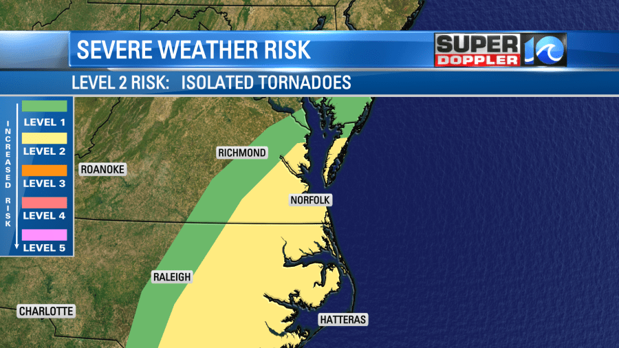
IMPACTS: Several inches of rain, tidal flooding, wind gusts to 35-50 mph and the potential for isolated tornadoes
WHERE: Entire region – all of SE VA and NE NC
A tornado warning was issued for Camden, Currituck and Pasquotank Counties until 6:15 p.m. Friday, but it was canceled early.
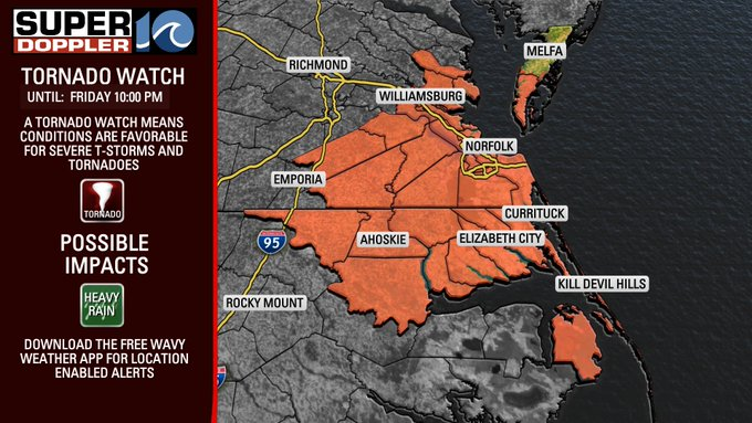
TORNADO WATCH: A tornado watch is in effect for the area until 10 p.m. tonight. That means conditions are favorable for a possible tornado.
Ian remains a strong Category 1 hurricane. The track from the National Hurricane Center takes the center of the storm towards the South Carolina coast this afternoon. We will see the remnants of Ian move into our area with periods of rain and wind.
RAINFALL: This afternoon, periods of rain are expected. Some of it could be heavy. Rainfall rates could lead to some issues with ponding of water on the roads and isolated flooding. A Flood WATCH is in effect, which means flooding is possible. If a Flood Warning or Flood Advisory is issued, that’s the time to be alert for flooding – as it is expected to occur soon or is occurring now.
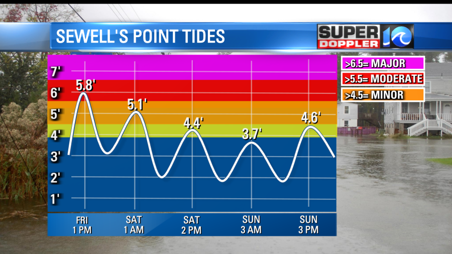
With the higher tides coming up around 1 p.m., and the heavy rain falling then too – we could see some issues with water backing up as the rain water isn’t able to go down the storm drains.
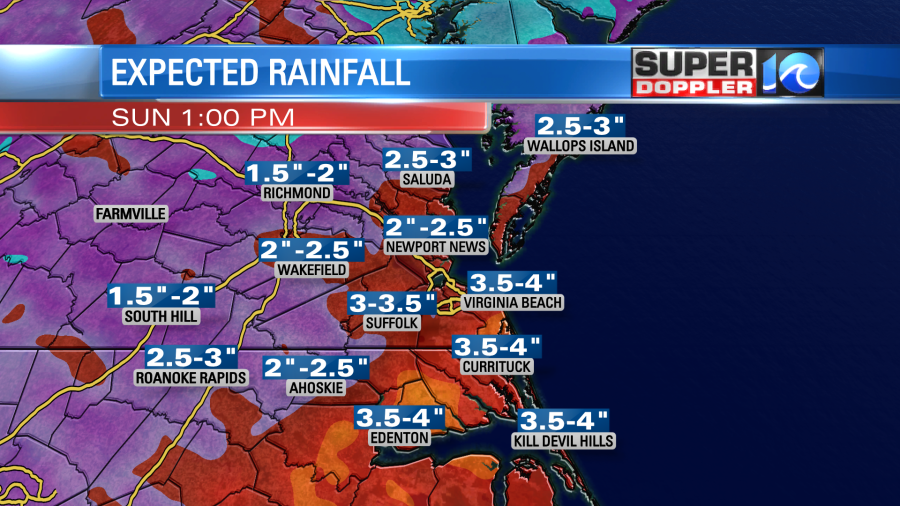
Overall rainfall totals are expected to be around 2-5″ today into tonight.
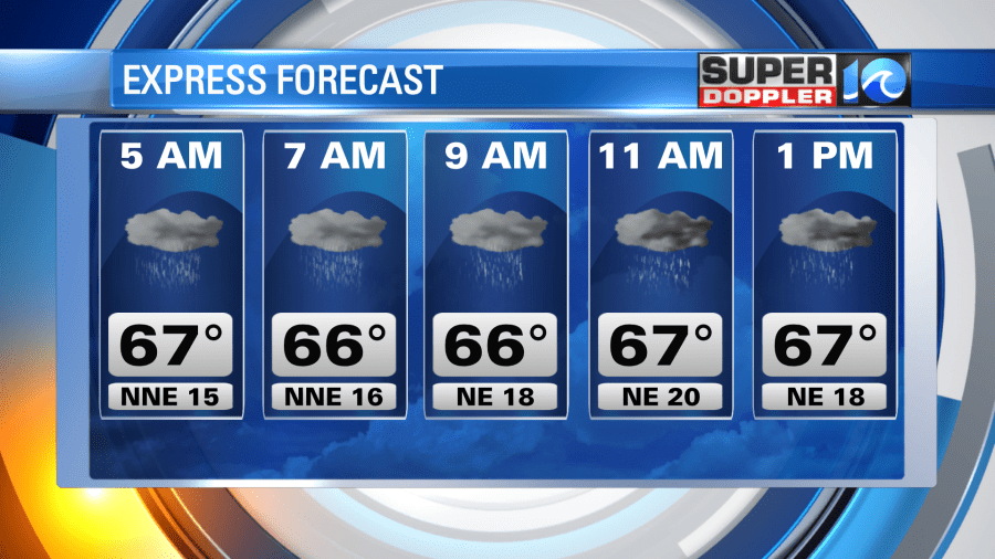
WINDS: In terms of wind gusts, we will see mainly breezy conditions with occasional gusts to 35-45 mph. These winds will be capable of knocking over lawn furniture, trash cans and downing some tree limbs. A few weak trees could also fall. Some of the higher gusts will be in the OBX and along the coast, where gusts to 50 mph will be possible.
TORNADO RISK: Late this afternoon and into the overnight, as Ian’s center and the associated fronts moves north, some warmer air will move into our area. That means we’ll see a risk for a few stronger storms – some of which could produce quick spin up tornadoes. These tornadoes can be hard to spot, as they’re often wrapped in rain – so if a tornado warning is issued for your location, don’t try to look for it. You most likely will not see it.
TIDAL FLOODING:
Tidal flooding will be an issue today around midday. We will see the tide begin to rise late morning and into the early afternoon. High tide at Sewell’s Point is around 1 p.m. Expect to see some issues with water on roads, perhaps increased by the potential for heavy rain around the high tide time.
Download our WAVY Weather app today to track the rain and have a way to get warnings sent automatically to your phone. We’ll of course keep you updated on air and online. If you have any weather questions, feel free to ask us on social media.
You can submit your pictures to us as well as the storm impacts our region. Email pictures to reportit@wavy.com
Meteorologist Ricky Matthews
Follow Ricky on Facebook and Twitter