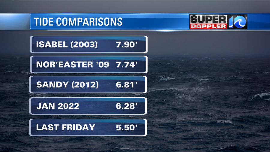
Today was a tricky forecast. When model guidance is suggesting historic tidal flooding, you cannot ignore it. However, you can be skeptical. In the past 48 hours in phone calls I had with the rest of our weather team, members did have hesitation that we would see 7 foot tide levels, but we agreed that we should still forecast that number.
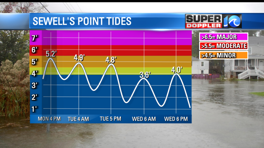
What happened, was a change in the wind direction. The wind today was circling the area of low pressure off our coast. Because that storm moved a little more north towards New Jersey, we saw a NNW breeze. If that wind was from the NNE, more water would have piled up in the lower bay, increasing our flooding by 1 to 2 feet at Monday’s 4 PM High tide.

The storm that is bringing us the tides, rain and wind will continue tomorrow, but the tidal flooding will be Minor across our area. We’ll still see highs in the 50s with rain and wind through Wednesday.

Chief Meteorologist Jeff Edmondson


