
The weather pattern recently hasn’t been super tough, but it has been tricky for us local meteorologists. The overall pattern recently has been stuck for a while. It’s been warm in the South and East, cold in the north and West, and highly variable in-between. Yesterday, we had a little wiggle in the pattern. So a back-door cold front came in early from the north and east. High temps ended up in the 60s. It was still a nice day, and it was still above average, but it was well shy of my 71 degree forecast in Norfolk. Having said that, we just finished February as the 4th warmest on record.
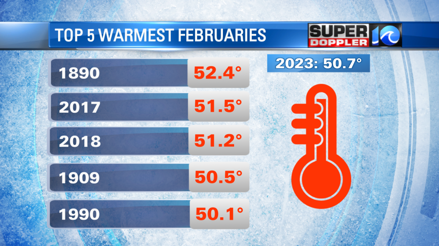
We finished 6.5 degrees above average. With that you would think that we were number one. However, there were a few chilly days as well as a few chilly mornings. So perhaps that’s why.

We also finished a bit below average for rainfall.
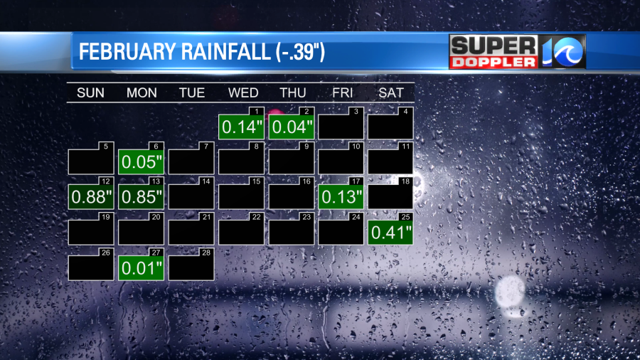
While we have had some occasional rain over the past couple of months. We’ve really been lucky in that we haven’t really had any big weather systems run directly though our region. Large storm systems tend to track along the jetstream, and that has been mainly running to our north like it is today.
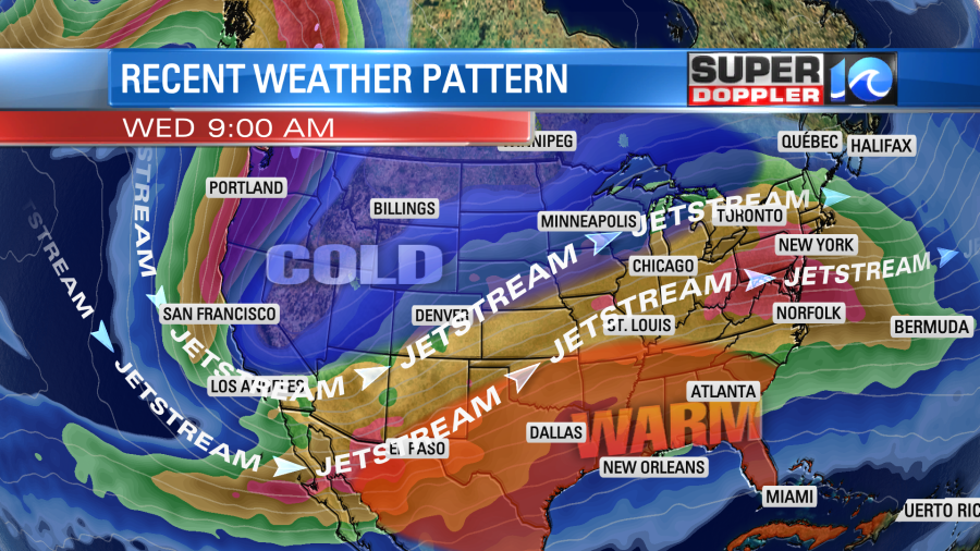
So storm systems have been dropping into California, and then running through the central U.S. up into the Midwest. That’s why there has been so much snow in the north and west. There have also been a lot of storms and severe weather in the Plains and Midwest lately. This is because the systems have been able to tap into the unseasonably warm and humid air in the south. Today we will have dry/mild air in our region. There is a cool front stalling out to our south.

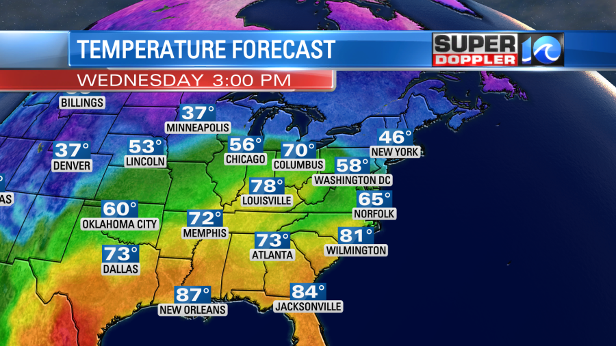
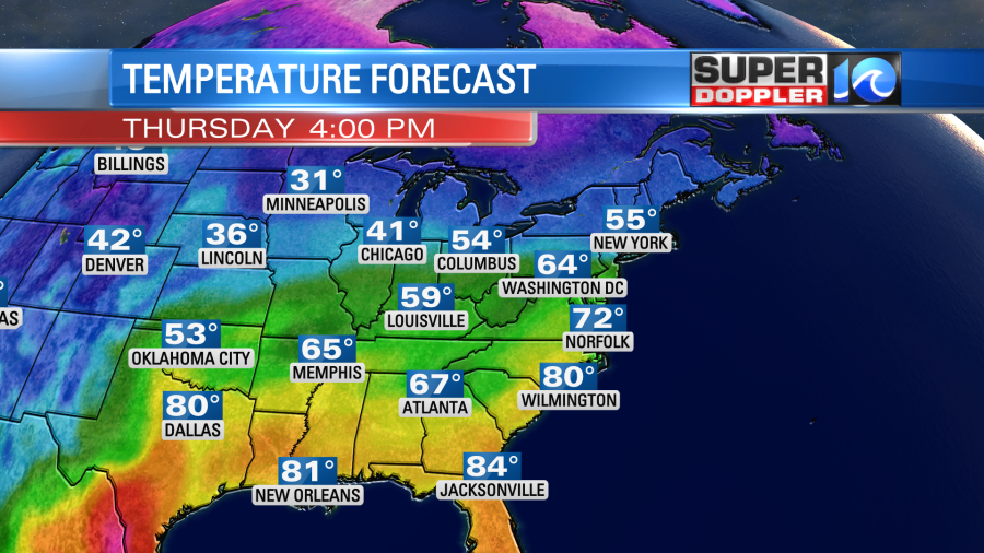
There is a cold front over the middle part of the country, and there will be some storms south of it today. We’ll have quiet weather here locally. We’ll have mostly sunny to partly cloudy skies. High temps will be in the low-mid 60s with warmer temps inland and cooler temps near the shore.
Winds will be out of the east and then out of the southeast.
The front will lift north as a warm front this evening. It will pull up a lot of moisture. Plus, a little ripple in the jetstream (a.k.a a shortwave trough) will run overhead into tomorrow morning. This will create a lot of rain during the morning commute.
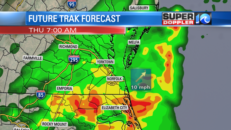
It could cause some problems on the roads tomorrow morning. However, the rain and the upper level disturbance should kick out by midday. So we’ll be dry for the rest of the day. There will still be a good amount of clouds, but winds will be light and out of the southwest. So high temps should be able to reach to near 70 degrees. It may even reach the low 70s.
During the day there will be another storm system (low pressure) developing over the Plains. That one will be stronger, and it will pack a punch.
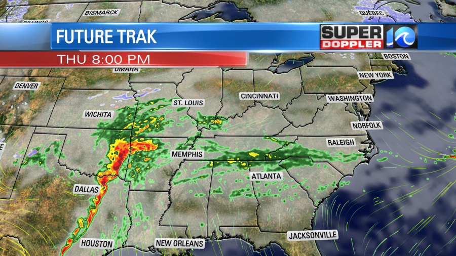
In fact there is a moderate risk for severe weather for out that way tomorrow.
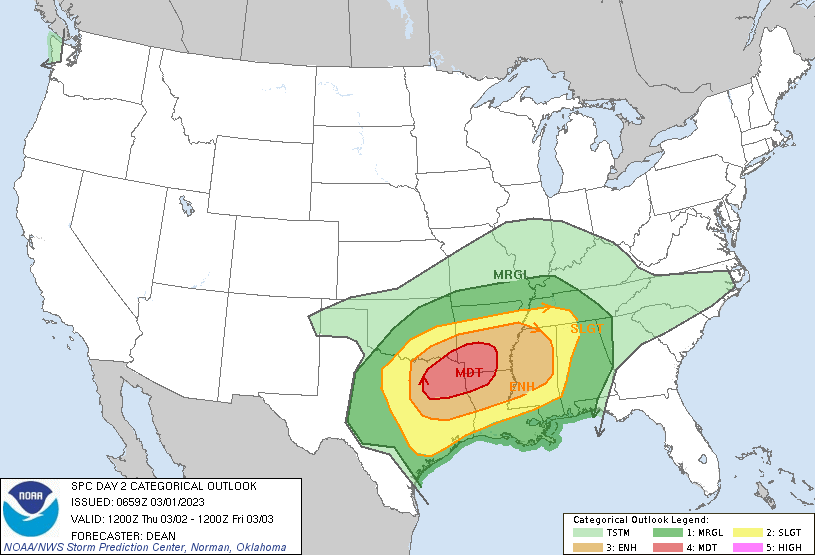
Moderate risks are fairly uncommon. So that could be a big deal. By the time that system moves east on Friday it should weaken quite a bit. So we will have scattered rain showers here during the day on Friday. It won’t be a washout, but rain will last for a while.
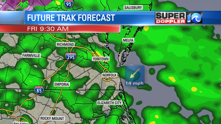
High temps on Friday have become VERY tricky. Yesterday it looked like we would hit around 70 degrees. When I got in this morning, the forecast had dropped to near 60. Through this morning the models started showing more numbers in the 50s for high temps.
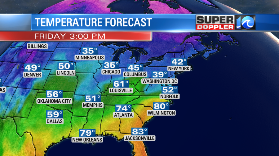
So I’ve been trending it downward. One good thing that cooler temps would create would be more stable air. So that would limit the threat for severe, and it may even limit any thunderstorm formation. We’ll see. Stay tuned.
I do still think that the weekend is looking good. FINALLY, we may have a mild and dry weekend. High temps are aiming for the mid-upper 60s on Saturday and upper 50s on Sunday.
Meteorologist: Jeremy Wheeler


