
Locally, we are looking at some great weather for the next few days. Meanwhile, the tropics have become very active over the last 24 hours. We are tracking 3 systems now in the Atlantic Basin. I’ll have more on that in a moment. First off, I’ll talk about our awesome local weather.
A cool front has dropped to our south, and it is going to stall out over Georgia today. High pressure is building in from the north.

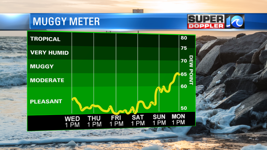
The northeast breeze has been persistent since yesterday. It will run at 10-15mph today with some gusts to 20mph. That cool breeze is pulling down some very dry air into the region. Dew points are in the mid 50s, and they will drop to near 50 later today into tomorrow.
This dry air will stick around through the weekend.
High temps will be in the low 70s this afternoon with a few mid 70s inland. I will say that this will be a true taste of Fall. Our Future Trak model suggests that we may have a few more clouds this afternoon, and it hints at a couple of sprinkles coming in off of the ocean. It’s not out of the question, but it’s a low chance. We’ll have similar weather tomorrow, but I think we’ll start a little cooler even. Low temperatures will be more in the 50s with 60s near the shore.
We’ll stay cool and dry on Friday with highs in the mid 70s. We’ll warm up into the 80s over the weekend, but the humidity will stay down. Enjoy the weather!
Two negative impacts of the wind will be the rip currents and the tides. We have a high threat for rip currents at the local beaches. There will be some rough surf as well. Waves will run about 3-5 feet, according to surfline.com. There will also be some nuisance to minor tidal flooding over the next couple of days. For more on that you can go to the National Weather Service site: NWS tides.
So now let’s talk about the tropics. There are 3 systems that we are tracking.
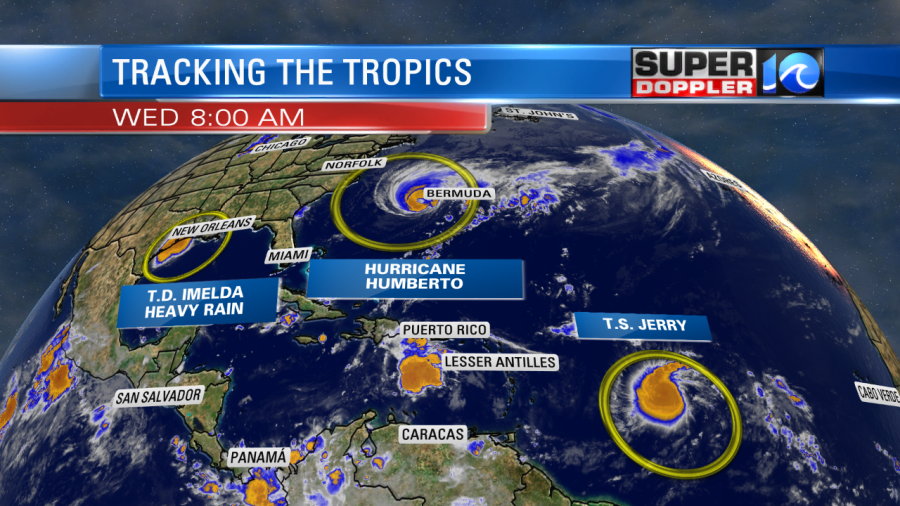
We’ve been following hurricane Humberto for some time now. It is mostly responsible for our waves along the local beaches even though it has been out to sea. However, the system may get fairly close to Bermuda in the next 12 hours.
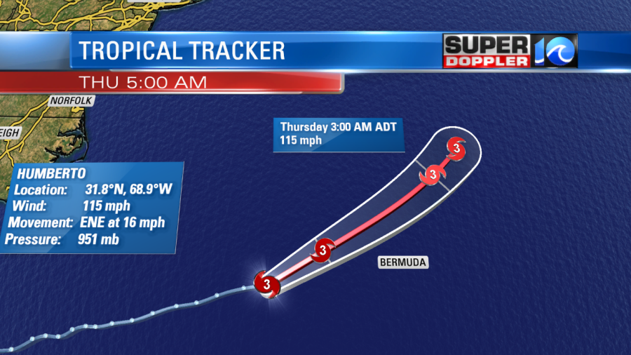
They will have some surge, wind, and rain there, but it still looks like the worst of the storm will pass north of the island. After that point it will move over the north Atlantic and weaken over the next few days.
Yesterday a tropical disturbance quickly blew up off the coast of Texas. It became a tropical depression, and then a tropical storm in a short period of time. Luckily, Imelda has moved inland. So it lost its ability to strengthen. However, it was and is forecast to be a heavy rain-maker for that region. Today, it will steadily move north with heavy rain continuing over Houston.
It will continue to move north and weaken over the next day or two.

The third system is Tropical Storm Jerry. That feature has gained some strength since last night. This morning it had winds of 45 mph. It is forecast to move west/northwest for a couple of days. This would bring it east of the Bahamas by the weekend.
At that point, it is forecast to turn more to the north.

However, the models are in pretty good agreement at taking it northward and then northeastward into early next week. That would keep it out to sea.
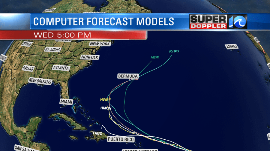
While this is good news, it’s also too early to let our guard down. That part of the forecast is a few days out, and still could change. Stay tuned for updates.
Meteorologist: Jeremy Wheeler


