
This job is a lot tougher than it looks. More specifically… I had about 3 days this week when I had about 4 hours of sleep or less. One night we had some warnings and storms that woke me up. One night I just woke up. Last night I had an old friend text me about a thunderstorm… in Baton Rouge… at 9:30-10:00pm.
So it’s safe to say that my body and mind are sleep deprived this week. Could you tell? On top of that, this weekend’s forecast is tricky, and there are some big outdoor events this weekend.
Having said that let’s talk about that weekend forecast. Today’s setup is actually simple. We have a big area of high pressure to the north with a weak area of low pressure along a front to our south.
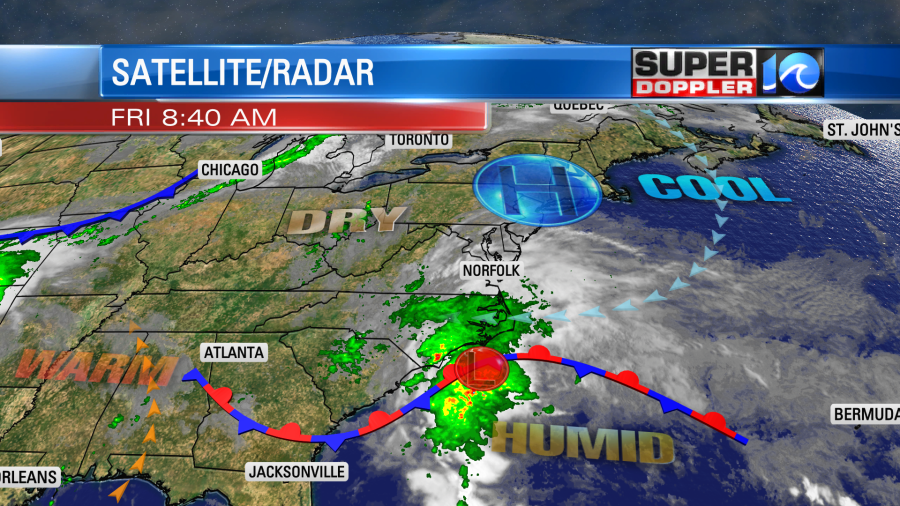
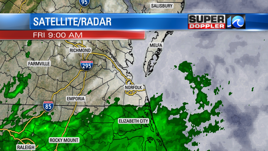
The trick is that the humid airmass is pushing north into the drier airmass, and the models handle that differently. That is mostly due to the different vertical layering of the models. Some of them even change from run to run. So this morning we had a lot of rain showers push up into North Carolina, but mostly they stayed south of Hampton Roads.
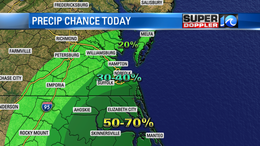
There’s no doubt that we’ll all have a lot of clouds today with a little more sun to the north. There’s also not doubt that we’ll have a higher chance for rain to the south with lesser chances to the north.
Here is the overnight version of Future Trak for today.
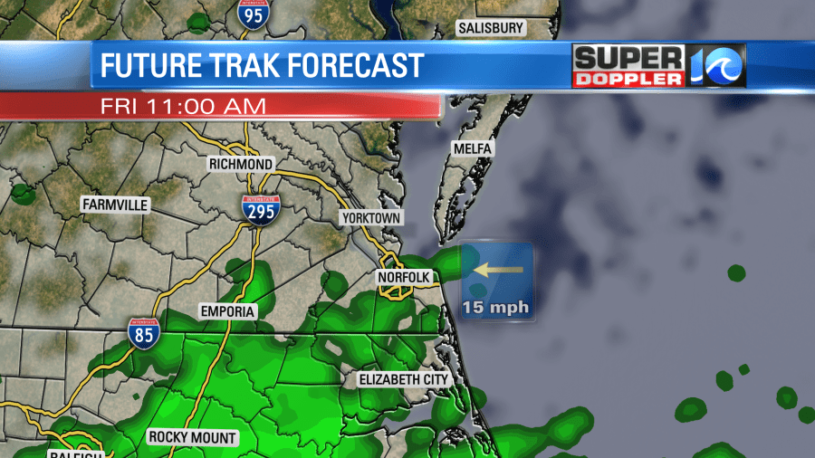
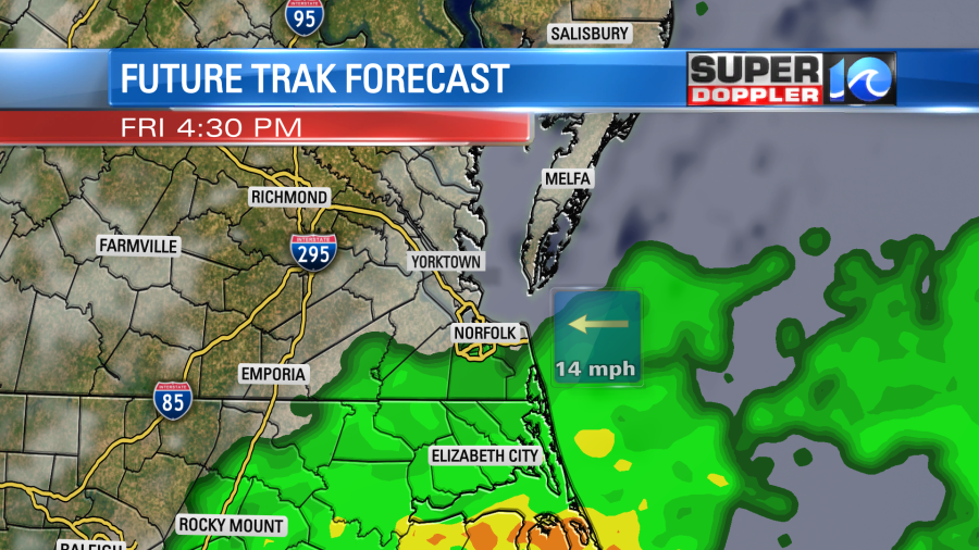
This version lined up with reality better at 7-8am. So I reverted it back to that run. The early morning run took out almost all the rain.
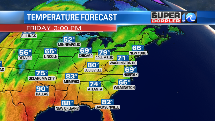
We will have a strong east breeze again. It will run at 10-15mph with gusts to 20mph. Between that and the clouds it will be another cool day. High temps will be in the upper 60s to low 70s.
Tonight the low pressure system will creep to the north/northeast. It will eventually push farther offshore. This will taper off the rain showers late, but scattered showers will continue for a while.
Tomorrow the low will slowly move to the northeast. A few showers (and moisture) will wrap around on the back-side. However, we’ll also have a little drier air work in as well. So we’ll have a mix of sun and clouds with a few possible showers.
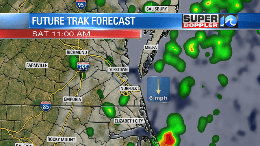
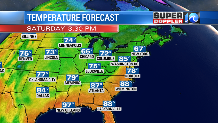
The models do have less of a chance for rain in the afternoon, but they do have some pickup late in the evening. High temps will warm to the upper 70s Saturday. We might even hit 80 degrees.
Winds will be lighter and variable.
Sunday is also a bit tricky. There will be a cold front moving into the region from the northwest. This will create a line of showers and possibly even some thunderstorms. There is a good shot at rain in the morning.
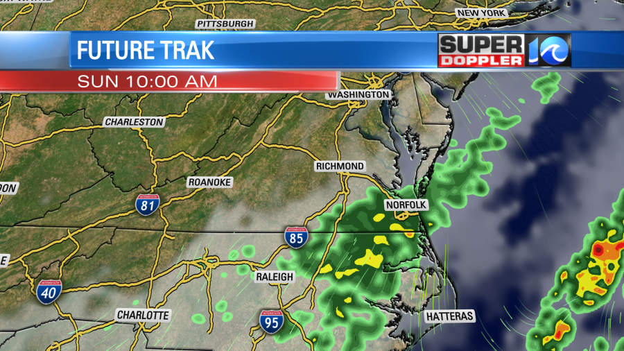
The tricky part is when the precip will drop to our south. Some of the models do have the precip ending by the late morning. Some others keep it going until the early afternoon. Hopefully, it sticks to the former so that it won’t affect most of the outdoor events. We’ll see. check back for updates on that. Either way it will be a bit cooler. High temps will be more in the low 70s. Maybe even in the upper 60s for some. Winds will pick up out of the north.
We probably won’t have too much for the rainfall totals. I think we are looking at a quarter to a half an inch for most. Some locations could see about three quarters of an inch.

Check back for updates to the forecast. Hopefully, that rain will stick to Sunday morning.
Meteorologist: Jeremy Wheeler


