
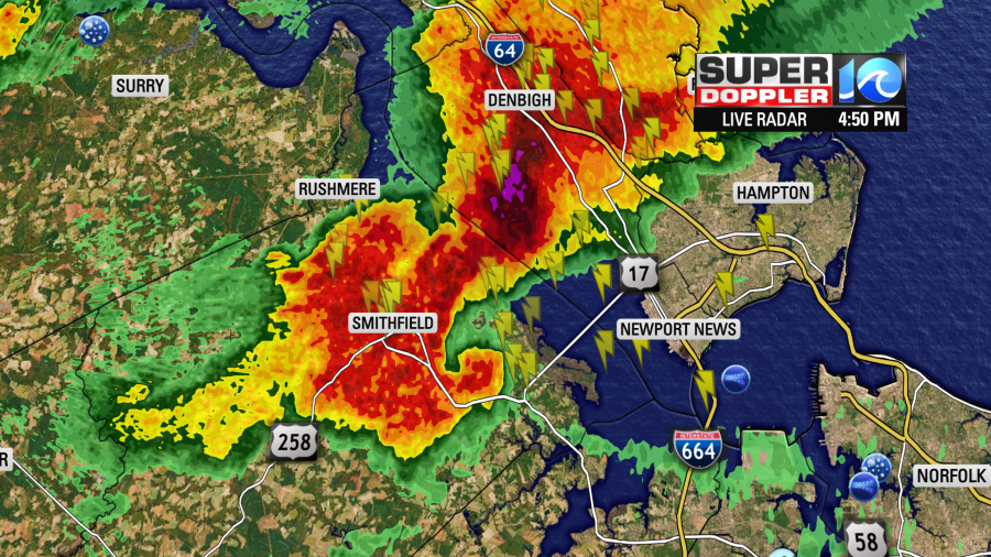
Shortly after 4:30 PM a strong thunderstorm developed over Surry County and started heading southeast. That storm developed a comma shaped hook over Smithfield which the National Weather Service in Wakefield quickly issued a Tornado Warning.
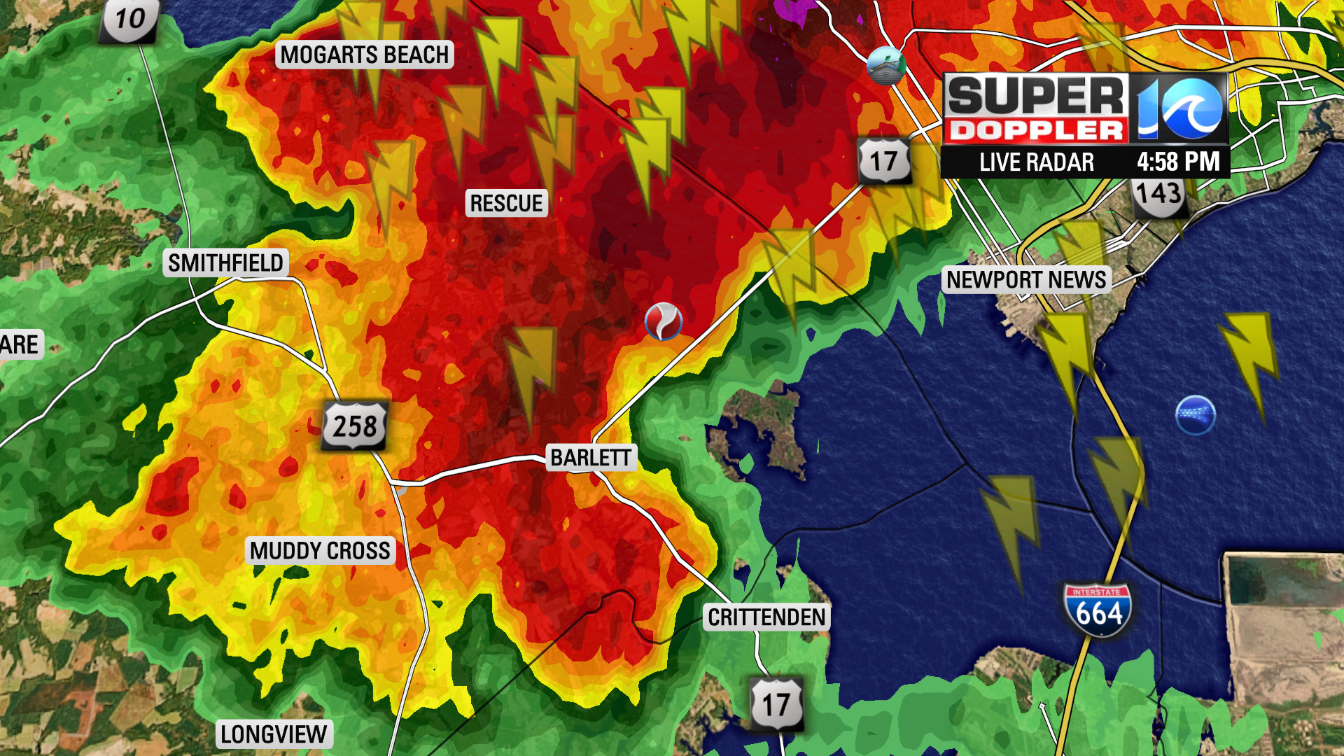
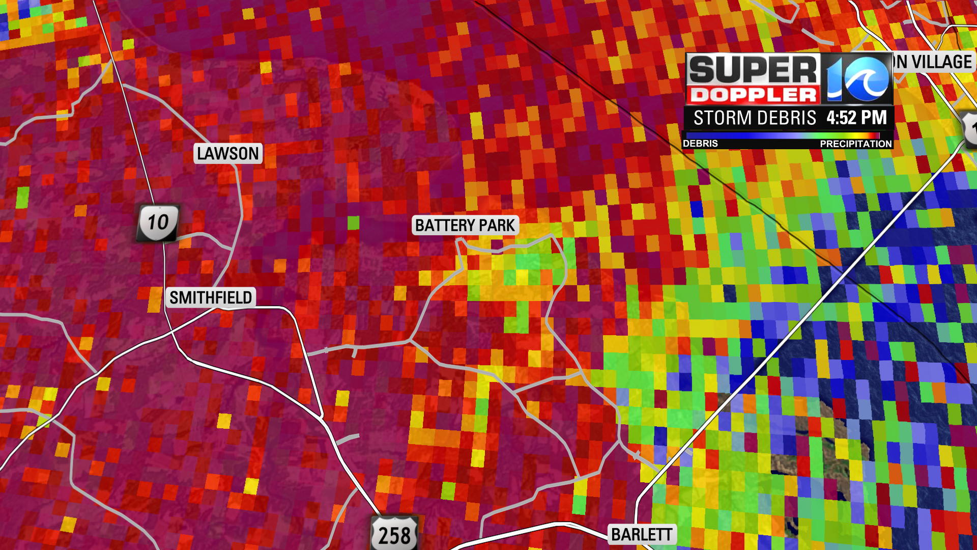
On the Storm Debris slider, do you see the area of light green near Battery Park? That was likely the area where the tornado was located. That is the area where the radar detected objects in the cloud that were not rain droplets.
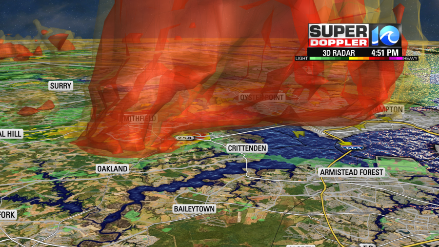
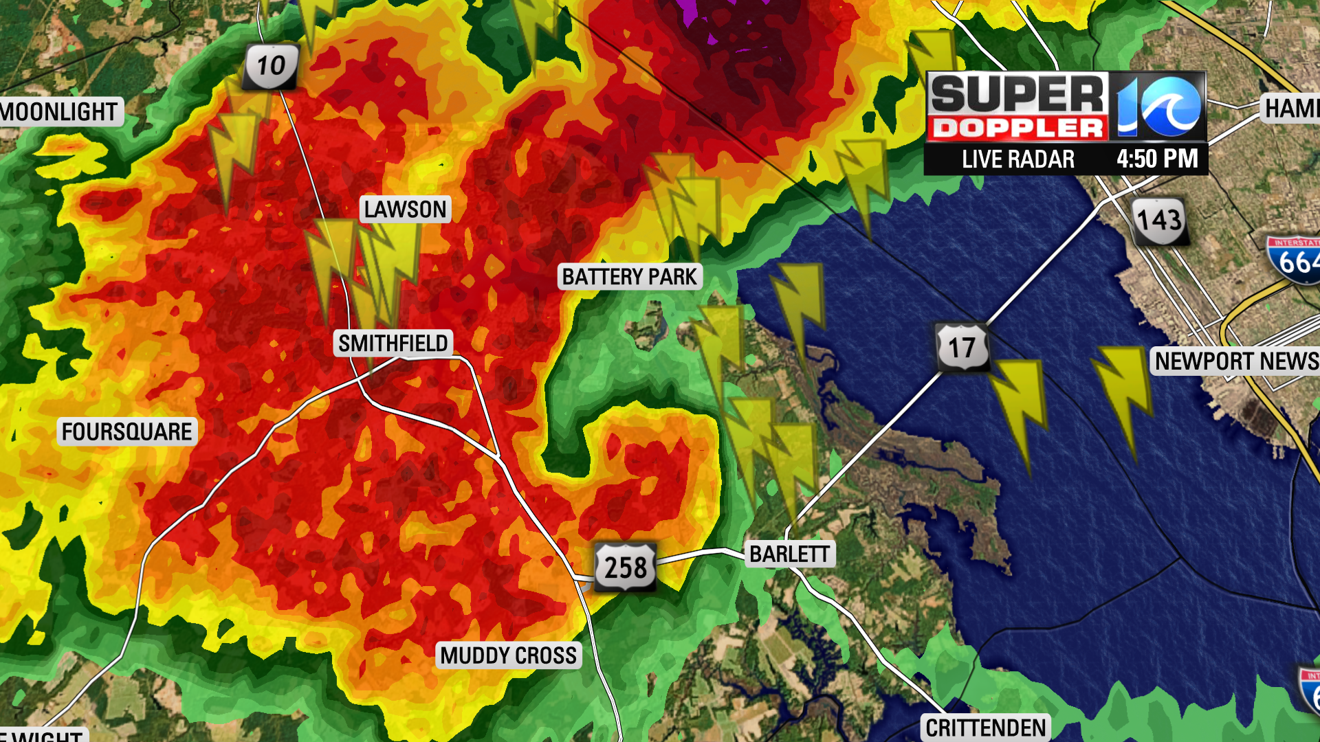
You can see the size of that storm just looking at it from an angle. Also the zone north of Crittenden, that was where the warm and humid air was flowing into the Supercell thunderstorm.
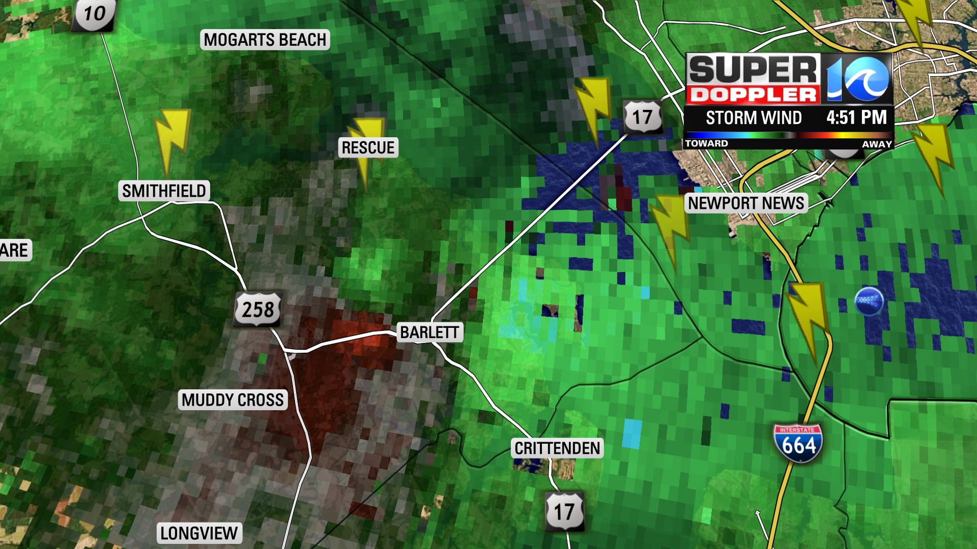
As of the time of writing, we don’t know the strength of the tornado, but it was likely rain wrapped. That is sheets of rainfall were being wrapped back into the thunderstorm blocking the view of the tornado. The National Weather Service in Wakefield will have more on this tornado in the coming weekend.
Chief Meteorologist Jeff Edmondson


