It happened again. Yesterday we had some strong storms popping up during the afternoon (as expected).
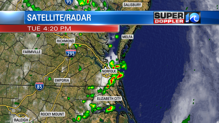
Heavy rain fell over parts of the metro and near the shore. Norfolk picked up 0.27″ of rainfall. With all of the recent rain, we are now well above average for the month of June.
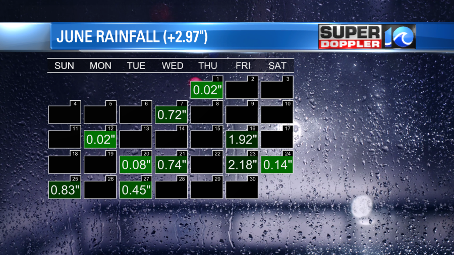
We definitely don’t need any rain in our region for a while. We are actually due for a break! Luckily, we will have some quieter weather for the next 3 days.
Today a cool front is sliding slowly offshore, but it is also stalling out.
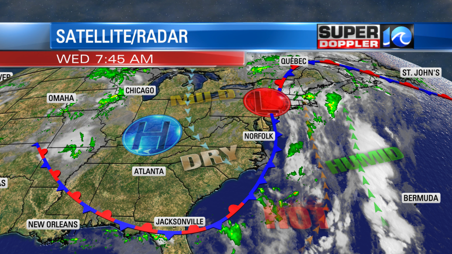
We’ll be on the cooler/drier side of the front. So high temps will aim for the low-mid 80s.
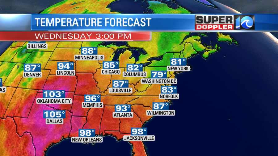
The extreme heat continues over the Deep South. Poor Texas! The heat has been brutal there lately. Power consumption is off the charts. They will get a break soon.
Around here we’ll have mild temps with partly cloudy skies through the day. Dew points will be in the mid 60s. So humidity will be moderate today. It will be high enough, and the front will be close enough that some isolated showers or storms may pop up this afternoon. However, I’ve capped the chance at 20%. All-in-all it should be a nice day!
Tomorrow the front will slide a little more offshore, and high pressure will edge closer to our region. So we’ll be mostly sunny with only a stray shower to our south. High temps will warm to the mid 80s, and the humidity will rise a bit.
By Friday we’ll heat up some more. High temps will rise to the upper 80s to near 90.
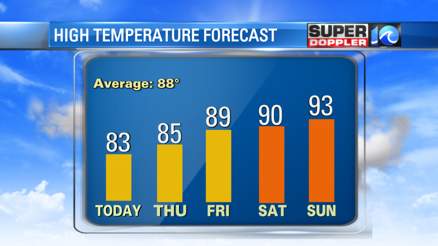
The extreme heat will break in the south, but the overall heat will start sliding east. We’ll be partly cloudy.
Over the weekend we’ll likely have some typical Hampton Roads Summer weather. We’ll be partly cloudy both days with some scattered showers and storms popping up. For now the chance looks a little higher on Saturday compared to Sunday, but neither day looks like a big area of rain. High temps will aim for the 90s. That will be interesting because the latest (first 90 degree day reading) was on July 2nd (1972). We are probably going to get close to that date for our first 90 degree day this year.
There hasn’t been much change in the tropics, but there is a subtle difference since yesterday. There is now another weak disturbance south of Bermuda. This is very close to the remnants of Cindy which could re-develop over the next few days.
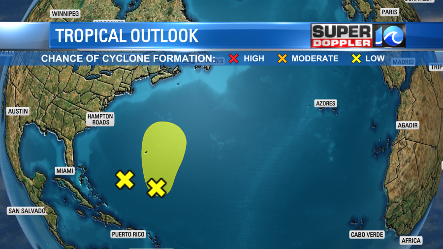
Neither should affect the east coast, but they may affect coastal Canada. We’ll see.
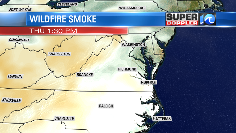
I’m not done yet. There are Air Quality Alerts up for parts of northeast North Carolina today.
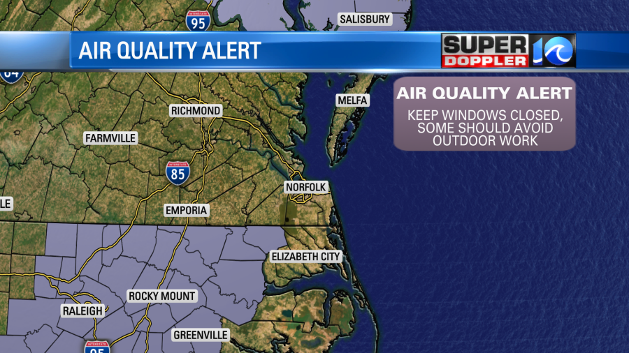
The smoke from the Canadian wildfires have been a huge problem in the Midwest over the past couple of days. Some of that has rounded the bend, and has made it into North Carolina.
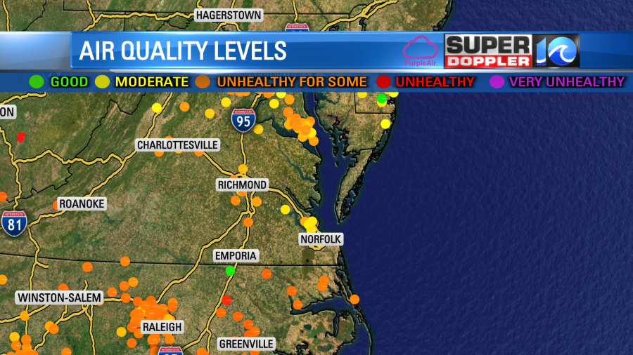
The smoke should thin out this afternoon, and a bit of thin smoke may work it’s way into southeast Virginia tomorrow.
Meteorologist: Jeremy Wheeler


