Locally, temperatures are on a roller coaster. (Maybe more like the Elmo coaster compared to the Griffon but still…).
They will be up and down for the next few days. Typically, when you have a series of cold fronts then you tend to get some showers and/or storms. However, we’ve been too dry for that to happen lately.
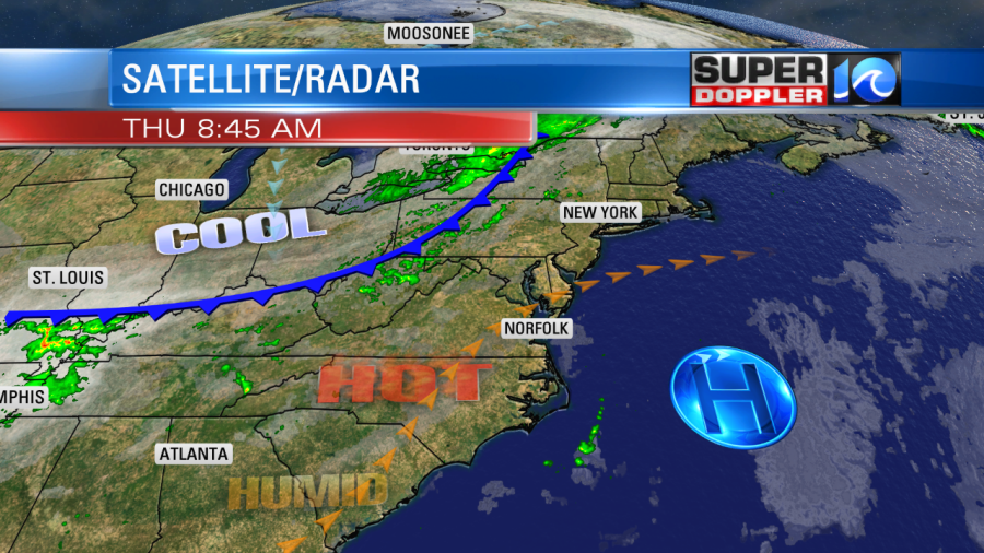
We’ve only had 1.77″ of rain since Sept. 7. Today temps are going up. High pressure is to our southeast. Our surface winds are out of the southwest.

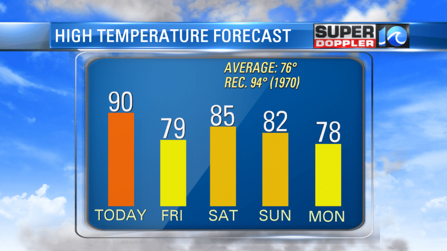
We’ll heat up to 90 degrees this afternoon with a head index in the low-mid 90s. This heat is unseasonable, but not unheard of. The average high for this time of year is 76 degrees. The record high for today is 94 (1970). A cold front will move in this evening. It will create some scattered rain showers. Maybe an isolated thunderstorm. However, I still only have the chance for rain at 30%.
Definitely not a drought-buster.
Tomorrow, we’ll cool down and dry out again as the front sinks to our south. High temps will be in the upper 70s with partly cloudy skies. It will be very nice out. We’ll have a northeast breeze. We’ll heat up again right away on Saturday. High temps will hit the mid 80s. Then we’ll be in the low 80s on Sunday and upper 70s on Monday…

I’ve got a 30% chance for showers on Sunday, but that’s about it. Otherwise, there isn’t much rain in the next 7 days.
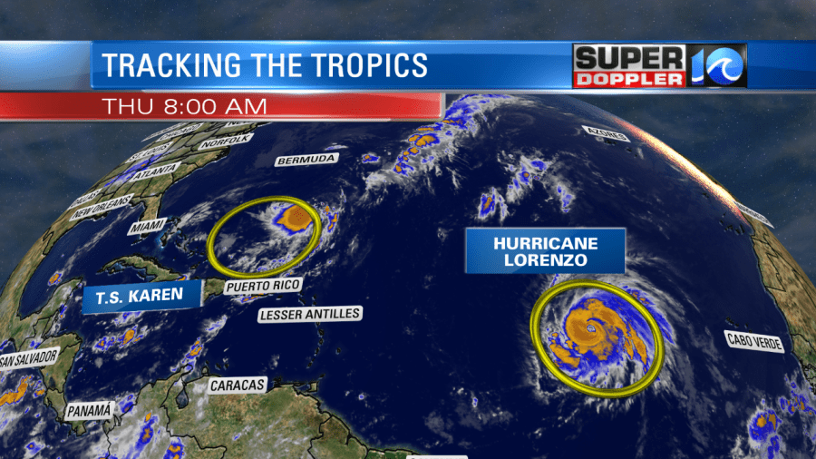
Meanwhile, there have been some interesting changes in the tropics. Jerry is no longer a system. So that’s one less thing to track. Tropical Storm Karen is very weak, and Hurricane Lorenzo has become very strong.

Karen was barely holding on to tropical storm strength this morning. It is north of Puerto Rico, and it is moving generally north. Dry air has probably kept the system weak. It probably didn’t help with the interaction with Puerto Rico either. High pressure is building in to the north of the system. So Karen is still forecast to move east and then to the north in the short-term. This is similar to yesterday’s forecast. However, now the system is forecast to weaken or even fall apart in a few days.

More dry air and increasing wind shear are expected to keep the system weak or even kill off the system over the next 4-5 days. Many of the models had predicted this before, but the statistical (mostly numerical) models strengthened the system and ignored the dry air.
Now, at this point, the National Hurricane Center is siding with the dynamical models. This includes the European and GFS. This is great news for the Bahamas, but it’s still too early to give the all clear.
There is still some warm ocean water down there. So it could maintain some strength. We’ll see.
Hurricane Lorenzo is churning over the central Atlantic. It is now a major Category 4 hurricane. However, it is forecast to move to the northeast and then north. This will keep it out to sea for the next few days.

The problem is that if the track continues to the northeast, then it could head towards the Azores islands. Hopefully, it weakens fast or changes track. Stay tuned for updates.
Meteorologist: Jeremy Wheeler


