
Yesterday we did have some scattered showers and storms firing up during the afternoon. I was on a Zoom call with some scouts at Pipsico Scout Reservation for a weather merit badge, and the counselor said there was a pretty strong storm out there right before we connected.
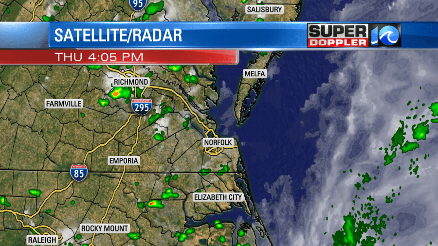
I got some heavy rain at my house during the evening. It was nice not to water again, but the hedges and weeds are starting to get out of control.
Since yesterday a stationary front has fallen apart, and a weak area of low pressure has drifted offshore.
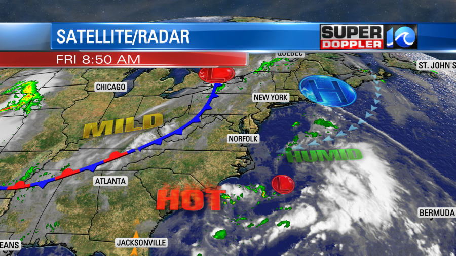
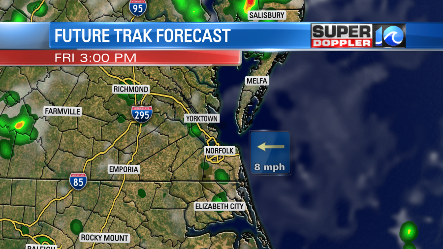
There is another cool front to the west, but it is very slow moving. So we are basically in-between systems today. We’ll be partly cloudy for a while. As we heat things up we’ll develop some isolated showers and storms this afternoon.
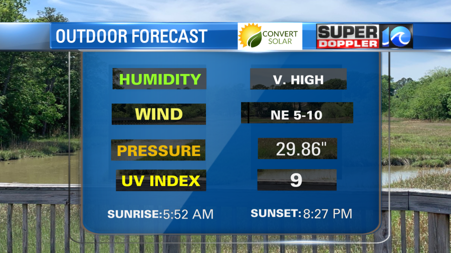
High temps will aim for around 90 degrees. However, the heat index will be in the upper 90s.
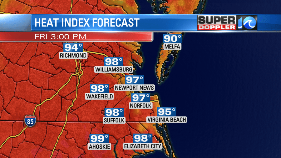
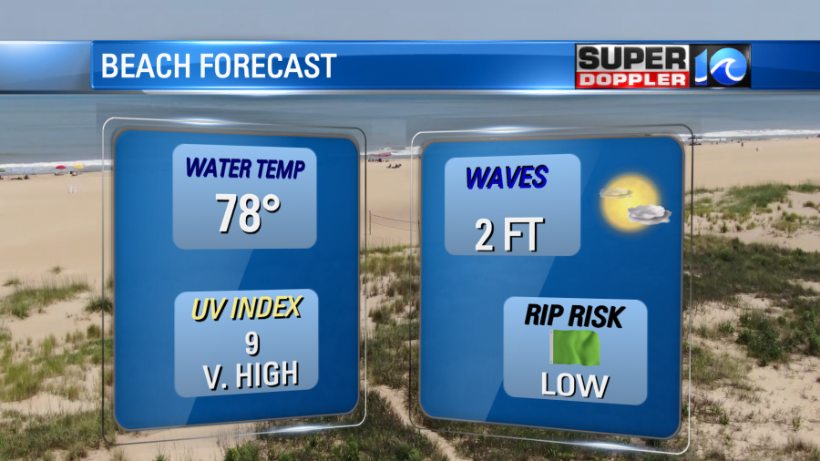
The wind won’t help much. It will only run out of the northeast at 5-10mph. So be sure to stay hydrated if you are out and about. The beach forecast looks pretty good as well as the outdoor forecast.
Tomorrow the front will be a little closer to our region, but it won’t move in and cool us down. However, there will be some scattered showers and storms firing up during the afternoon.

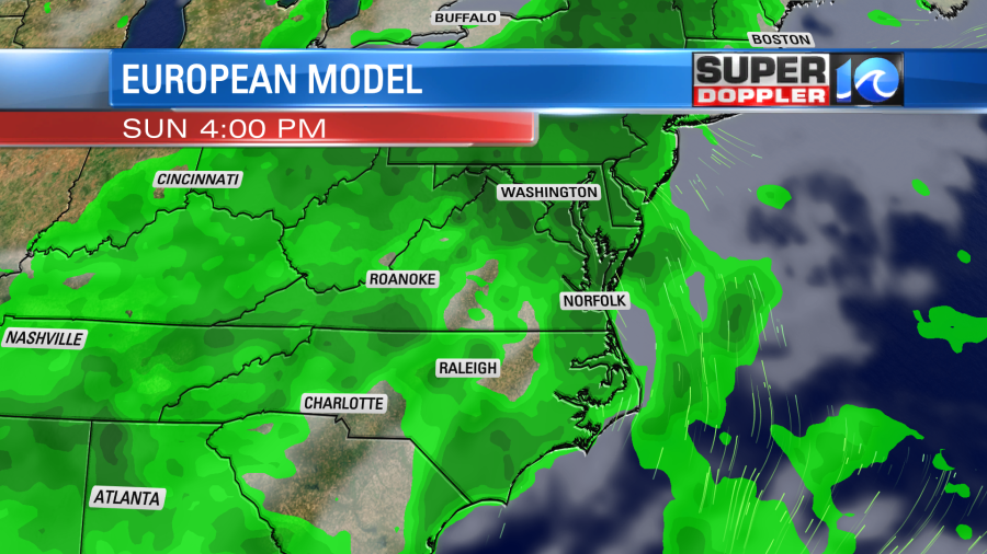
Some of these could contain some heavy rain. There will also be more clouds tomorrow. So both the clouds and rain will keep high temps more in the mid-upper 80s. It will feel like the 90s with the heat indices. By Sunday the front will be moving in from the west. So there will be a pretty high chance for rain and thunderstorms. Especially in the afternoon.
High temps will be in the 80s.
The front will stall out near the area on Monday. So we’ll have more clouds along with some scattered storms. Down the road the weather looks quieter and hotter towards the second half of next week.
The tropics are quiet for now. However, one group of forecasters (Colorado State University) is increasing their hurricane season forecast.
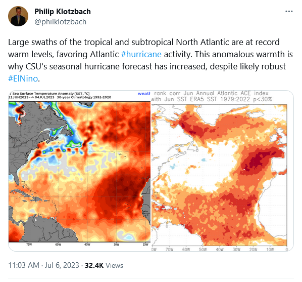
Usually during an El Nino year (which is a Pacific Ocean phenomenon) the hurricane activity in the Atlantic is lower. This is due to increased trade winds over the Atlantic that happen through a teleconnection. However, this year the water temps are running waaaaay above average. Plus, we’ve already had a few systems form. So the CSU forecast is getting increased, and more will probably adjust upward.
Meteorologist: Jeremy Wheeler


