
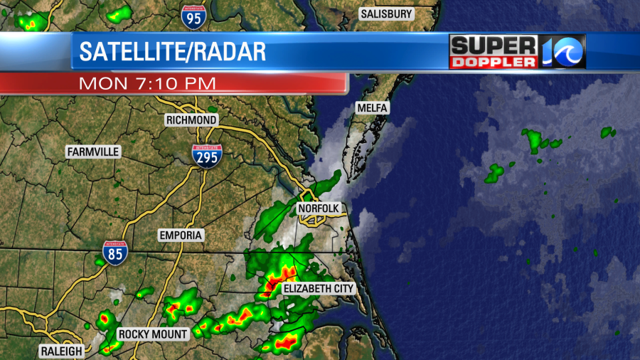
After yesterday’s flooding rain there was even more scattered showers and thunderstorms in the evening. A couple of the storms over North Carolina were rather strong.
The rain totals added up over the last 24 hours. At least for most locations.
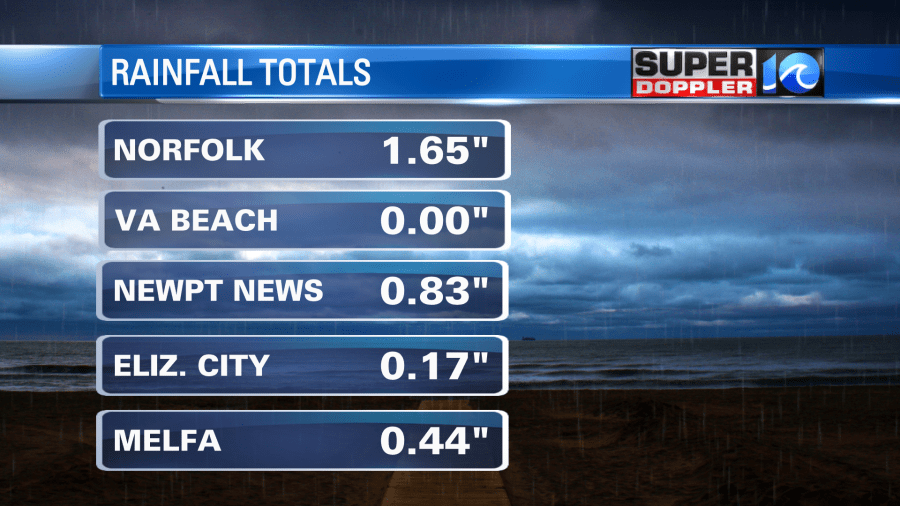
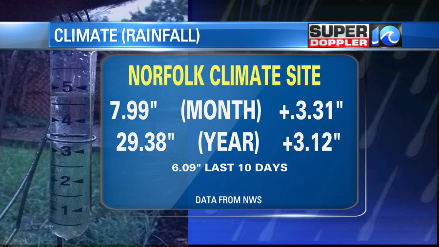
I saw the zero in Virginia Beach. I do think there was a decent amount on the north end, but I thought that at least some made it to NAS Oceana. I know that the rain did weaken as it moved into Virginia Beach. With this recent rainfall we are now over 3 inches above average for the month and the year.
There was a weak area of low pressure just to our south yesterday. Today that has moved out to sea. There is still a stationary front to our south with another weaker low to our southwest.
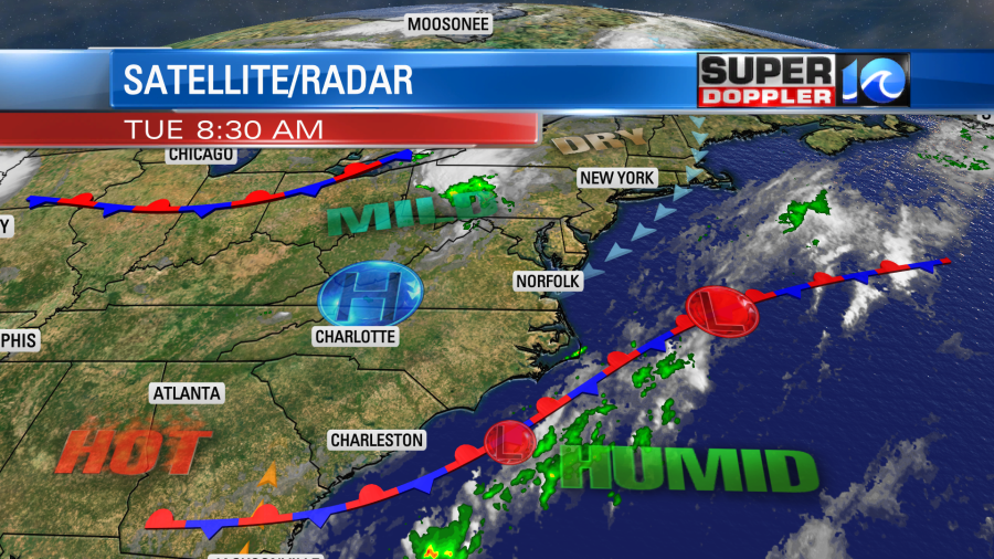
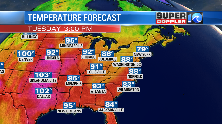
High pressure is just to our west. We will have some quieter weather today. We’ll be partly cloudy for a while. There will be some isolated showers and storms this afternoon, but the chance is much lower than yesterday (20%). We’ll heat up here to the upper 80s to near 90 degrees, but they will be hitting 100s over the central U.S.
It will feel like the mid 90s locally with the heat index. With that low moving out to sea today there will be a light northeast wind. That should keep the temps in check and near average. However, over the next few days we will really heat up.
Before I get to that I do want to mention that there will be a cluster of showers and storms tonight. They will be coming in from the northwest. This will be between about 9pm and 12:23am.
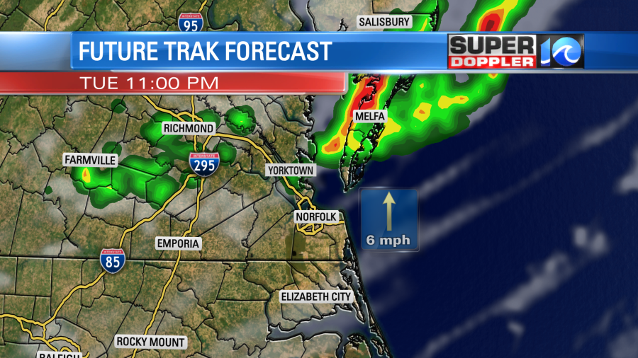
A couple of strong storms will be possible. They should weaken shortly after midnight.
Now….the heat. Tomorrow we’ll have partly cloudy skies and not much rain. Other than some isolated showers or storms it should be a quiet day. We’ll also have a light southeast wind. So temps will be able to heat up to the low-mid 90s. The heat will really spread out over the eastern 2/3rds of the country. Look at how many upper 90s and lower 100s are forecast:
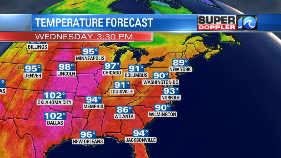
Our local heat index will be near 100 degrees. However, the temperatures and humidity will climb even more Thursday through Saturday. High temps will rise to the mid-upper 90s. The heat indices will be between 100 and 105 degrees.
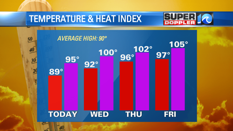
There may be heat advisories posted by the end of the week into Saturday. There won’t be much rain Thursday and Friday. There will be a few showers and storms on Saturday and Sunday, but it should be far from a washout. A cool front will move into the region. So temps should fall on Sunday to the upper 80s to near 90. I’ll talk more about that in tomorrow’s weather blog.
Meanwhile the tropics are somewhat calm, but it is interesting. Tropical storm Don has fallen apart. However, we are still watching that tropical disturbance that is rolling over the Lesser Antilles soon.
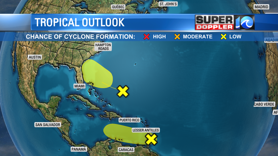
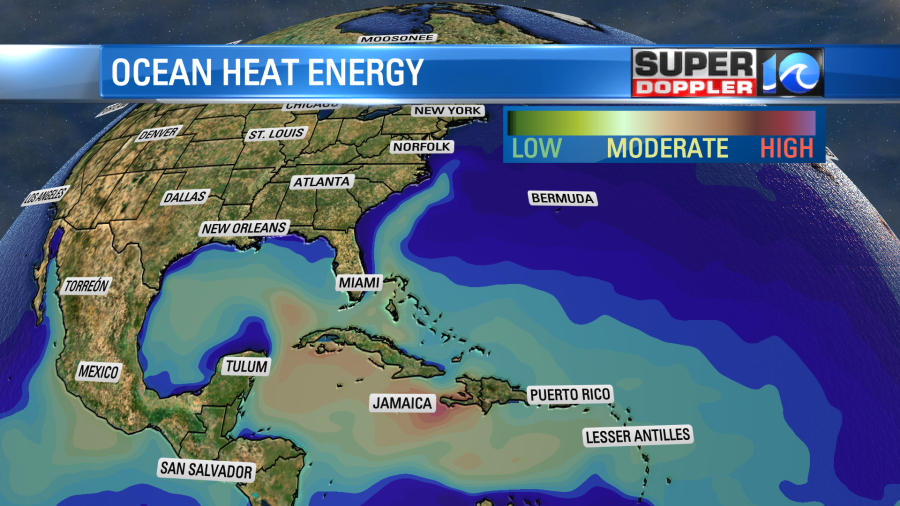
It has a low chance of formation, and soon the upper level winds will become a bit more unfavorable for development. You probably also noticed that there is another feature that is working towards the U.S. What? Where did this come from? No, I’m asking. I don’t see it on the GFS nor the Euro models. So we’ll see if it does anything in the next couple of days. Regardless, we will watch it very closely. I will say that there is some low ocean heat energy over the Gulf Stream. There is a little more of that down towards the Caribbean.
Stay tuned for updates, and be sure to stay hydrated over the next few days.
Meteorologist: Jeremy Wheeler


