(Update: We are still tracking 2 hurricanes, but now we are also tracking tropical depression 11. It will stay out to sea. However, it could briefly become a tropical storm. It is over the central Atlantic and moving northward).
Yesterday we had some very heavy downpours. They were expected, but there was a large area in Hampton Roads that had some street flooding.
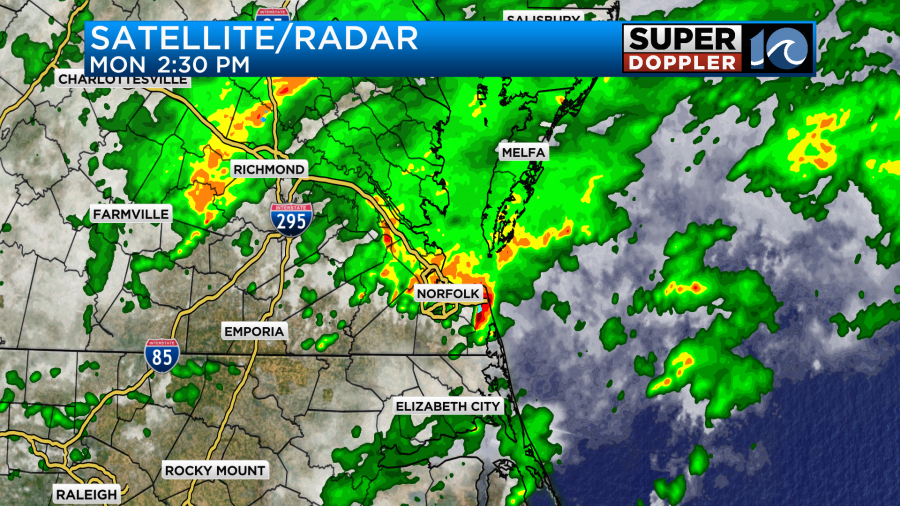
A lot of the metro had 1-3″ of rainfall. Some isolated spots had more.
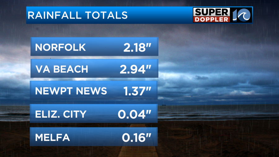
There was much less over areas north and south of Hampton Roads. This was caused by ample humidity, a stationary front, and a weak area of low pressure. Today the front has drifted a bit west. Also the weak low has moved to our northeast.
So even though the shifts have been subtle we should be looking at a different forecast today. We’ll have a mix of sun and clouds through the day with a few showers and storms popping up. The chance for rain and heavy downpours will both be lower than yesterday. There may be some isolated heavy showers due to the high humidity though. Winds will be light and variable. High temps will be in the mid-upper 80s.
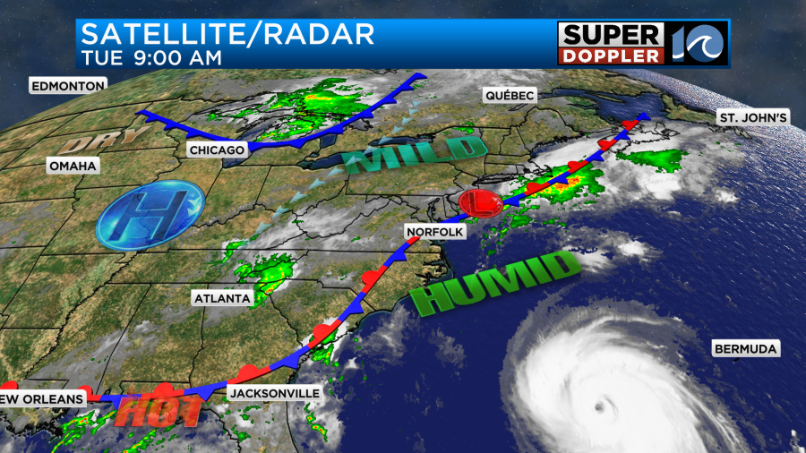
Tomorrow a cool front will run down out of the Midwest, and it will merge with the stationary front. As this gets closer to our area we should have some pickup in shower and storm activity. There may even be some more heavy downpours again.
That new front will stall out over the area on Thursday. It will be part of the steering guide for Idalia. So our forecast for Thursday and Friday will be very track-dependent on that system. For now I have scattered showers on Thursday with some breeziness near the coast. High temps will be cool in the 70s. We will probably dry out through Friday, but that depends on which model you look at.
This morning Idalia had strengthened into a hurricane by the 5am update. It had gained a little more strength by the 8am update when it had sustained winds of 80mph.
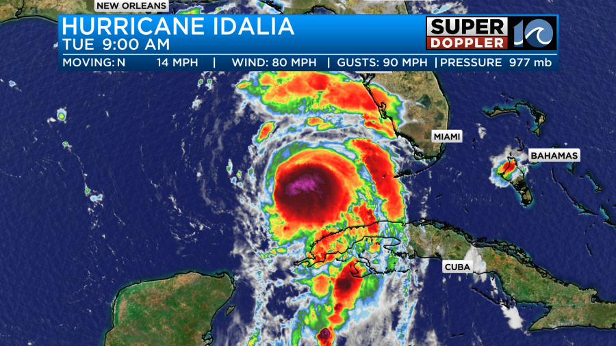
Idalia is forecast to strengthen quickly as it moves north/northeast over the warm waters of the Gulf of Mexico. Temps there are way above average.
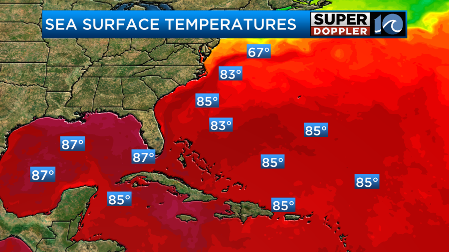
The wind shear will be easing, but the storm has already shown a healthy outflow on the satellite loops. The hurricane is still forecast to become a major hurricane before making landfall sometime tomorrow morning.
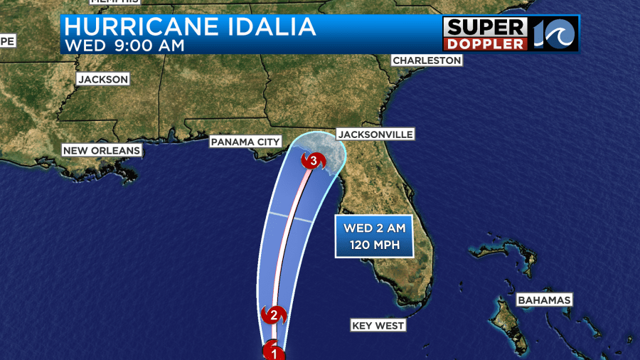
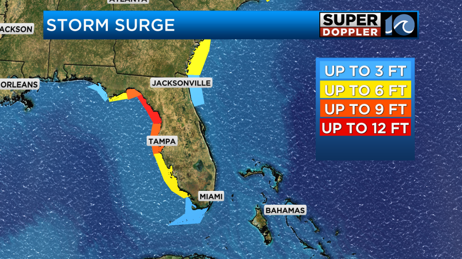
Most of the models top it off at a cat 3, but with the unprecedented warmth it’s very possible that it could become a category 4. The landfall forecast puts it somewhere near Cedar Key Florida or at least the Big Bend area. Despite that being the focus for landfall, the significant surge could reach as far south as Fort Myers Florida.
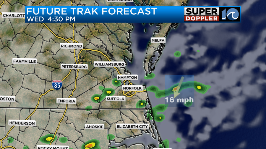
After landfall the system will move quickly to the northeast over land, and it will weaken. It will turn into a tropical storm between Wednesday and Thursday. Then it should move more to the east. This will pass it to our south Thursday into Friday.
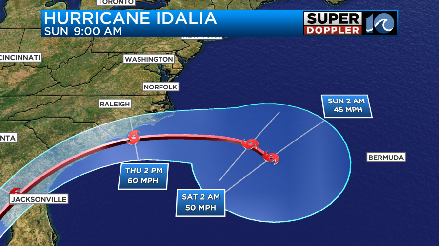
It is expected to maintain strength as it moves back over the water, but it could restrengthen a little. Even if it were to move along this track it would still have an impact on southeast Virginia as it would interact with an area of high pressure to our north.
The track models are in fairly good agreement in the short term, and they are coming into more agreement in the longer forecast.
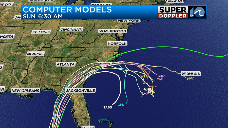
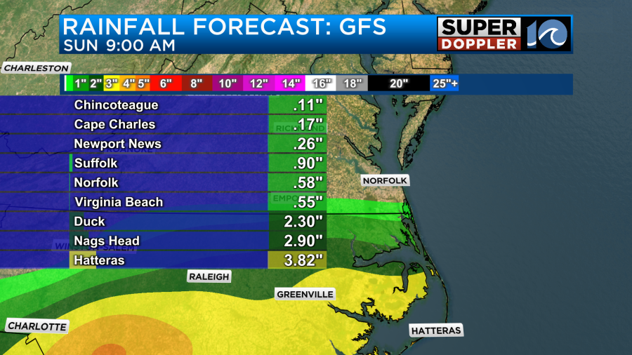
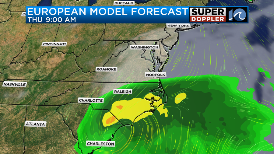
The GFS model is still slower than the euro, but they at least now have the same flavor. They both push some rain up into Hampton Roads with the higher amounts staying over North Carolina. The highest amounts of rain are forecast for Hatteras.
Here are the GFS and European models for Thursday and Friday.
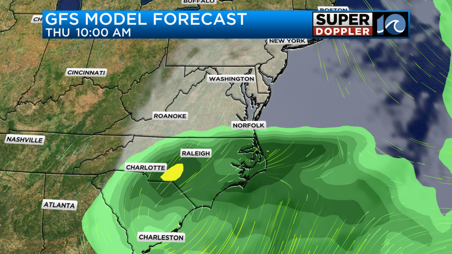
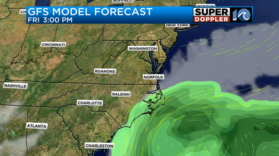
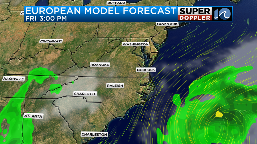
You can see that the GFS lingers Idalia just off the coast Friday into Saturday. Meanwhile the Euro kicks it out during that time. So we still have some time for updates. Stay tuned.
Meanwhile hurricane Franklin is a monster hurricane with a very distinctive eye on satellite.
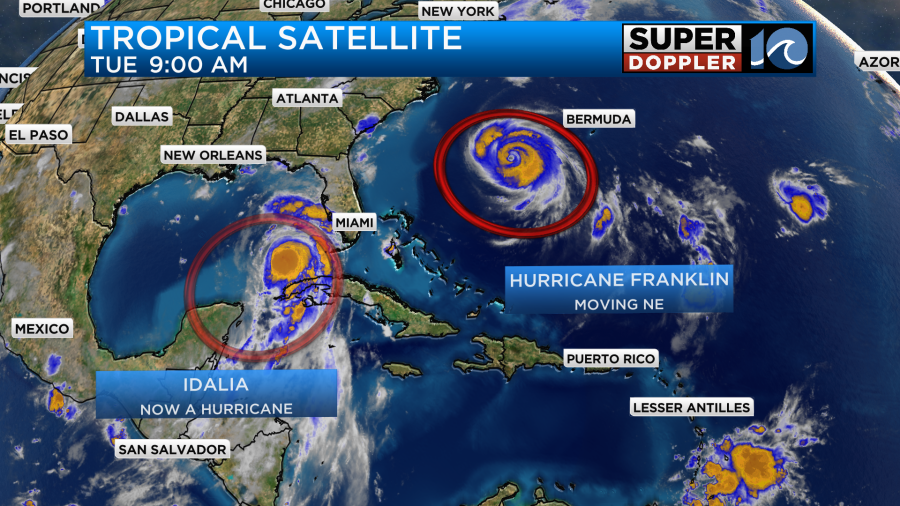
It was a category 4 this morning, and it was moving northeast. Sustained winds were around 130ph. Luckily this will stay away from all of the major landmasses.
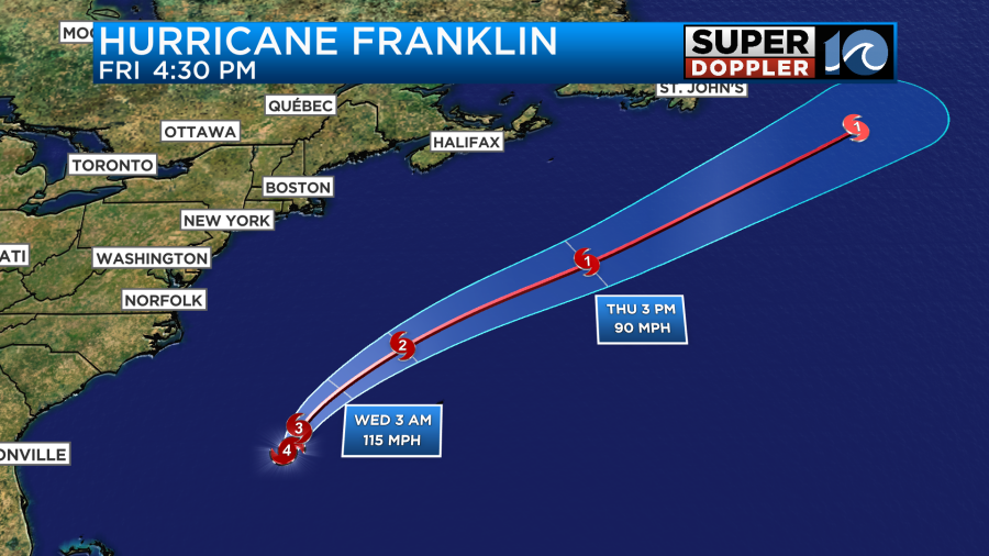
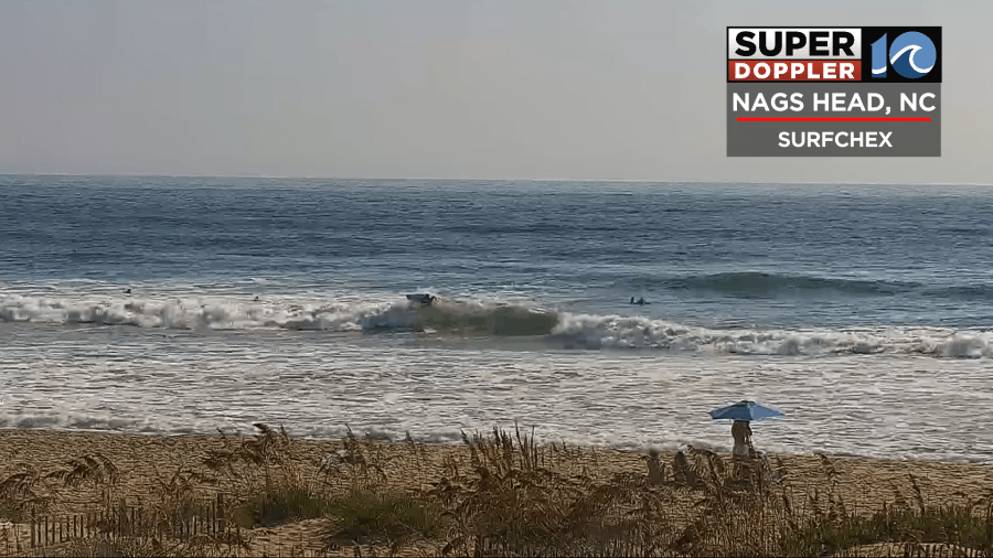
It will eventually weaken over the north Atlantic. However, it has been throwing a lot of ocean swells along the east coast. We had some nice surf this morning on our cameras.
However, this is creating a high risk for rip currents along our beaches.
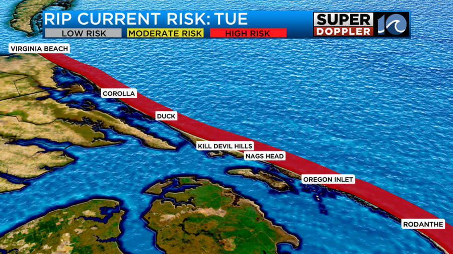
So there should only be experienced surfers in the water today. Waves are running about 3-5ft with some 6 footers possible along the Outer Banks. It will be dangerous for swimmers. That may not change through Friday.
Again…check back for updates on all of this.
Meteorologist: Jeremy Wheeler


