Yesterday tropical storm Idalia moved out to sea as forecast. After the wet weather through the early afternoon we had some great weather by the evening. So my wife and I went for a long walk with the dog. This morning we started with lots of sunshine in the area.
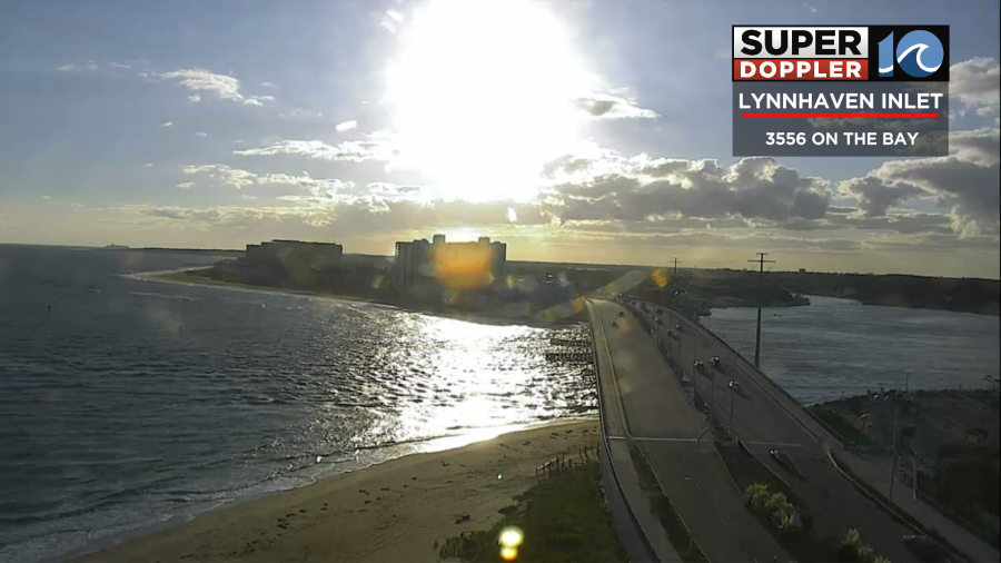
It looked great! It felt great! Temps were mixed with some 70s near the shore, 60s in the metro, and 50s inland. This was due to the northeast breeze and the wind off of the warm water. However, that breeze (and the recent tropical activity) made for some rough surf along the oceanfront.
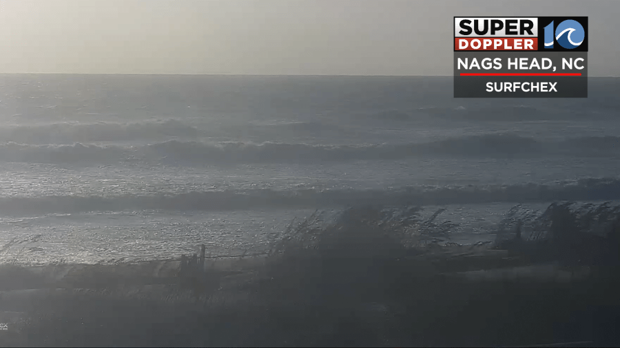
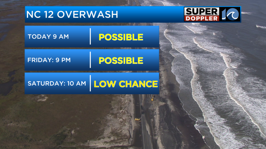
Unfortunately, there will be a high threat for rip currents at all of our beaches today. That high threat may continue into tomorrow. There is some ocean overwash happening along highway 12 and the Outer Banks this morning. There may be some more of that this evening.
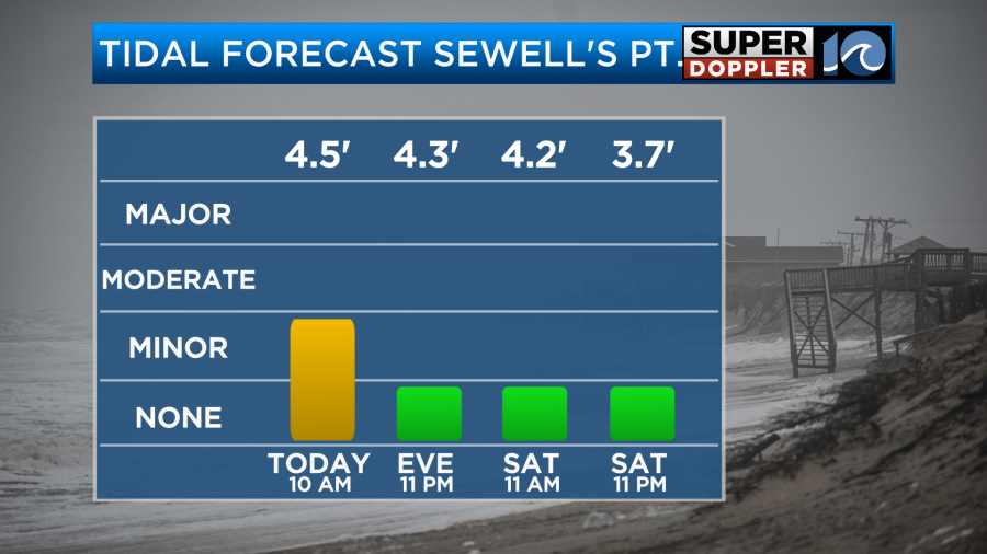
The high tide this morning will produce some minor tidal flooding in the region.
It will be minor to moderate over the Atlantic side of the Outer Banks, and that is helping to create that overwash along with the recent high waves. Again all of this is from the recent tropical activity and the ongoing northeast wind.
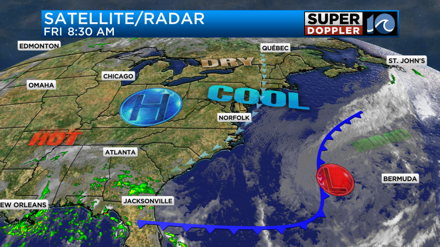
Idalia is currently post-tropical as many of the thunderstorms have fallen apart around the center. It’s even hard to find the center on the satellite loop.

Idalia will move towards Bermuda, and it could redevelop some of the thunderstorms in the next couple of days. So it may become tropical again for a time.
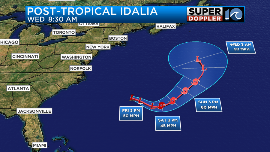
After that point it should bend northward. It still could push back to the west a bit in the 6-7 day forecast. Some models do still suggest that.
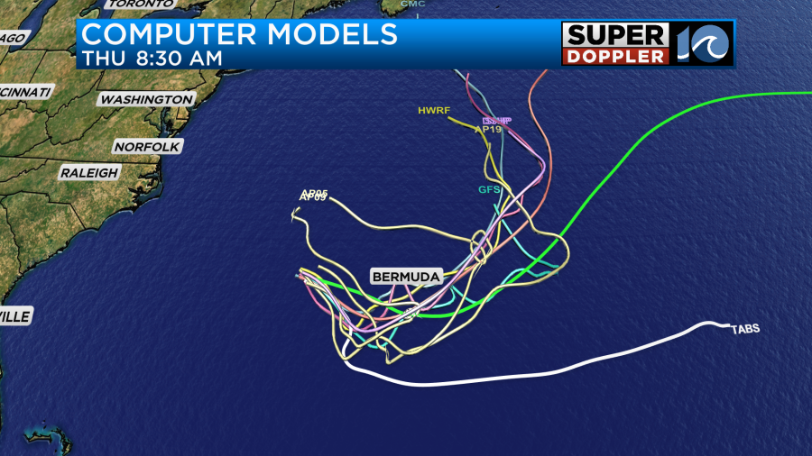
However, I’d say that the latest consensus is for Idalia to move more northward during that time.
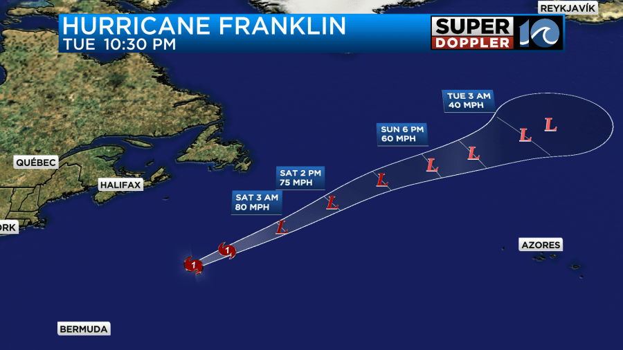
Meanwhile, hurricane Franklin continues to slowly weaken over the north Atlantic.
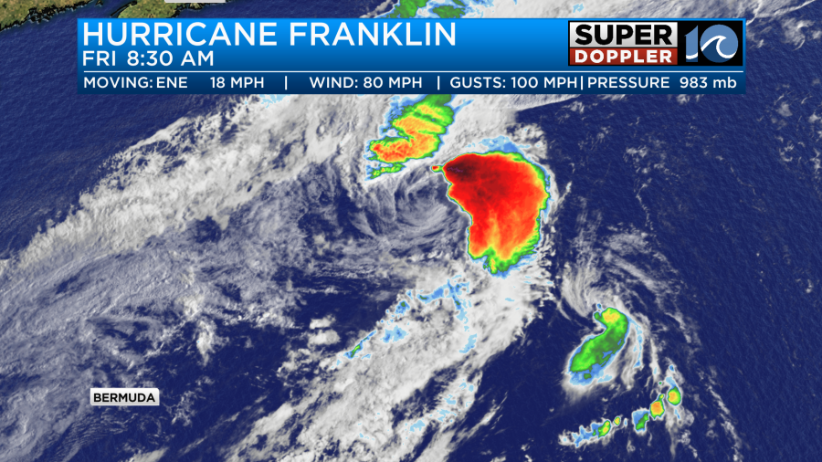
It will move northeast and become post-tropical over the next couple of days.
Tropical storm Jose should fall apart soon as it moves slowly north.
Newsflash... Tropical Depression Gert has re-formed in the central Atlantic. Luckily this one will also stay out to sea. It will move north and possibly strengthen again over the next 48 hours. It should weaken and fall apart in the next 3-4 days.
Meanwhile, we’ll have some great weather here. A cool front has moved far offshore along with Idalia. Now high pressure is building in from the west.
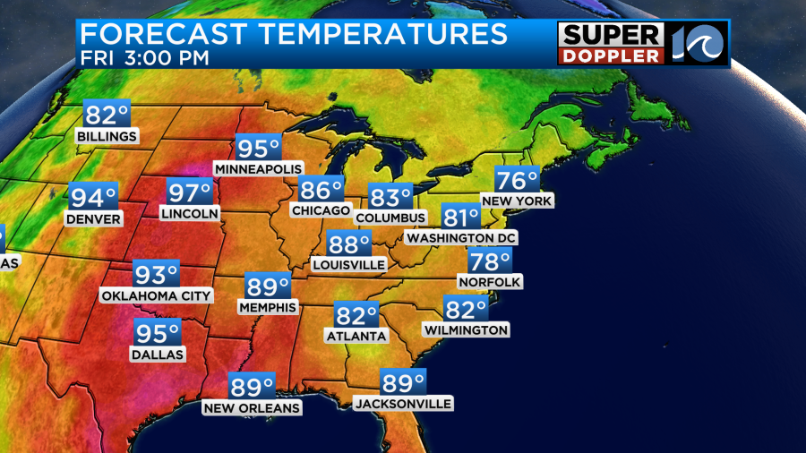
We’ll be mostly sunny today with high temps in the mid-upper 70s.
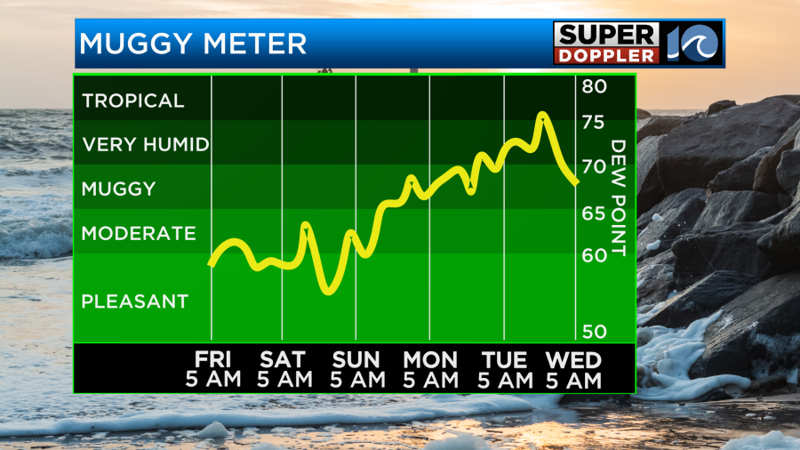
It should be awesome out with the dew points down in the 50s! Remember, it will be pretty breezy near the shore. There may be a few gusts to 25mph there. So it may even be a bit cool for some.
Tomorrow the high will be closer to our area. So we’ll have less wind, but we’ll still have lots of sun. High temps will be in the upper 70s to near 80. We’ll stay dry over the weekend, but temps will warm to the 80s on Sunday.
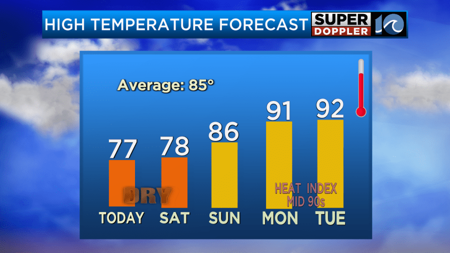
We will heat up on Labor Day. High temps will be in the low 90s, and the humidity will increase.
If the ocean calms down, then it should be a good day for the beach. Stay tuned for updates!
Meteorologist: Jeremy Wheeler