Wet and windy conditions are expected Friday and Saturday across the area as a tropical storm makes landfall in southeastern NC. A storm surge warning is also in effect for most of the WAVY viewing area.
HAMPTON ROADS AND EASTERN VA IMPACTS:
- WIND: 30-45 mph gusts, with some higher gusts along the coastline.
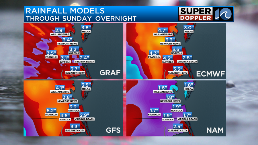
- RAIN: 2″ to 5″ of rain, with the heaviest late Friday into the overnight.
- TIDAL FLOODING: Minor to Moderate tidal flooding in the metro, major tidal flooding possible inland along the James/York Rivers in Jamestown, Surry and Yorktown.
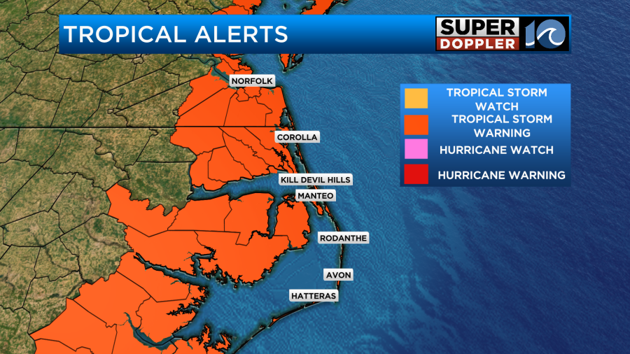
NE NC AND OUTER BANKS IMPACTS:
- WIND: 30-45 mph gusts, with some higher gusts along the coastline. Wind gusts of up to 70 mph in the southern OBX towards Hatteras and Rodanthe.
- RAIN: 2″-5″ of rain in NE NC with 4″ to 6″ of rain in the OBX, with the heaviest late Friday into the overnight.
- TIDAL FLOODING: Some soundside flooding and oceanside flooding possible along NC 12 in the southern OBX. Exact impacts depend on wind direction late Saturday afternoon.
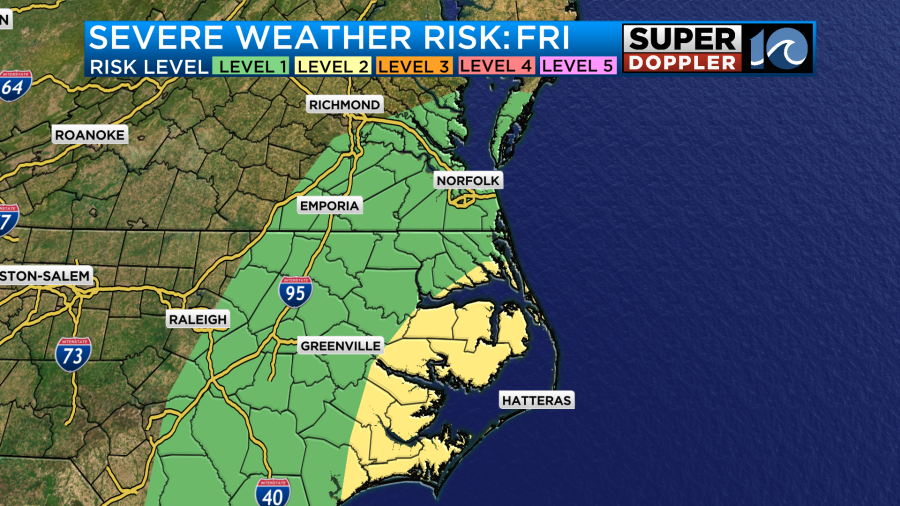
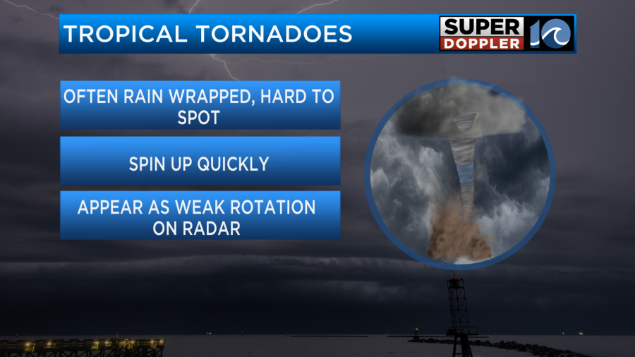
- TORNADOES: Isolated tornadoes will be possible, with the highest risk early Saturday morning
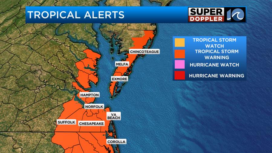
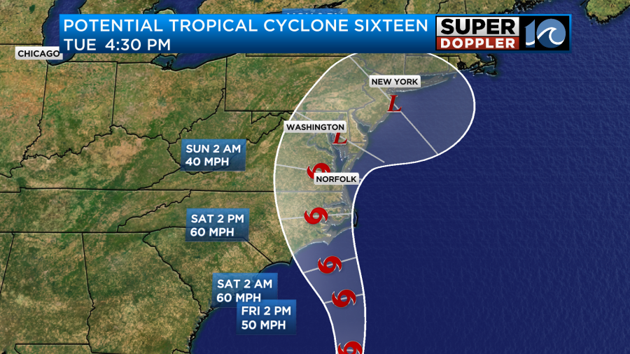
As of 11 a.m. Thursday, the National Hurricane Center has deemed the low off our coast as Potential Tropical Cyclone 16. This does not really change the impacts to our area– but it allows the National Weather Service to issue Tropical Storm Warnings. These warnings are in effect for all of coastal areas through Saturday. The system will likely be named Ophelia.
The track from the NHC takes the low inland west of Ocracoke towards Beaufort/Atlantic Beach and Morehead City. The strongest winds will be to the eastern side of the low, so the further inland you are there will be less wind gusts.
Tides could be a big problem with this, especially Saturday. The tides will increase Friday, but the bigger impacts from tidal flooding will likely be Saturday morning and Saturday evening. Minor-Moderate tidal flooding could occur in the Hampton Roads area, with major tidal flooding towards areas of Yorktown and Jamestown. We could also see some beach erosion and ocean overwash along NC 12.
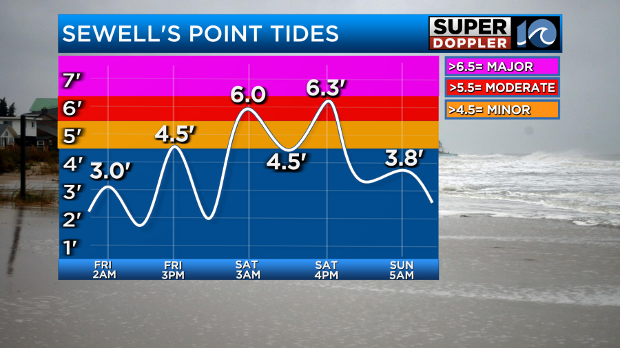
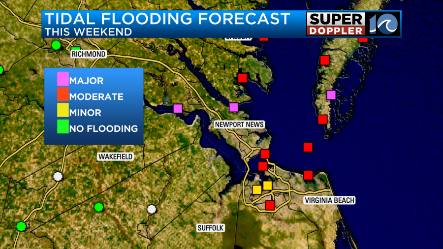
6.3 ft would be equal to what we saw in January of 2022. Check back for updates as some adjustments to the tide forecasts are likely.
Rainfall totals could lead to isolated flooding. A Flood Watch has been issued for the area. We’ll see the heaviest rain late Friday, through the evening/overnight and into Saturday morning. Rainfall totals of 2″-5″ will be possible. Even inland, higher amounts could occur with several inches of rain into Franklin, Surry and Williamsburg. Notice how some models (NAM) bring in drier air to the region Saturday, leading to a bit lower rainfall totals.
A few isolated tornadoes could also occur with this system as the low tracks north. The most likely spot for tornadoes in a tropical cyclone is in the northeast quadrant. There is a Level 1/Level 2 risk for much of our area.
The bottom line here is this won’t be a huge storm, but it’ll be a good soaking rain and in some spots — too much rain. I expect to see some flooding issues Friday night and Saturday. Expect a moderate tropical storm. Tie down the boats and move your cars from the flood zone. We’ll be back to nicer weather by late Sunday into next week.
Meteorologist Ricky Matthews


