Yesterday we ended up very warm as expected. Temps had made it into the upper 70s to low 80s as expected.
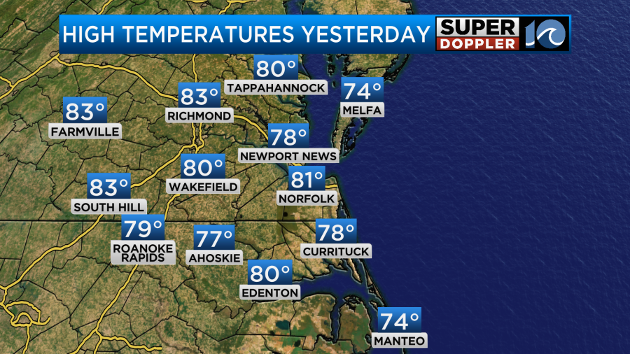
We were just shy of the record in Norfolk. Richmond did break a record. The breeze did make it feel pretty nice out, but it was definitely warm for early November. Today a cold front has dropped to our south.
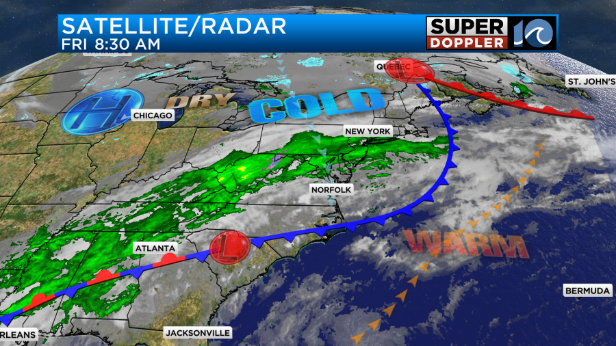
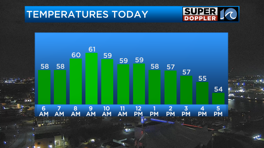
The breeze picked up out of the north/northeast. It will stay up through the day. Gusts will be up to 20mph. The cooler air is slowly filtering into the area. So temps actually started near 60 degrees. We’ll stay near 60 for a bit. Then temps will fall to the mid 50s by the afternoon.
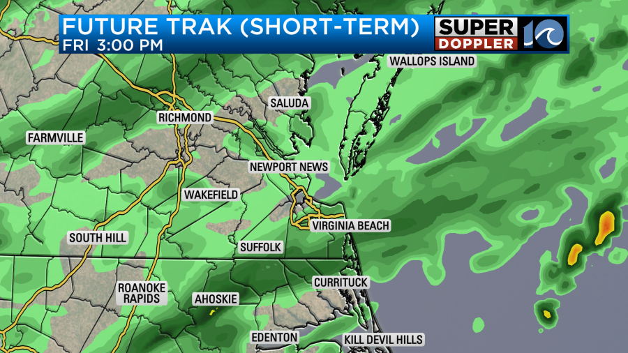
We’ll pretty much be cloudy all day. However, the precip forecast is a tough one. The bigger models only show some drizzle for later today. The hi-res NAM model has scattered rain showers developing along with some drizzle. Our Future Trak model is totally SPLIT! So I decided to show both of them this morning. The short-term version of Future Trak uses the HRRR model. It showed scattered drizzle and showers developing by midday with a bigger area of rain this afternoon.
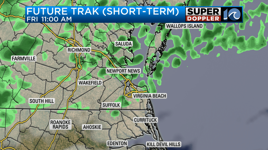
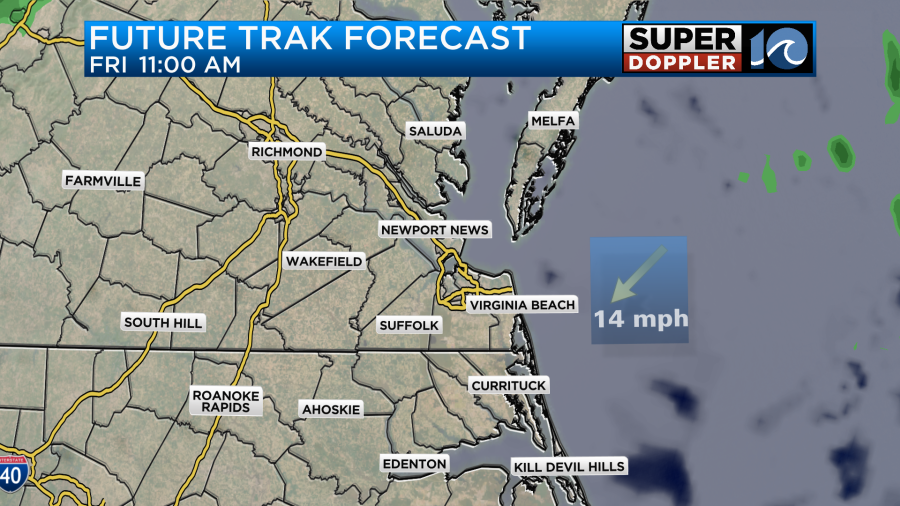
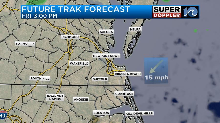
Meanwhile our regular version of Future Trak (GRAF model) barely shows anything other than clouds all day.
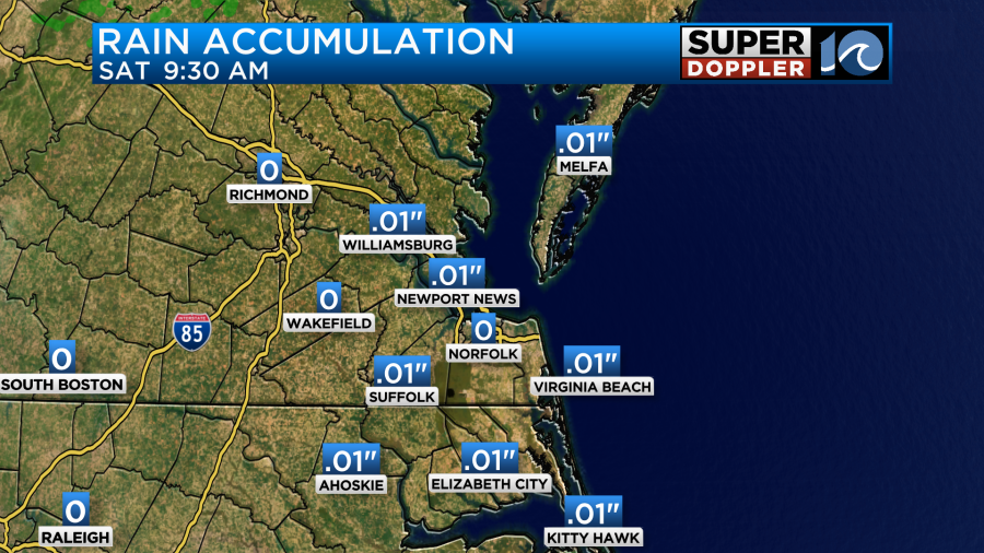
So now you can see a little peak from behind the meteorologist curtain. Now you may ask…”Ok, so what do you do?”. Well, the regular version of Future Trak doesn’t do well with drizzle and light precip. The short-term version tends to overdo things. So I think we’ll have scattered areas of drizzle developing with a few light rain showers this afternoon into the evening. It’s kind of an average of the two models. We really need rain, but the amounts forecast are light on ALL models. So we’ll probably only get a one-hundredth of an inch.
Tomorrow the front will sink to our south some more. We’ll have a mix of sun and clouds with high temps solidly in the 50s.

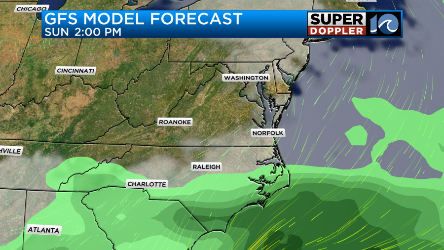
Other than an isolated shower over the southern Outer Banks we’ll be dry. On Sunday an area of low pressure will move along the stalled out front, but it looks like the front will make a little more progress to the south. So as of today I only have some isolated showers over the Outer Banks and coastal North Carolina for Sunday’s forecast.
This part of the forecast still could change a bit. So stay tuned for updates over the weekend. Regardless, high temps will be in the 50s again. We’ll stay cool and dry early next week. However, we might have some warm temps back by later next week.
Meteorologist: Jeremy Wheeler


