
We started the day with some downright chilly conditions across the region. Temps were in the 30s, 40s, and 50s this morning before the bright sun started warming us up. We’ll have sunny conditions today, but a northwest breeze will reinforce the seasonably colder air. High pressure is just to our west. The big nor’easter over the northeast states is moving farther east today.
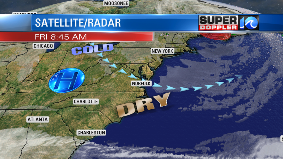
Our local winds won’t be as strong as yesterday, but they will still run at 5-15mph with gusts to 20mph. So despite the strong sunshine, we’ll only top off in the low-mid 60s this afternoon. Dew points are mainly in the 30s. So it is very dry outside.
Tonight we’ll have clear skies and light winds. The air will stay very dry with dew points in the 30s. So our low temperatures will bottom out in the 30s and 40s tomorrow morning with a couple of 50s near the shore. Water temps are in the 60s, and that creates the milder air near the water.
Tomorrow we’ll be mostly sunny with highs in the upper 60s. Then on Sunday an area of low pressure will bring rain and some gusty winds to the region.
As of this writing the feature that I mentioned was a cluster of thunderstorms over the central Gulf of Mexico. It looked like there were 2-3 distinct clusters, and the National Hurricane Center said that none of them had become dominant yet.
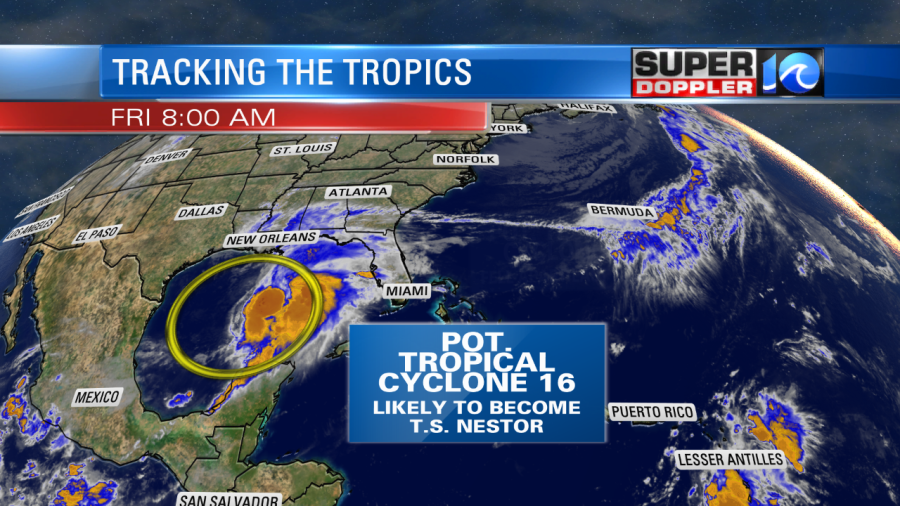
Eventually the models and the forecast suggest that this organize soon. So it will likely turn into a tropical or subtropical storm in the next 6-12 hours. The tricky part of that is finding the actual center of the storm. Wherever that center sets up will determine the eventual track. Ironically, the models are in very good agreement in taking the system to the northeast towards the Florida panhandle by tomorrow. The system will then move inland and will likely weaken. After landfall the models have it moving northeast along the east coast (but inland).
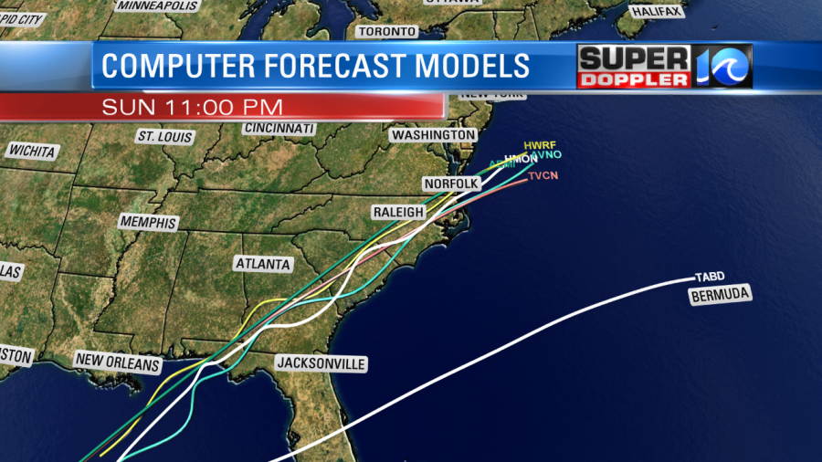
The official forecast calls for the storm to become post-tropical as it moves into North Carolina. So it looks like it will be an area of low pressure as it moves through coastal North Carolina. It may strengthen offshore, but more likely as a non-tropical low.

Based off the latest track we are likely to get a big area of rain over our region. It could be heavy at times. The rain may pick up by the mid morning, and could last through the mid-late afternoon.
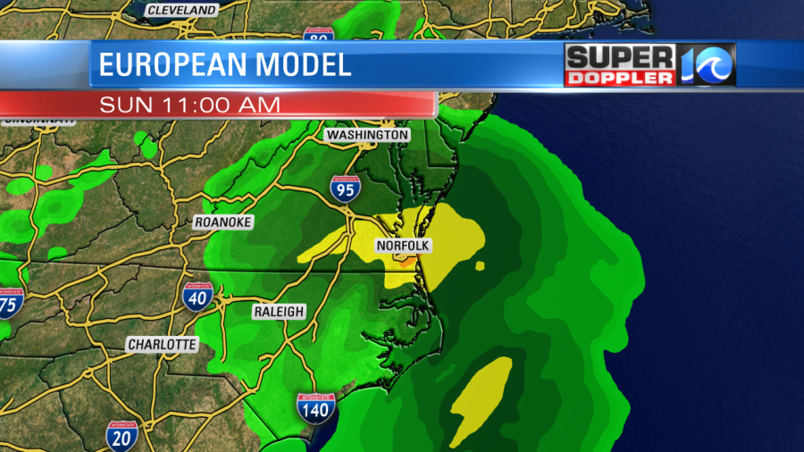
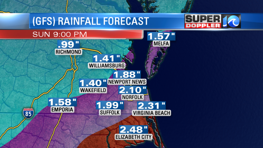
The system should move through fairly fast. It should kick out by Sunday evening. The European model and the GFS model are in fairly good agreement in the forecast rain totals. They are painting 1.5 – 2.5″ of rain with about 3″ over northeast North Carolina.
It’s still a little early to nail the rainfall forecast. There is some pretty dry air up here right now, and that could impact the system as it moves northeast. So keep that in mind for future updates. Regardless, it looks like we will have a pretty wide area of rain.
There will be some gusty winds along the coast, but I don’t think they will be too bad. For now I see some gusts to 30mph with higher gusts possible over the Outer Banks. This could still easily change depending on the track. The winds may be strong enough for some nuisance to minor tidal flooding, but the gusty winds and higher tide should be brief. So we are talking about 1 tidal cycle. Probably Sunday afternoon.
After the system we’ll have quiet weather on Monday with highs in the 60s. then we’ll have some more scattered rain showers on Tuesday as a cold front moves into the region.
Stay tuned for updates to all of this. We’ll update things frequently over the weekend.
Meteorologist: Jeremy Wheeler


