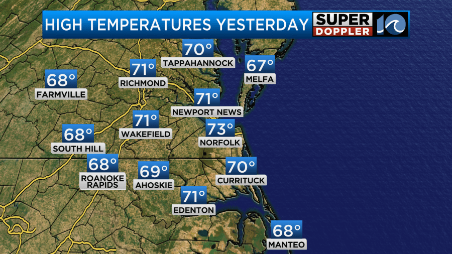
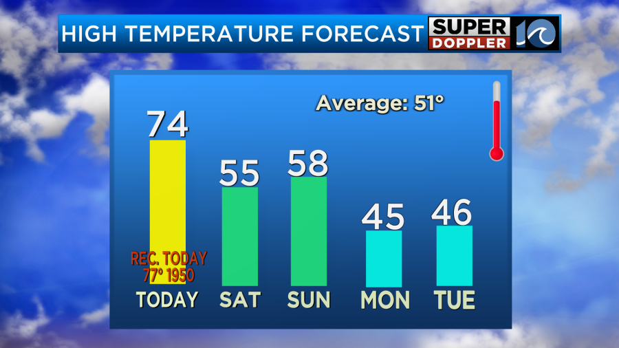
Yesterday we ended up hitting the low-mid 70s again. However, yesterday was humid if not muggy. It felt like late Spring!
Dew points have risen into the low 60s. Today the humidity is still up, and the temperatures are going to be way up. High pressure is offshore with a stationary front to the north. There is a cold front to our west, and it is moving in our direction.
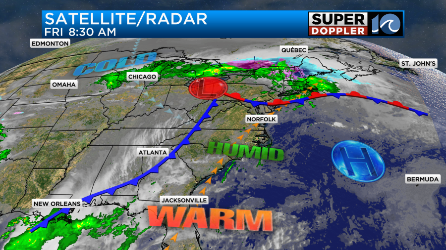
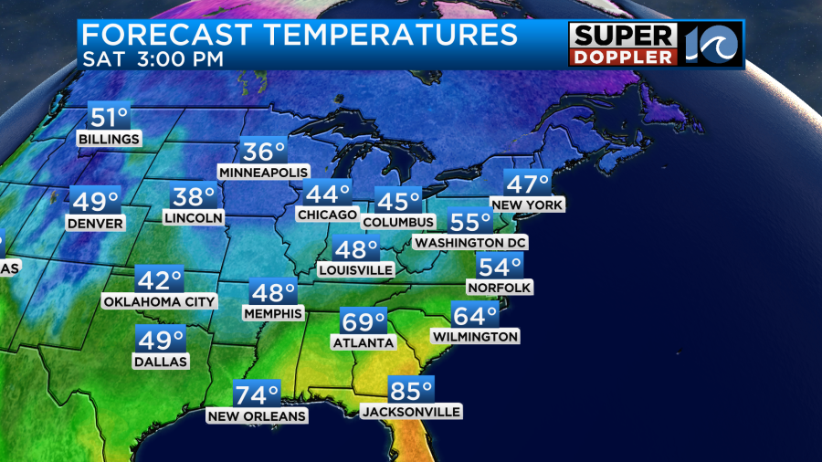
We are in that large warm zone which covers most of the east coast. Temps today will make it into the low-mid 70s locally, and I think many temps will be closer to the mid 70s.
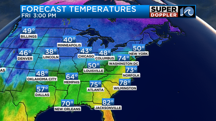
They’ll be hitting 80s in Florida, and it will even be in the 70s in D.C. We’ll have mostly cloudy skies for most of the day. The sun will peek out at times, but it won’t be out long. By midday we’ll have some scattered rain showers coming in from the west. We’ll have a bit more during the early-to-mid afternoon.
The models back off of the rain during the evening even though the cold front will be moving in during that time. Winds will be out of the southwest until the front arrives. Then winds will turn out of the north.
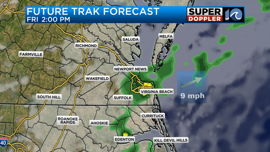
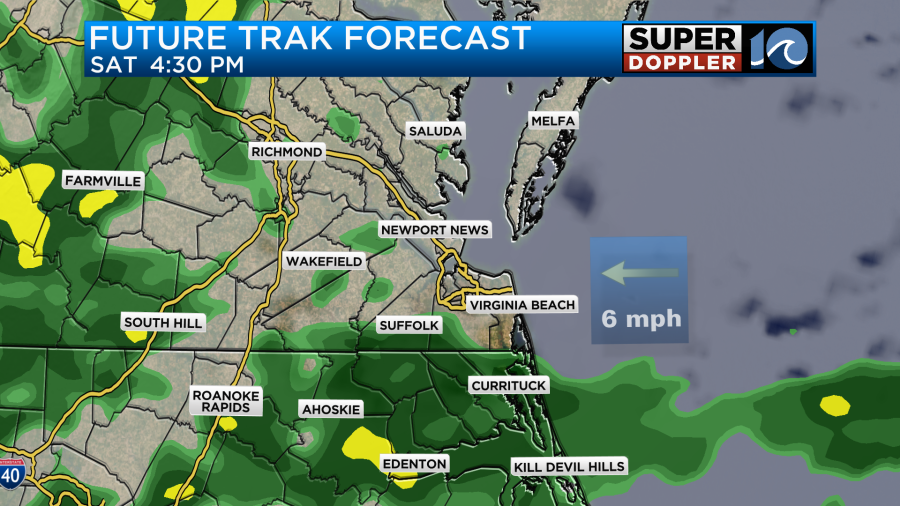
The cold front will stall out just to our south tomorrow. We’ll start off with mostly cloudy skies Saturday. Other than a couple of sprinkles it should be pretty quiet. However, rain will return later in the day. It may come in a couple of rounds like our future trak model shows.
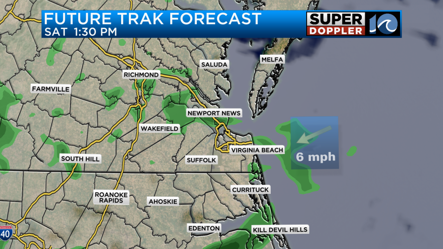
The GFS is in some agreement with this. This will be as warmer/more humid air pushes up into our cooler airmass. High temps will only be in the mid 50s Saturday.
That is actually still a bit above average, but it will be a big 24 hour drop in temps.
An area of low pressure will be moving in from the west. It will roll along the front which will bump north just a little bit. The low will roll east Saturday night into Sunday morning. This will bring us our highest rain chances for the weekend.

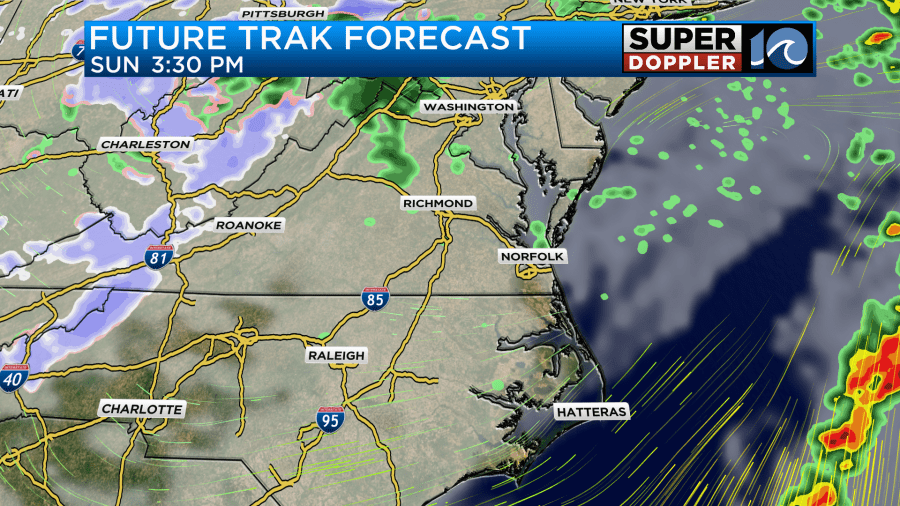
The models disagree on how fast the rain will taper off on Sunday as the low moves east. Future Trak and the GFS model have only some spotty showers Sunday afternoon, but the NAM model keeps a lot of rain in until the mid-late afternoon.
High temps will be in the upper 50s.
After Sunday the models have trended towards a drier Monday. I’ve only got some isolated rain showers that day now. However, all the models have colder air in our area. We won’t go back to the deep freeze that we just had, but high temps will only be in the 40s for the first half of next week.
Speaking of warm temps…Recently in Spain they’ve had some of the warmest January temperatures ever recorded. Many temps reached about 30 degrees Celsius the other day. That’s about 86 degrees Fahrenheit. Apparently, some people were heading to the beaches. Here is the article with more information: Record heat in Spain.
Meteorologist: Jeremy Wheeler


