Today is looking great! A warm front has moved north of our area already. So not only will we be in the warm zone today, but we’ll also have a good amount of sunshine.
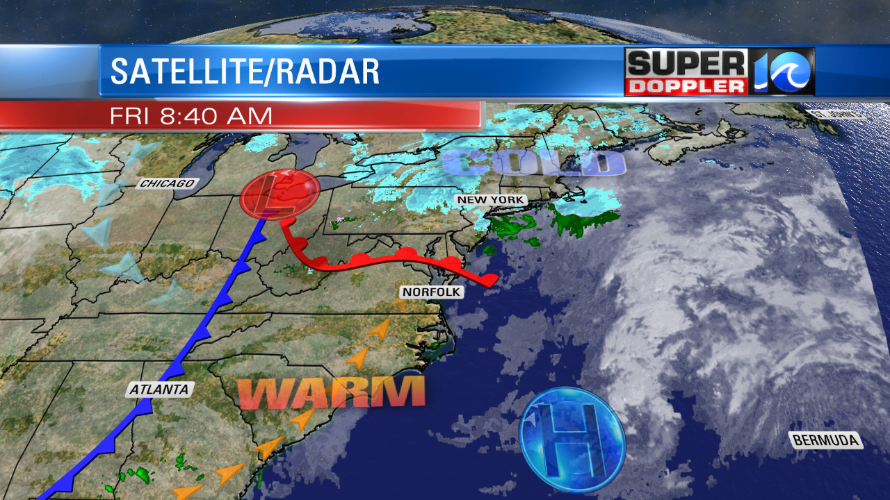
Temps started off near 40 this morning. High temps will aim for the low-mid 50s this afternoon. We’ll have clearing skies and light southwest winds. This is excellent weather for mid-January. We’ll stay mild for the next couple of days. Tomorrow we’ll have high temperatures in the mid 50s.
Clouds will increase, and the moisture will increase. We may even have some isolated showers later in the day, but there shouldn’t be too many.
On Sunday we’ll start off with very warm temperatures and rain showers.
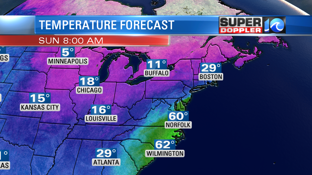

There will be widespread rain in the region in the morning. A warm front will lift through the area at first. Temps will start off in the upper 50s to near 60 degrees. However, this will be chased with a powerful cold front that will move through around the midday. This will drop temps sharply. We’ll drop all the way down to the mid 30s by the afternoon.
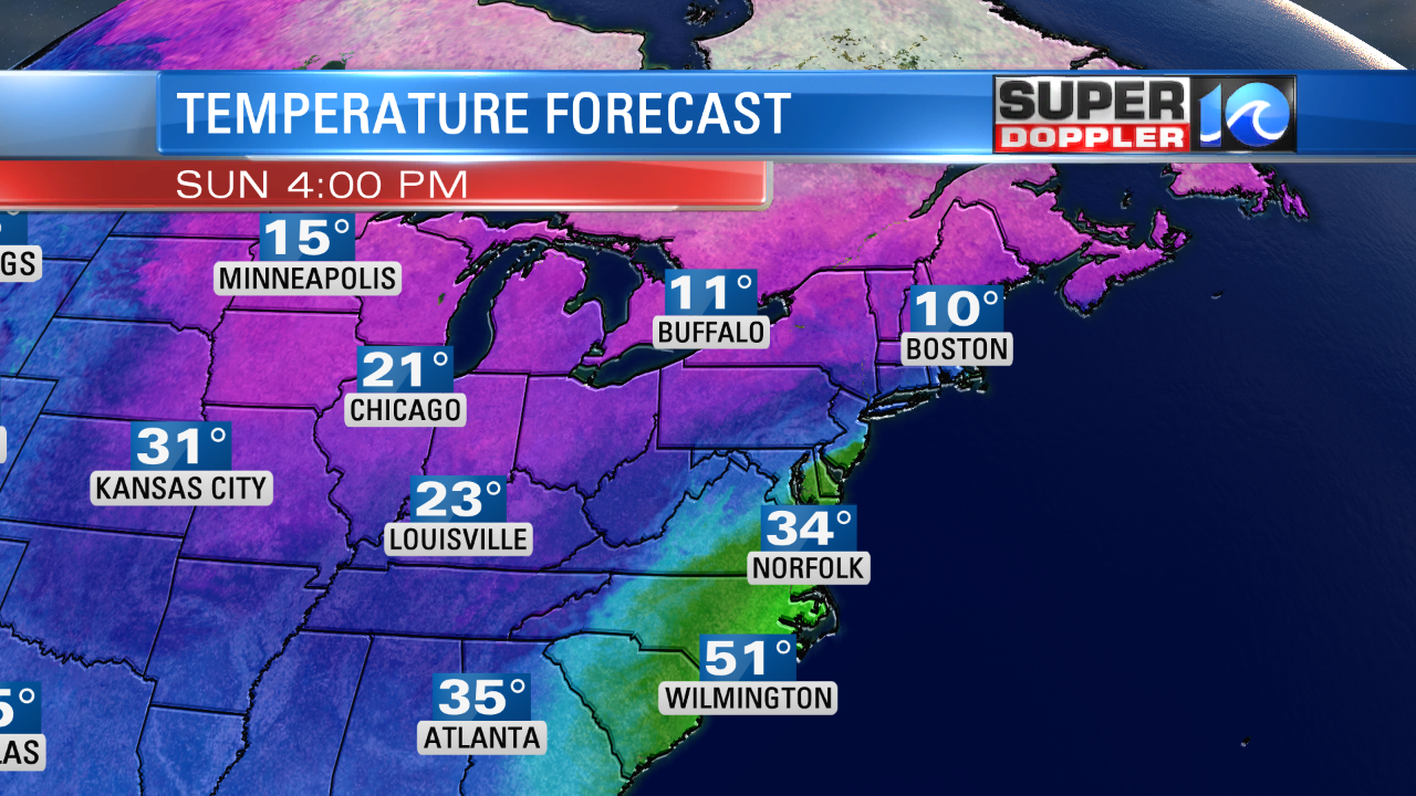
The rain showers could briefly turn into a wintry mix of rain, sleet, and snow during the early afternoon.
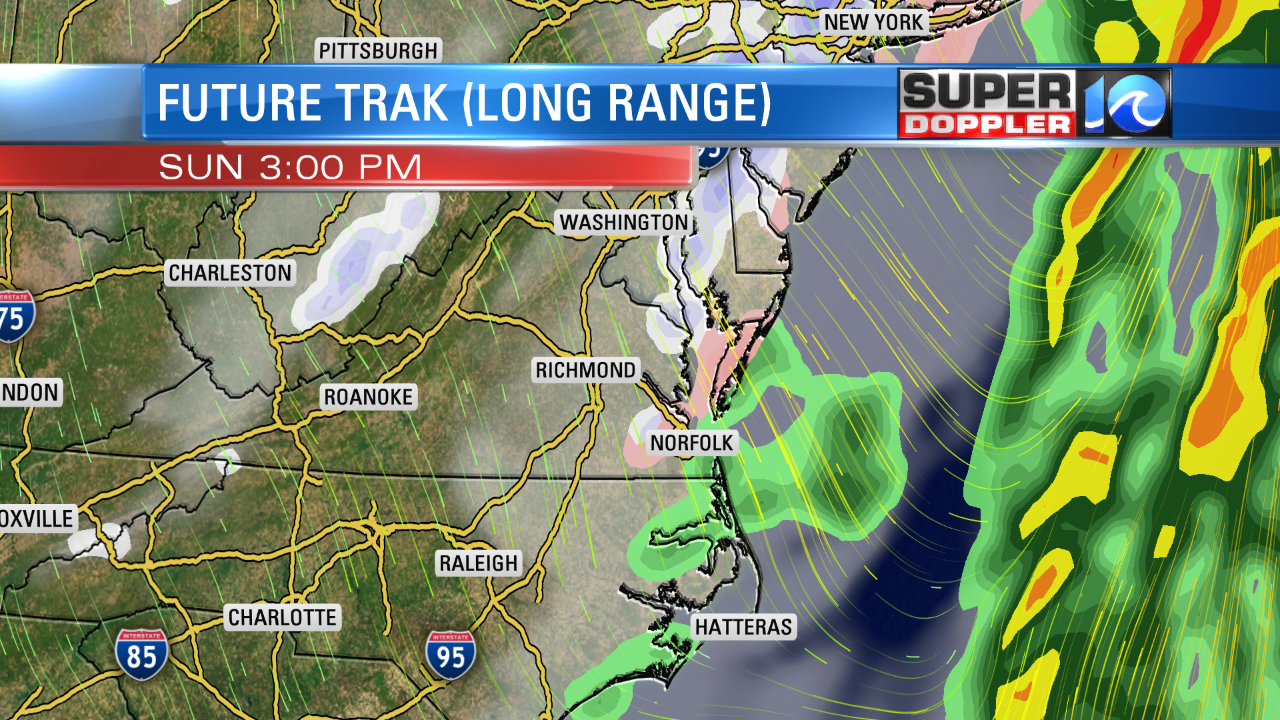
However, even though temps will be falling, they should stay above freezing as the precip wraps up. So most or all of it should melt. Ground temps will also be above freezing from the previous mild three days. So any mixed precip shouldn’t pose a problem. There will be a strong north/northwest wind. Hopefully, this dries us out before the really cold air arrives by Sunday evening/Sunday night. Any water that doesn’t evaporate could “flash freeze”. So there may be some icy areas Monday morning. But we are hopeful that many of the major roads will dry out before freezing, but we’ll see.
Stay tuned as there could be some problems at the start of MLK day.
Either way we’ll be dry, cold, and windy on Monday. High temps will only be in the low 30s. We will will warm up a little by Tuesday afternoon. Highs will be in the low 40s with partly cloudy skies. Then high temps will be in the 50s again by Wednesday. Another system will bring colder air and more rain by next Thursday. It’s possible that some inland locations could be dealing with some snow or a wintry mix at that time. As I mentioned a few days ago. It’s best not to jump the gun with these systems. We’ll wait and see how the models update over the next few days. Stay tuned!
I haven’t posted a lot of national or world stories lately. However, there is one that is big news in terms of world geology/navigation. The magnetic north pole does move over time, but at a somewhat steady pace. However, over the last three years the motion has increased quite a bit. It is changing so fast that navigation charts, models, and technology have to be updated pretty soon. Here is an article with more information about it: Magnetic North Pole.
Meteorologist: Jeremy Wheeler


