Yesterday we had some flooding in the region. The downpours started up early in the morning. Especially around eastern Gates county.
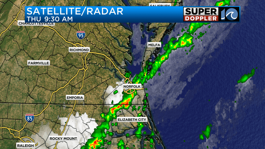
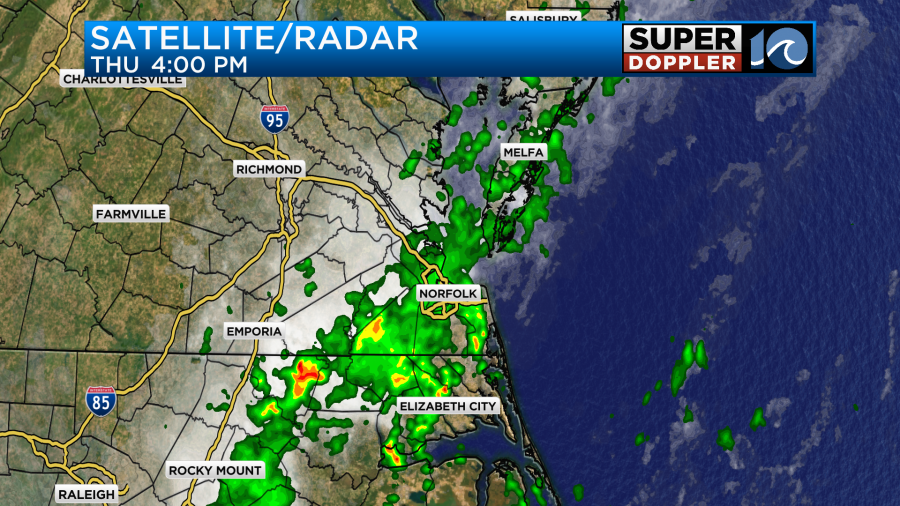
They sat there for a while. Then scattered showers and storms fired up in other locations between the late morning and the afternoon.
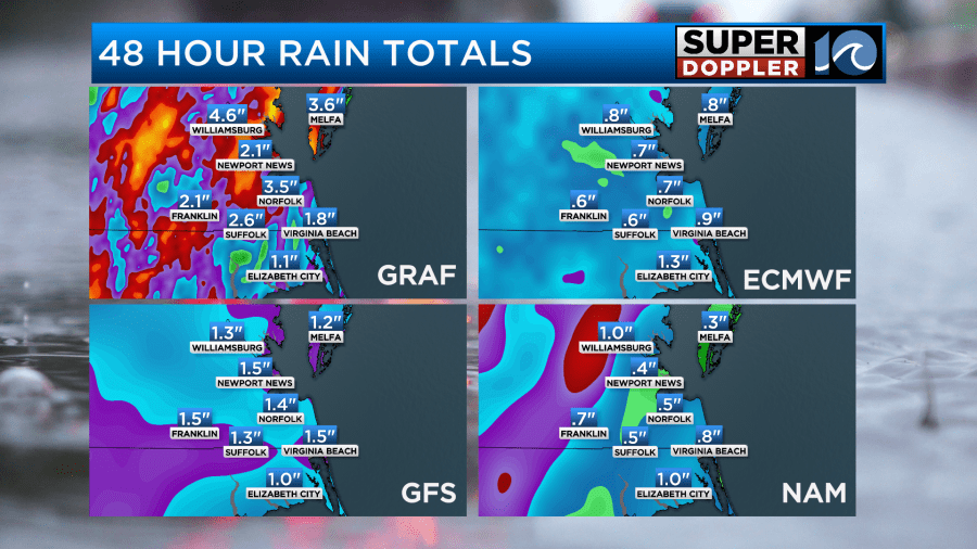
The rain wasn’t heavy everywhere. Amounts varied greatly. Take a look at some of the actual numbers.
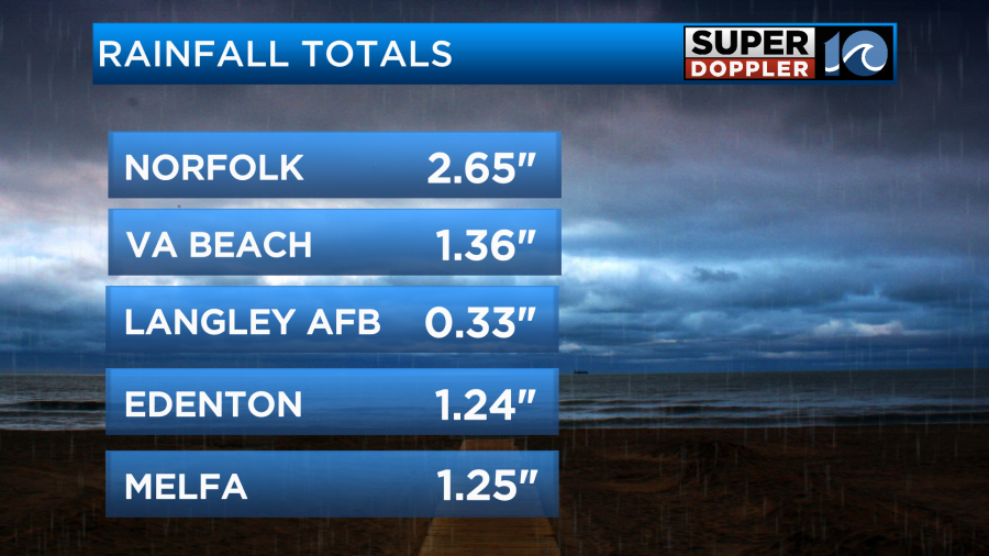
Some places had less than half an inch. Meanwhile the rain over Gates county got up to about 7-9 inches.
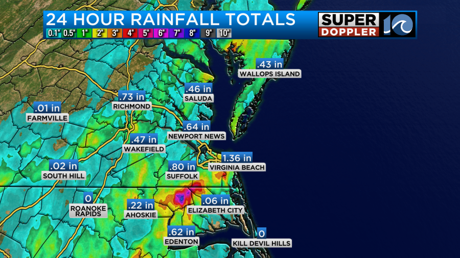
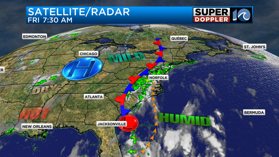
There was also some spots of heavy rain over parts of the Southside. However, there wasn’t too much on the Peninsula, Middle Peninsula, and other areas in North Carolina. It’s amazing how much the rain varied in a short distance, but that was due to the scattered nature of the showers and storms. This was all along a stationary front which sat overtop of us for a while. Today the front has drifted just a bit to the west.
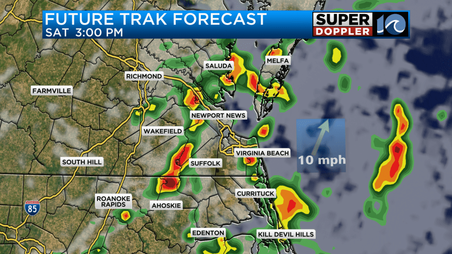
The rain has pushed a little more to the north and west as the front moved. Our Future Trak model has a lull in the activity until midday.
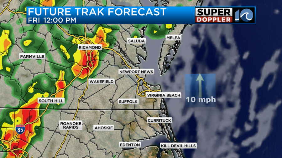
I think the chance will be lower for a while, but I think there will be at least a few scattered showers through that time. However, I do agree that rain and storms will increase again this afternoon.
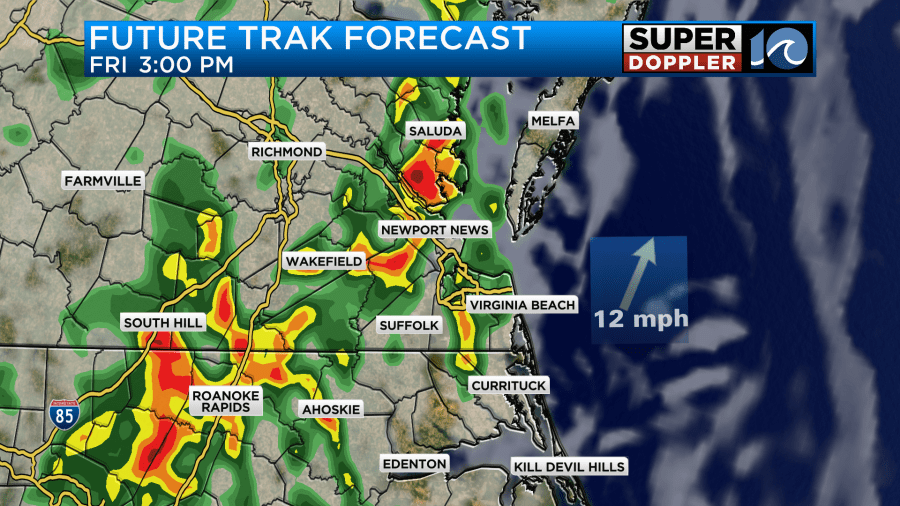
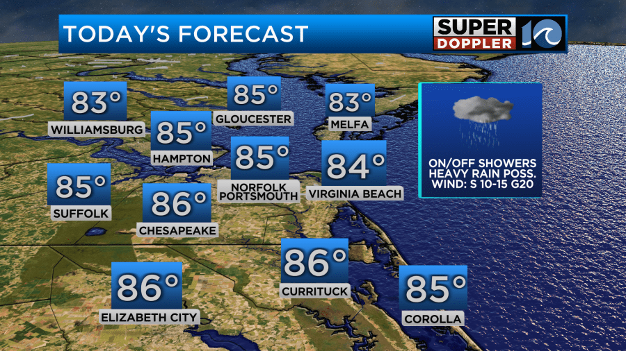
Heavy rain will be possible. We do have a Flood Watch in effect again today and tonight.
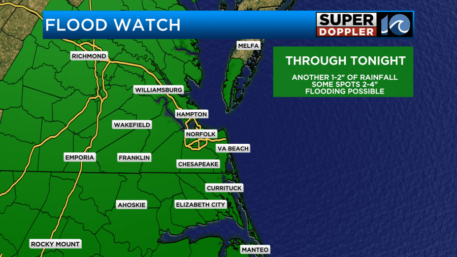
Rainfall will vary again quite a bit. We could see a half an inch up to 2″ in the next 48 hours. Some isolated spots could even see more.
We had a little sun peeking out this morning, but we’ll have a lot of clouds overall. High temps will be in the mid 80s with a few upper 80s south.
The scattered showers will continue overnight. Then tomorrow the front will still be around. We’ll have more scattered showers and storms at times through the day.
However, I think there will be more breaks in the rain. Still, there will be some heavy rain possible. There may be another Flood Watch posted. So check back for updates on that. It will definitely stay muggy through that time and beyond.
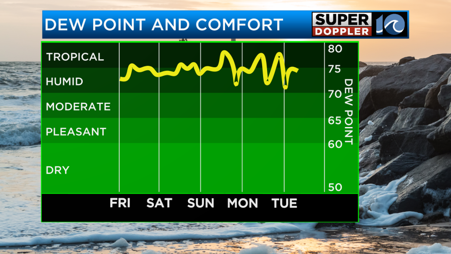
So we’ll stay muggy on Sunday, but the Sun will start coming out more. The front should fall apart. Any showers or storms should be much more isolated. High temps will rise to the low 90s. The heat index will be in the upper 90s.
We’ll transition back to extreme heat next week. High temps will rise to the mid-upper 90s Monday into Tuesday. The heat index will likely be over 100 and probably over 105 degrees.
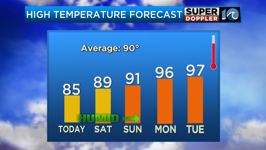
I may even be lowballing the Monday/Tuesday numbers. We’ll talk more about that over the weekend.
Meteorologist: Jeremy Wheeler


