The heat is gone – but in its place today comes a chance of heavy rain and storms.
As of 1 p.m. – here’s the weather situation:
A Severe T-storm WATCH has been issued for parts of the area. A WATCH means conditions are favorable for severe storms to develop. Today – the main concern is gusty winds that could cause scattered trees to fall or power outages.
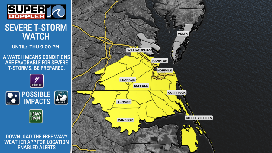
We’re watching a line of showers and storms to our west that will approach later this afternoon. Ahead of this line, some scattered storms may pop up. Anything that develops today could have heavy rain in it.
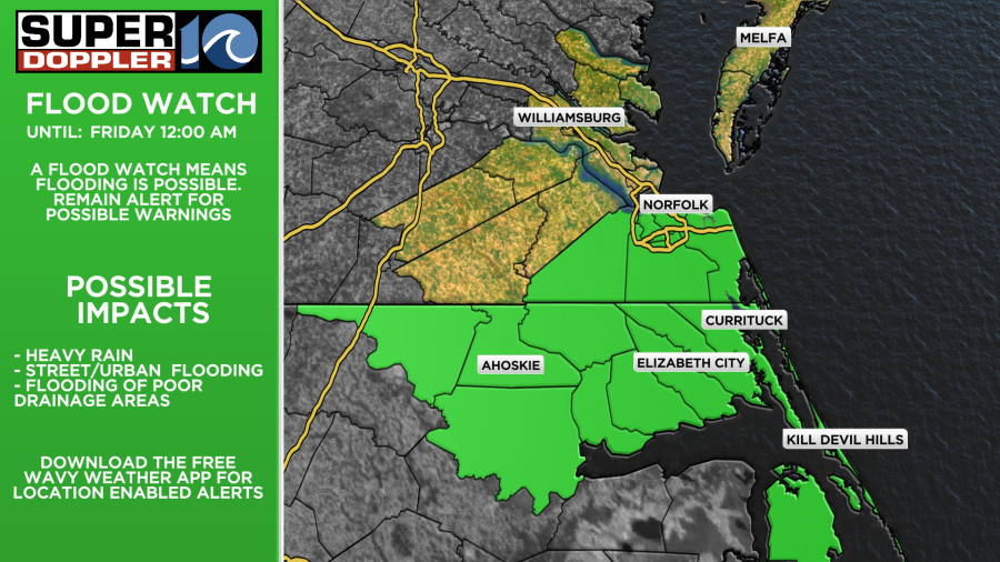
A Flood Watch is in effect for the Southside and NE NC through this evening (counties shaded in green below). With heavy rain over the past week and some heavy rain overnight in NE NC, we could see flash flooding develop.
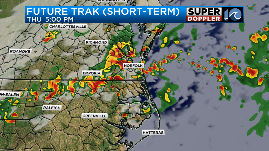
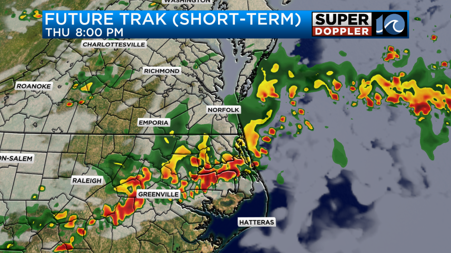
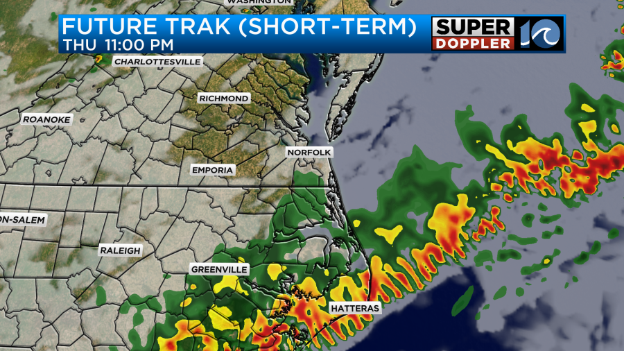
This line of showers and storms will move through the metro during the mid to late afternoon/evening. The highest impacts may be around 4-5pm. Around 3-8pm. Then, it’ll move into NE NC bringing more heavy rain to that region around 4-9pm. For the Outer Banks, we’re talking 4-8pm with 8-midnight for the southern OBX including Hatteras.
Meteorologist Ricky Matthews
Follow Ricky on Facebook and Twitter


