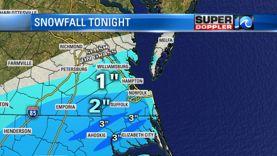
For how this has been developing for the past 2-3 hours, Don and I are not impressed by how heavy this snow is falling. Because of that, we have dropped our expected totals to this:
Don and I are going to be here throughout the evening with updates. In the meantime, I uploaded our High Resolution Future Trak (New weather Model by IBM [GRAF])
The temperatures in the morning will likely be in the low 30s, and below freezing for the areas that see the most snow. Roads could be snow and ice covered in these areas before sunrise.
Be careful as there could be patchy ice! Remember, AWD doesn’t mean you have better traction on ice!
As the sun gets higher in the sky, our temperature will climb to 37 degrees and the sun should aid in the roads melting off any extra snow or ice by the midday hours. The wind chill will be between 18 and 26 degrees Friday. Temperatures will drop to the 20s Friday night.
Meteorologist Jeff Edmondson


