We have a lot of rainy days ahead this week, and today is no exception. We started off the morning with widespread rain. Luckily it was mostly light, and the wind wasn’t too strong.
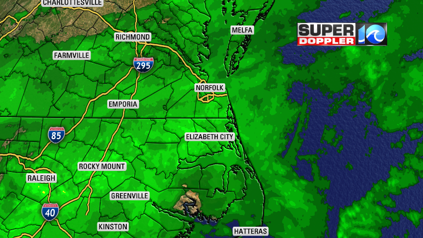
There is an area of low pressure moving northeast along a stationary front that lies to our south. There is a lot of moisture pushing north of the system into our area.

There is also a cold front moving in from the north. This will increase the wind out of the north today. It will gust up to 25mph between the late morning and the mid afternoon. There will be a high chance for rain through the mid afternoon hours.
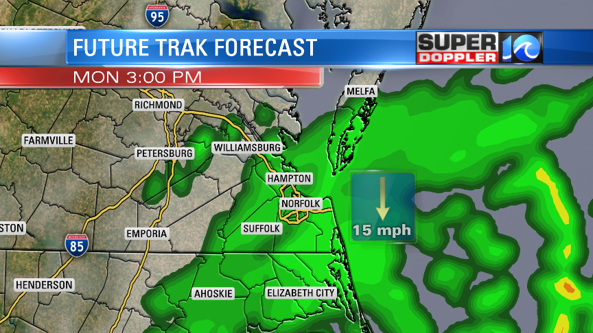
Then the showers will taper off quickly between 3 and 6pm as the low moves farther offshore. We’ll be fairly cool and stable over southeast Virginia. High temps will only be in the upper 50s to low 60s this afternoon. However, there will be a few thunderstorms over parts of North Carolina (Closer to the low). There could even be a few strong storms over the Southern Outer Banks. We’ll dry out this evening into tonight. Low temps will drop down to near 50 with 40s inland. Tomorrow we’ll be dry for the first half of the day. Winds will be out of the southwest through the early afternoon. However, a cold front will move in during the mid-late afternoon. This will bring a few showers and storms to the region. It will also change the wind from the southwest to westerly/northwesterly. High temps will rise to the low-mid 70s before the front arrives.
We’ll be cool and dry on Wednesday with highs in the low 60s. Then we’ll have another good chance for rain on Thursday. A few showers and storms on Friday. Make sure you’ve got the rain gear handy for this week!
Meteorologist: Jeremy Wheeler