
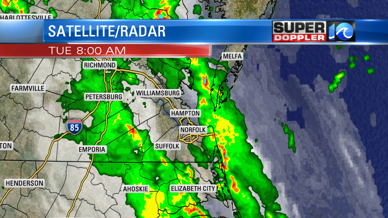
The rain has been ongoing since the overnight, and we have a way to go before it all shuts down. A few pockets of heavy showers fell last night. It turned into 2 bands of heavy rain this morning.
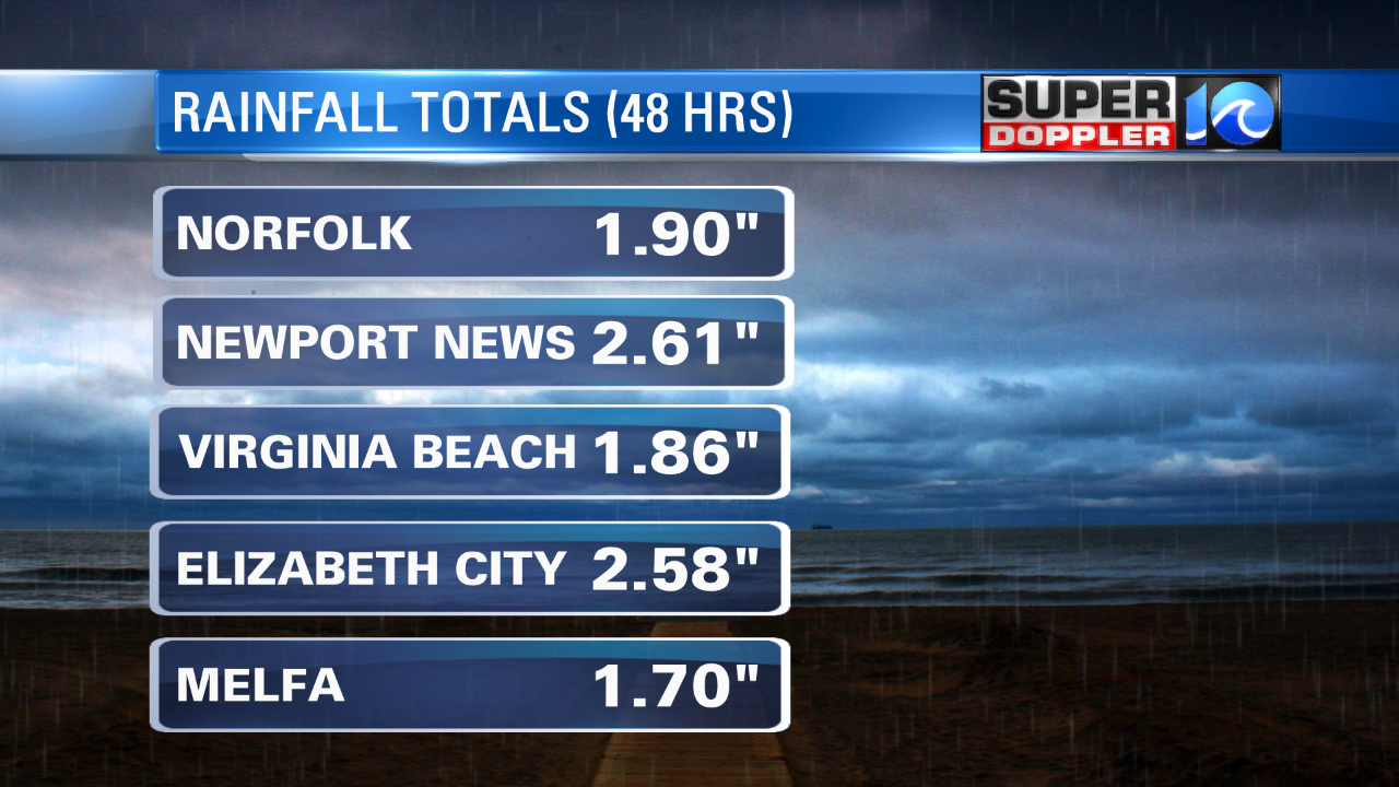
The rain has been adding up in the rain gauges. Here were the 48 hour totals as of 7:30am.
The weather pattern hasn’t changed since Sunday. So wet weather will continue again today. Rain showers will be on and off through the day. It will be heavy at times. We may have some isolated thunderstorms mixing in, but most of the rain will just be showery.
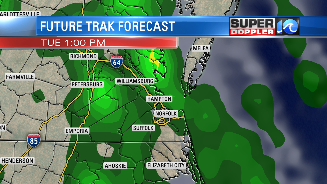
There is a Flash Flood Watch in effect through at least this evening (as of this writing). It is through tomorrow for parts of North Carolina. We could see another 1-2″ of rain with some areas expecting above 3″. Again….this could create some localized flooding in the area. High temps will be in the low-mid 80s. We’ll have that strong southeasterly breeze running at 10-20mph with a few gusts to 25mph.
We’ll have more on-and-off showers tonight through tomorrow. Rain showers will continue through tomorrow evening. Finally, I think the pattern will break up by Thursday. The upper level low should dissolve and move north. Plus, the front should fall apart. So we’ll have a mix of sun and clouds. There will still be some scattered showers and storms, but there should be a lot more breaks. The NAM doesn’t show much rain during the day, but the GFS model has about a 40-50% chance for rain. Splitting the difference I’ll say a 30-40% chance. High temps will be near 90, and it will be humid. A couple of cool fronts will drift into the region into the weekend. We’ll have more scattered showers and storms, but they won’t be as widespread as the recent rain Friday through Sunday. I’ll be able to fine-tune that part of the forecast as it gets closer. Stay tuned for updates.
Meteorologist: Jeremy Wheeler


