
Heavy Wet Snow…(meaning snow with low snow ratios due to high water content) is falling across our area. The radar snap show below show some of this (this picture is from the 7PM hour).
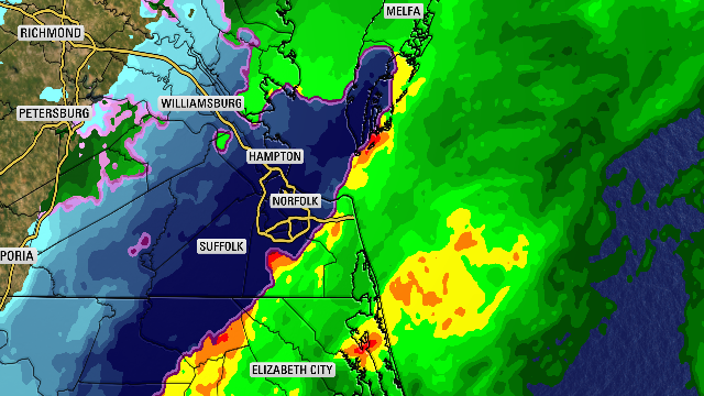
Notice the deep blue shading which signified the higher intensity. Because the atmosphere (especially as you go several thousand feet up in the atmosphere) has temps hovering near 0° celcius (or 32°), the snow is hovering around the freezing line…leading to that heavy wet and moisture filled consistency. This type of snow creates big fat flakes that can quickly stick. However, in our case, it’ll lead to lower snowfall amounts…but create some slushy travel. It’s also dangerous because it’s so heavy that it could snap tree limbs or power lines.
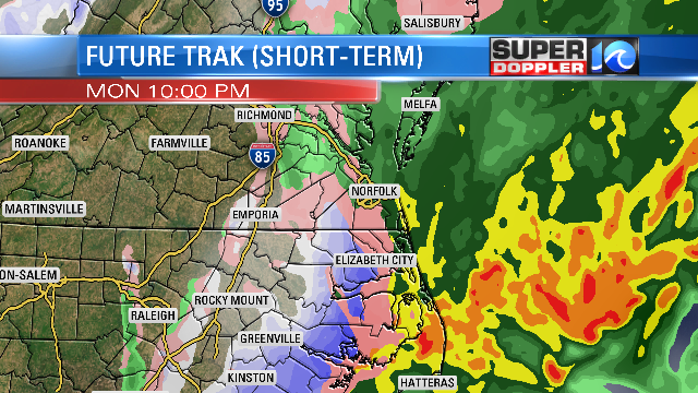
The wet snow and wintry mix will continue for most of the area through 10PM. After that time, conditions will gradually improve as the snow tapers off.
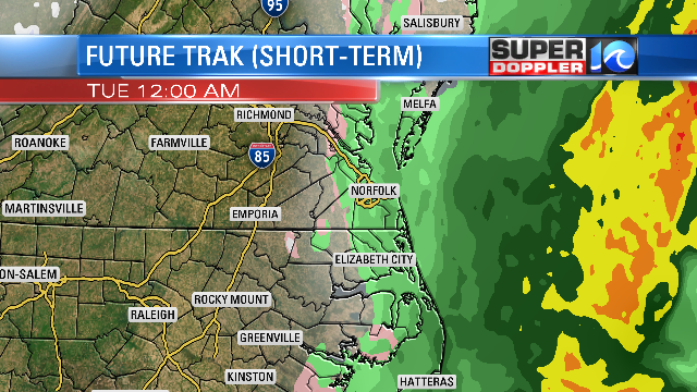
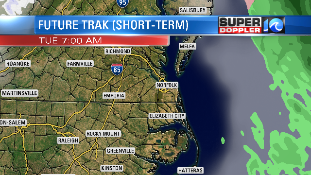
By sunrise on Tuesday, this system will be out of our area. The “system” is an area of low pressure that’s riding parallel to our coast…moving NNE.
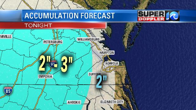
Because of the water content of the snow, snowfall amounts will only be up to 2″ for most of Hampton Roads (however, the highest amounts of the forecast models below…greatly underestimates the amounts). Heavy Wet snow can be hard to forecast snowfall totals.
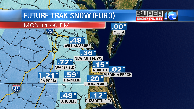
From a line from Williamsburg to Franklin to Ahoskie and points west, up to 3″ is possible. Near the coast, you can definitely have some wet snow flakes,sleet, and rain, but accumulations should be very low…less than 1″.
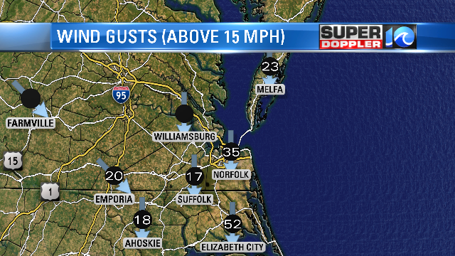
Also, the wind is a big story…especially near the coast. Below is a snapshot of wind gusts from earlier this evening….notice Elizabeth City…wow!
Watch Chief Meteorologist Don Slater tonight on WAVY NEWS 10 at 11PM … and on FOX43 at 10pm.
Meteorologist Deitra Tate


