
The melting process began yesterday. Today we will see stronger melting and for a longer time. This morning temps were 15-25 degrees warmer than 24 hours ago.
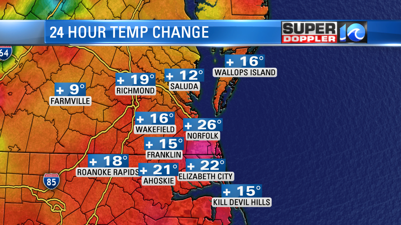
Most temps were in the 30s, but there were a few 20s inland. We had some rain and clouds overnight which helped to keep the temperatures above freezing over most of the area. The rain didn’t add up to much, but it did help to create some more slushiness on the roads in Hampton Roads. It did lead to some iciness north and west of the metro as temperatures fell before sunrise. The rain moved out early this morning. Today we will have high pressure sitting over the region.
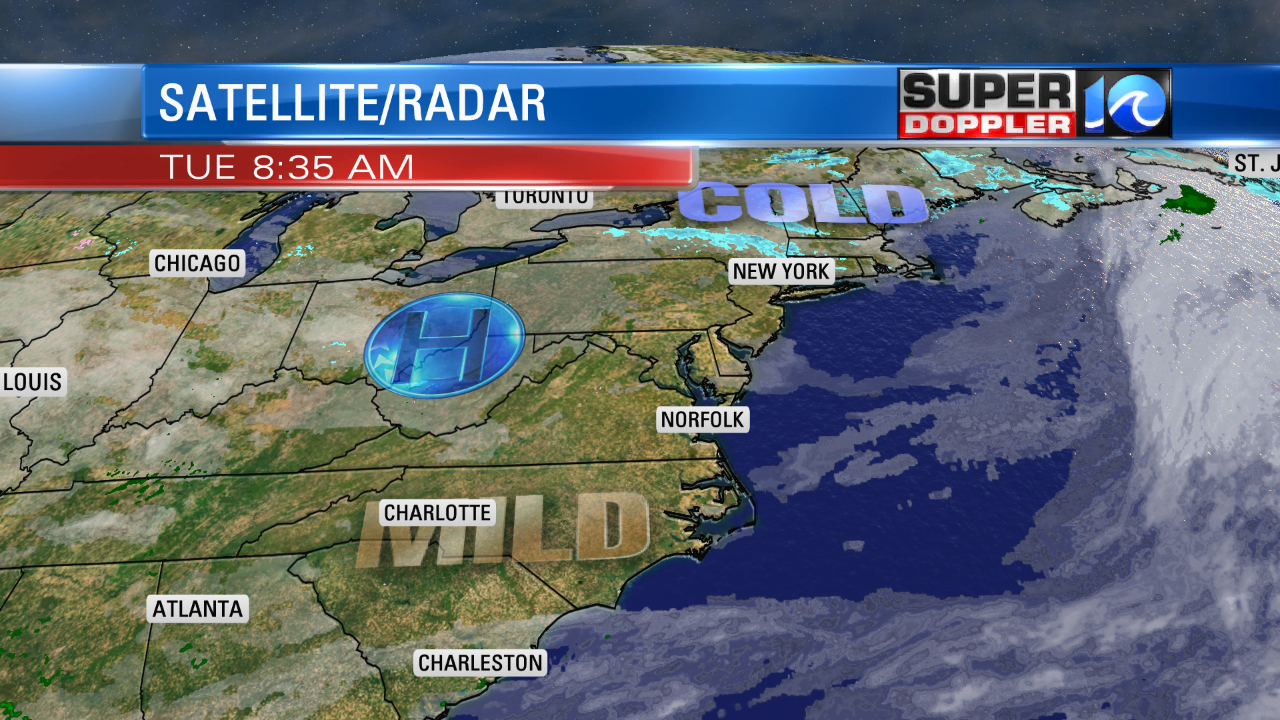
This will bring us a lot of sunshine through the entire day. We started off the morning with lots of bright sunshine.
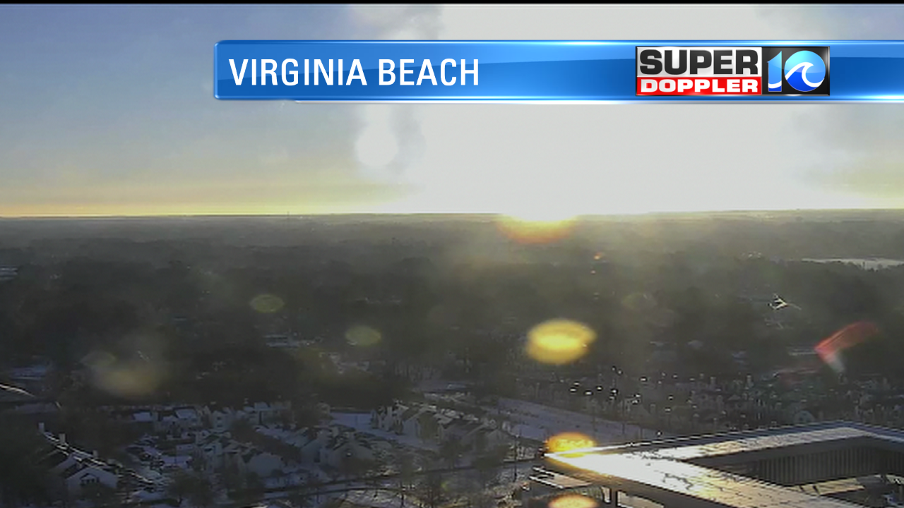
Before the sun rose higher some inland locations did drop down to the freezing mark, but most of Hampton Roads stayed above freezing. This is giving us a good start to some stronger melting. High temps will rise to the upper 40s this afternoon with a few 50s inland. The main roads and secondaries are in great shape now. The neighborhoods are still a problem. This morning there was more slush and less ice. However, there should be a lot of melting of both the ice and slush today. Hopefully, it will be enough for the kids to head back to school tomorrow. I’m sure the kids have been loving it, but a lot of parents have had to take off work to stay home with them or they have brought their kids to work. So keep your fingers crossed that today the strong sun will be enough to clear up the neighborhoods.
Tonight we will have some clouds popping back in. It would be good if we do get some clouds. That would keep the temps up a bit. For now I am calling for temps to fall to the upper 20s to low 30s. So there will be some patchy ice from the melt as it re-freezes. Tomorrow we’ll have partly cloudy skies with high temps near 50. The bigger warming will arrive by Thursday. High temps will rise into the 60s as the winds strengthen out of the south. We will have increasing clouds with some isolated showers in the region. The moisture will increase along with the temperatures on Friday. We’ll have lots of clouds, occasional rain showers, and highs in the upper 60s. Temps will be about 20 degrees above average. This will be ahead of a big cold front. That will move in by Friday night. Temps will hold steady in the 50s or drop slightly on Saturday. We’ll have a few showers in the morning with drying in the afternoon. Then highs will only be in the upper 30s on Sunday and Monday.
The deep freeze has been tough over the eastern parts of the country. Yesterday there was a huge water main break in Richmond that flooded out a small part of I-95. This was likely due to the cold weather. Meanwhile there has been record heat in Australia. The temperature in Sydney hit 117 degrees Fahrenheit the other day. I am looking forward to some warming, but not that much.
Meteorologist: Jeremy Wheeler


