We finally have some great weather headed our way. The only thing our local area will have to deal with is some high waves and some ocean overwash along the Outer Banks. The pattern has changed. After several days of strong northeast winds now today we will have a lighter north wind. High pressure is sinking south, and hurricane Teddy is streaming north.
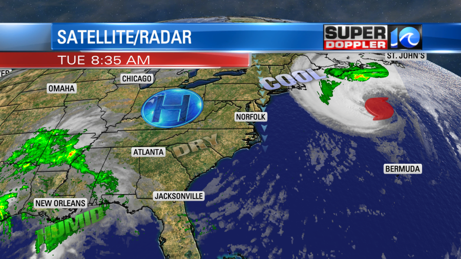
The cool north wind today will run at 10-15mph. There will be a few gusts to 20mph near the shore. We’ll only have nuisance tidal flooding today over the southern Chesapeake Bay. However, the tide at Duck, NC is forecast to be around 5.8ft around midday. This is minor to moderate tidal flooding, and it could lead to some more ocean overwash. It just won’t be as bad as yesterday.
With this pattern change we’ll have lots of sunshine for the next few days. High temps will be in the low-mid 70s today. Then we’ll be in the upper 70s to low 80s Thursday and Friday. We’ll have some more moisture by the weekend and more clouds. There may be some isolated showers. However, the weekend overall doesn’t look too bad. High temps will be in the 80s, and the humidity will increase a bit.
The tropics are still busy. There are 3 systems that we are tracking.
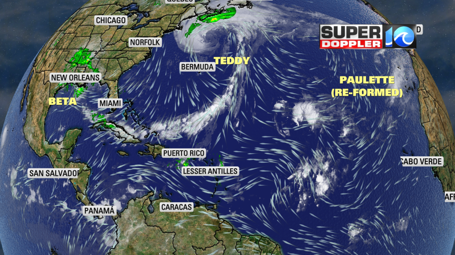
Paulette did re-form in the eastern Atlantic last night. However, it is basically going to meander around for a couple of days. It should fall apart in a few days. So I won’t even track it.
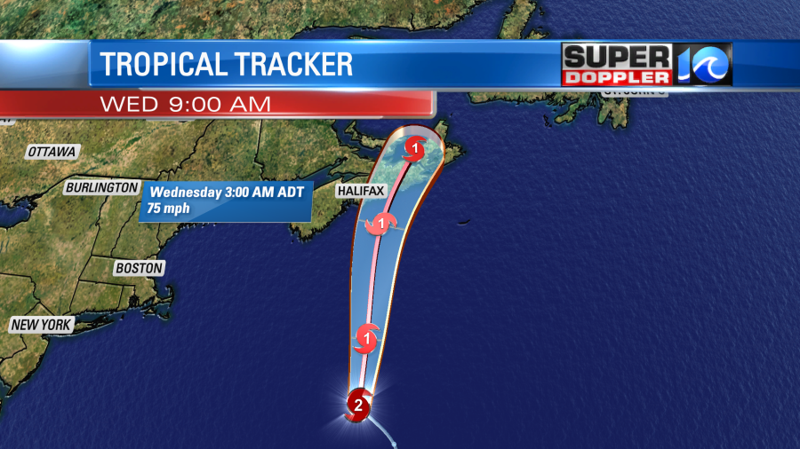
Hurricane Teddy was a category 2 hurricane this morning. Sustained winds were 100mph, and it was moving quickly to the north. The forecast changed a bit as far as Nova Scotia is concerned. Now it looks like the system will remain tropical as it makes landfall up there. So the latest forecast has Terry as a category 1 hurricane tomorrow morning over eastern Nova Scotia.
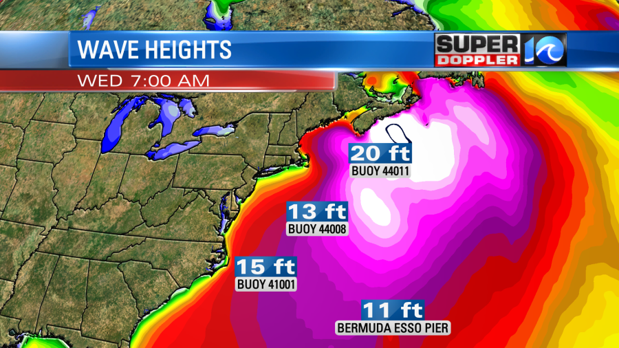
The waves are huge around the storm. Our model is calling for 30+ ft waves near the center. Waves could be up to 20 feet or higher as it moves onto the Canadian coast.
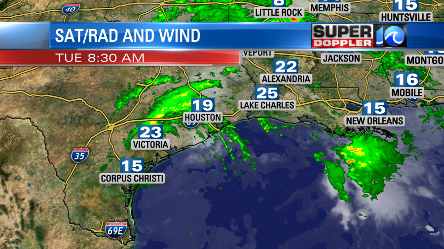
In the mean time. Beta has made landfall over Texas. It does have some gusty winds near the center, but they aren’t too bad this morning.
The storm will move generally east over the next 24 hours. It will become a tropical depression. Then it will keep moving east/northeast through Thursday. It will fall apart over Mississippi later this week.

We’ll get a little moisture from it this weekend, but not a huge amount.
Stay tuned for updates
Meteorologist: Jeremy Wheeler