
Locally, we are looking at some pretty good weather this week. Yesterday, there was a front and a weak area of low pressure near the coast. So there were lots of clouds with a few rain showers. It rained for a long time over the Outer Banks. However, today that system has pushed a little farther offshore.
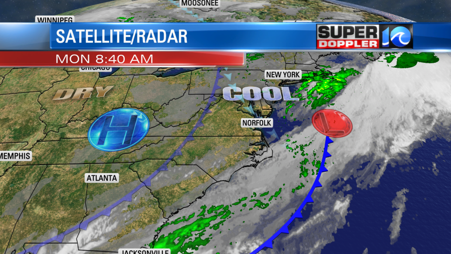
There is another cool front to our west, but it is falling apart. High pressure is getting a bit closer to us from the west.
Basically we’ll have a lot of sunshine today. There will be a light northwest wind, and we’ll have dry conditions. It will feel great outside! High temperatures will rise to the low 70s with a few mid 70s inland. Get out and grab some fresh air if you can. Tomorrow we’ll still have lots of sunshine, but there will be a few more clouds in the afternoon. There will be a light southwest breeze. This should allow temps to bump up to the upper 70s. We may even hit80 inland/south. Luckily, the humidity should still be fairly low. We’ll warm up even more on Wednesday with highs in the low 80s. Then we’ll cool down later this week.
There may be some rain by next weekend, but that will depend on what happens in the tropics.
There are two tropical systems in the Atlantic basin. Tropical storm Gamma did move over the Yucatan Peninsula a couple of days ago. Now it is wandering around the southern Gulf of Mexico. Tropical storm Delta just formed over the central Caribbean.
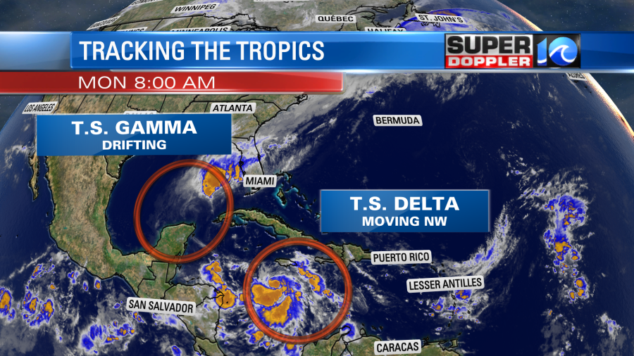
Tropical storm Gamma is weakening. There has been a lot of wind shear lately. So the bulk of the thunderstorms have actually been blown off to the northeast by a couple hundred miles. The forecast has Gamma falling apart in a few days.
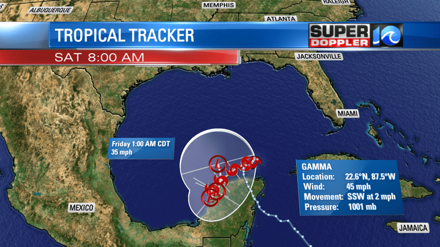
It’s easily possible (and mentioned by the National Hurricane Center) that Gamma could fall apart within the next couple of days. The life span of Gamma could have an minor impact on Delta.
Again, Delta became a tropical storm this morning. It is over the central Caribbean and moving west/northwest. It is over warm water, and there is not much wind shear. So it is forecast to strengthen. It will likely move into the Gulf Of Mexico within the next 2 days. Then it is forecast to become a hurricane. It is expected to be a category 2 hurricane when it makes landfall towards the end of the week or early in the weekend. This could happen anywhere from the Louisiana coast to as far east as the Florida panhandle.
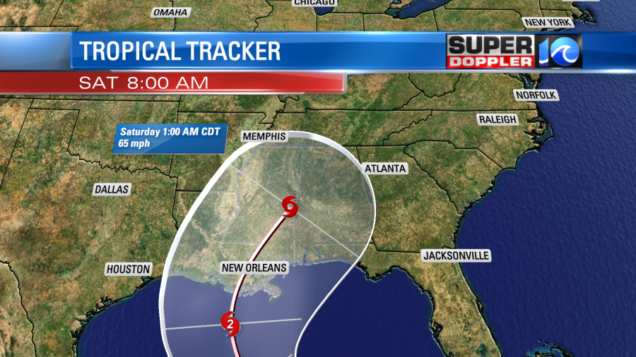
This is still pretty far out in time, but there is some clustering in the computer model forecasts up through landfall.
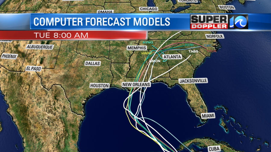
The trend is for it to then move north/inland. Then it would move northeast and weaken in 4-5 days. It is forecast to get wrapped up into a cold front, but some of the moisture could push up into our region by next weekend. I’m sure there will be some changes and quirks coming down the road in the forecast with Delta. So stay tuned for updates.
Meteorologist: Jeremy Wheeler


