
Yesterday’s washout was rough. We had reports of flooding all over the region. It came down heavy during the morning and midday hours.
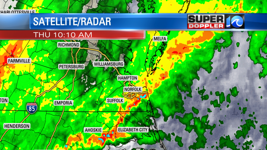
The rain overflowed some of the rain gauges. We had about 3-5″ of rain with some locations getting 6-7″. Here are some of the totals:
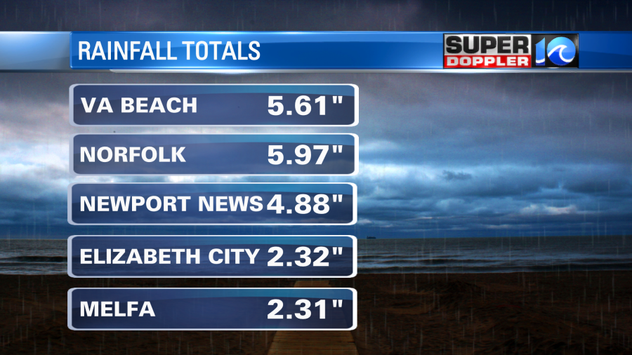
My weather watcher Kurt in Smithfield had over 6″. Donna in Blackwater (southern Virginia Beach) had about 7″. Barry in Gloucester had 2.25″. There were still some areas with standing water this morning, but they will go down today. There will be some minor river flooding over the next day or two. A couple of rivers could be up to moderate levels.
There was fog, clouds, and patchy drizzle this morning. The cold front has dropped to our south. However, some moisture has lifted north of the front. Eta did fall apart as it got wrapped up into the cold front, but it did push a little moisture northward.
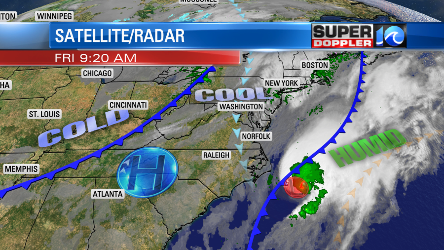
As the remnants of Eta move farther offshore with the front the north/northwest winds will pick up today. Drier air will move in, and we’ll have some clearing through the afternoon It will turn into a nice day with high temps in the mid 60s. Dew points will drop to the 40s. By Tonight the winds will die down and skies will clear. Low temps will drop to the 40s. A second punch of colder air will arrive by early tomorrow. So high temps will only be in the upper 50s Saturday despite lots of sunshine. I’m actually looking forward to it. I’m just not looking forward to raking leaves.
After starting in the 40s again on Sunday we’ll warm up to near 70 in the afternoon. It should still be dry for most of the day. However, a few showers may arrive by the evening. This will be ahead of a cool front that will move through Sunday night. There will be a few light showers with it, but they should move out by Monday. Then we’ll be dry and cool for most of next week.
The tropics are still chugging along. Talk about topical burnout… As mentioned Eta did fall apart as it got absorbed into the cold front. The remnants of it will move farther out to sea. There is a tropical disturbance in the central Caribbean. It is moving west. The National Hurricane Center is going to start issuing advisories on it today as Tropical Depression 31. It could impact Central America in a few days.
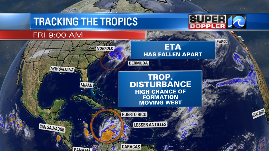
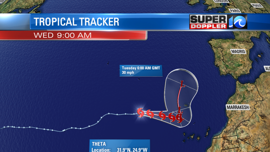
Finally, Theta is over in the eastern Atlantic. It is moving generally east. It will become extra-tropical in a few days.
That’s it for the tropics and local weather. Before I go…I found an interesting article about seal level rise and NASA. Apparently there are several NASA sites that are being affected by rising water levels. A couple of them are local. It is even affecting their operations as some buildings have had to move or be torn down. Here is the article with more information: NASA struggles with sea level rise.
Meteorologist: Jeremy Wheeler


