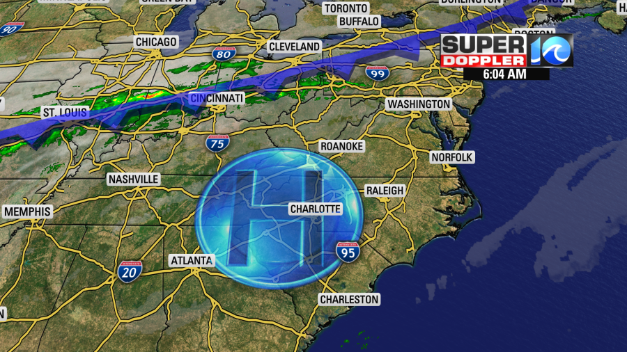
Good morning, friends. We’ve been spoiled these past few days! Sure, chilly mornings, but sunshine filled afternoons and crisp autumn breezes went all too well with those peppermint latte’s and sweater weather Instagram selfies. We can thank high pressure (and the new iPhone), but will only have a day and a half of it left in the forecast.
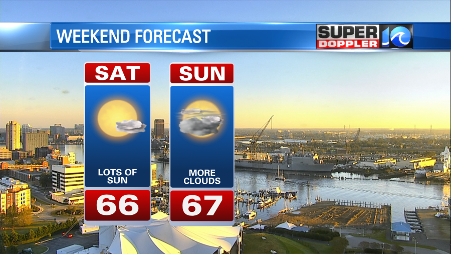
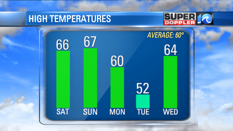
Expect a lovely, lovely Saturday – classic November sunshine with seasonable high temperatures, in the mid 60s. There’s a front and rain to our north, but high pressure keeps it there as it slides by today. By Sunday, this high is offshore and the window is open for some changes. A secondary front drops in to finish the weekend.

So tonight there’s a couple clouds around after the winds shift to the northeast. Lows into the low 50s, upper 40s in spots, so a bit milder compared to this morning. More clouds than sun on Sunday with highs in the mid to upper 60s. The more sun we get Sunday would put highs at 70° in spots.

Good news, most of Sunday, if not all of it, will be dry. Some models (pieces to the puzzle) are hinting at an earlier arrival of precipitation Sunday, but even then it’s well after dark. Look for just a few scattered showers around midnight through the early morning on Monday. About 40% of us should get in on the action (so even then, not all that impressive).
What is a bit more interesting, is that high temperatures Monday should peak in the early morning hours. Around 60° is the overnight temperature and that should be the high for Monday! Dry, cooler air squeezes in throughout the day, so by the afternoon temperatures will fall into the 50s. Increasing sun should take us into Tuesday, which will be a much colder day.

Unfortunately, the pattern doesn’t look too quick into Thanksgiving. As of now, another frontal system should swing in later this week, so we’ll keep showers in the forecast for Thanksgiving Day, while temperatures remain in the 60s.
Stay stoked! – Meteorologist Steve Fundaro


