*5:30 PM Update from Meteorologist Jeff Edmondson
The latest models are still in agreement on the timing of this snow. 3-5 AM is likely when we will see the rain change over to snow. We have up until around 6 AM for the heavy snow at the latest, then it will be mostly light snow and flurries as the storm moves away.
Road conditions could be slick in the morning, especially on the bridges. There could be a few towns in North Carolina that see 3″ of snow by tomorrow morning.

Full Forecast From Jeremy Wheeler
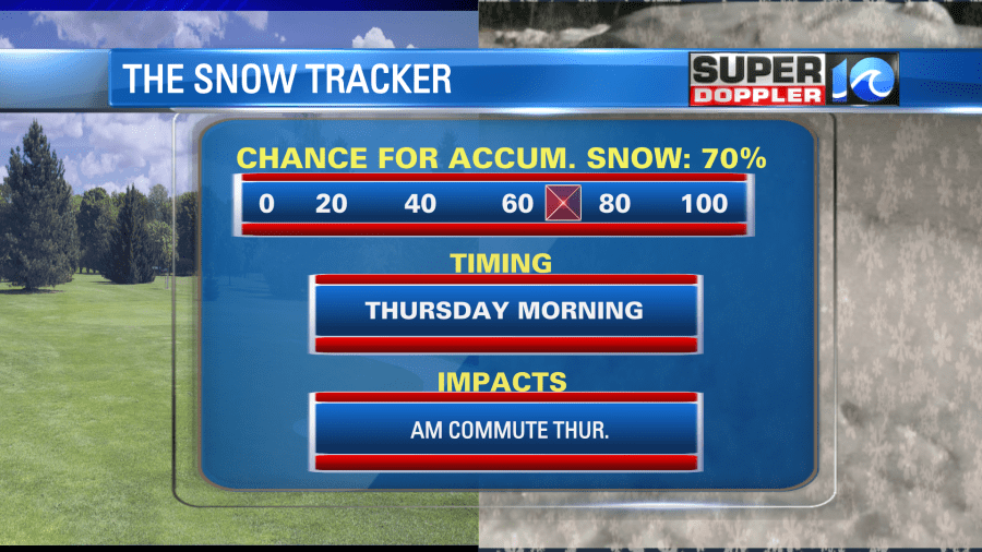
Since yesterday the models have finally come into some agreement about tomorrow’s wintry weather. Thank God! So the models that previously had zero snow forecast have now come up, and the bullish GFS model came down (slightly). I’ve increased the chance for accumulating snow in Hampton Roads. I put the chance up to 70% (as of this morning).
More on that in a moment. First, today we will still have quiet weather. We have a cold front stalling out to our south, but some moisture is pushing north of the front.
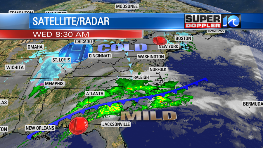
We’ll have lots of clouds this morning with some isolated showers over northeast North Carolina up to the VA/NC state line. Then during the afternoon we’ll have a mix of sun and clouds. High temps will be in the upper 40s with a couple of 50s south. The area of low pressure is still down towards the Florida panhandle.
Today that system will slide to the east/northeast along the stalling-out cold front. By tonight the low will move to our south. It will remain weak, but it will push some moisture up into our colder airmass. Meanwhile an upper level low will be slipping overhead to the east.
Temperatures won’t drop much for a while tonight. They will be in the upper 30s to around 40s overnight as thick clouds act like a blanket. That will last until about 2-4am. After midnight enough moisture will push north to initially bring some scattered rain showers to the region.
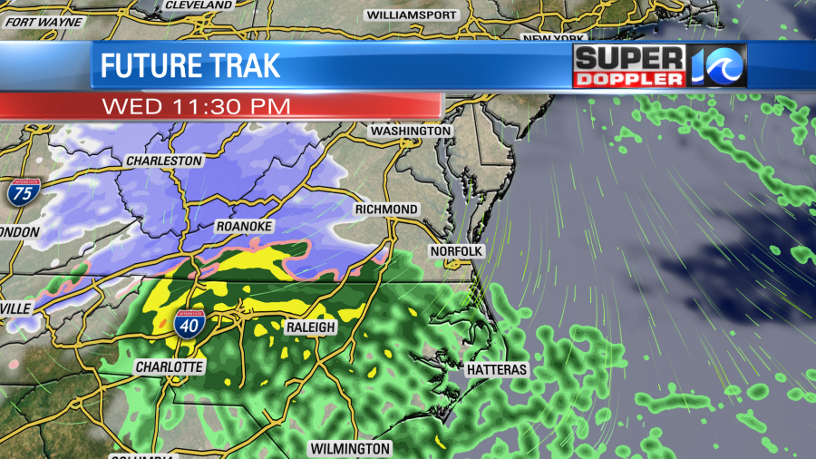
Then, between about 2 a.m. and 5 a.m. the showers will turn into a wintry mix and some snow. It will be below freezing aloft, but surface temps will still likely be above freezing. Plus, the ground will be wet from the rainfall.
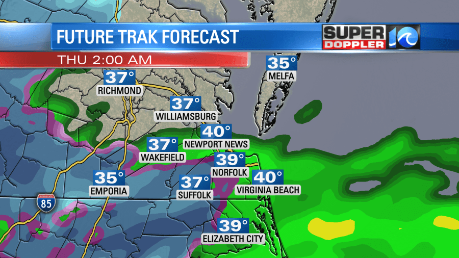
This means that at least the first snow that falls should melt. Eventually though the snow may overcome that effect. Our model suggests that either a wind-shift or an upper level disturbance will drop southeast between 5-8 a.m. So the model has a small pocket of light snow showers at that time.
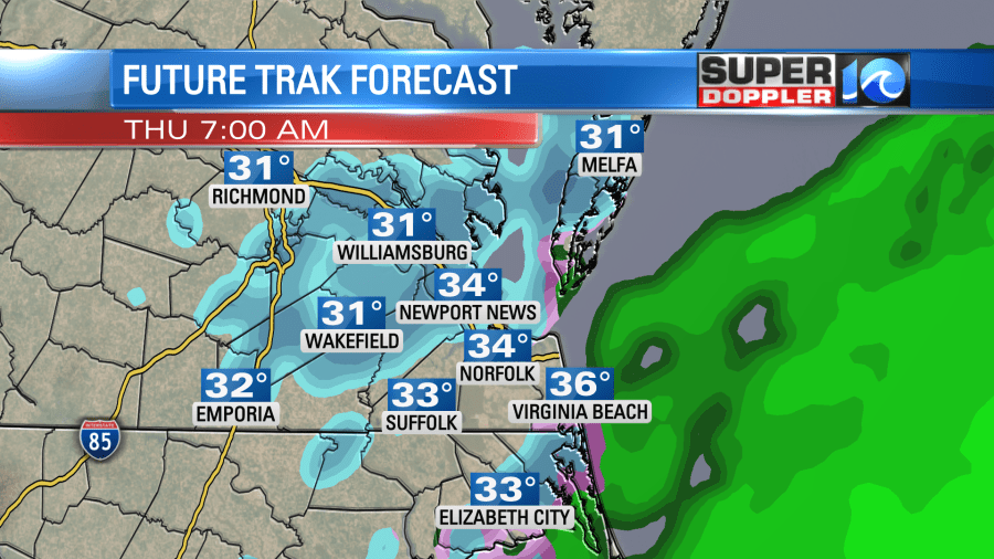
The surface air temperature will probably drop to near freezing for some areas during this time. It will also be right during the morning commute.
So while most of what falls will stick to grass, ground, and decks, there may be a brief time when we get a little slushiness on the roads. Again this could cause some real headaches for tomorrow’s morning commute. Even falling snow that melts can be distracting to drivers.
After about 9 a.m. most of the precipitation will push out to sea. The area of low pressure will be strengthening as it moves offshore. We’ll have a strong north wind developing. Drier air will drop into the region, and we’ll have some clearing during the afternoon. However, cold air will drop south. So high temps will only be in the upper 30s tomorrow. The wind will be blowing out of the north at 10-20mph with gusts 25 to 35mph. There could be some gusts to 40mph near the shore.
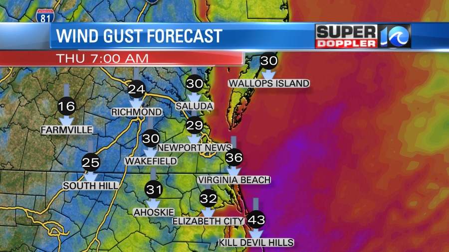
While there will be a strong wind, I’m not seeing too much tidal flooding. It may get up to some minor levels, but I don’t think it will be a huge problem as the winds should settle a bit by Thursday evening. There will be some high waves though near the shore.
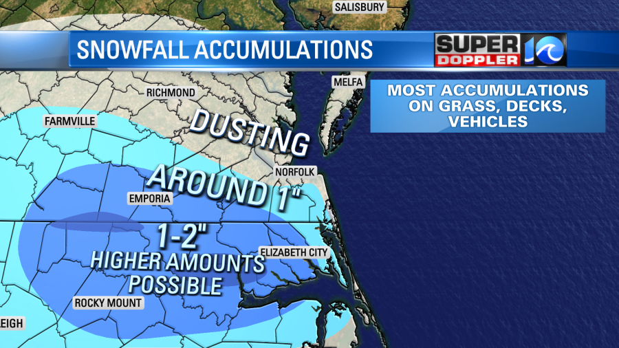
The models are in fairly good agreement now about the snow forecast. They are coming in with about a half inch from the Peninsula northward, about an inch over the Southside, and 1-2″ over northeast North Carolina.
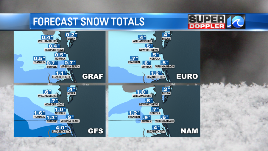
The GFS is still showing 3″ or a little more over parts of North Carolina, but most of the other models have less. Using all the models this morning, including the National Weather Service output, I put together a snow forecast map. Here is my latest version:
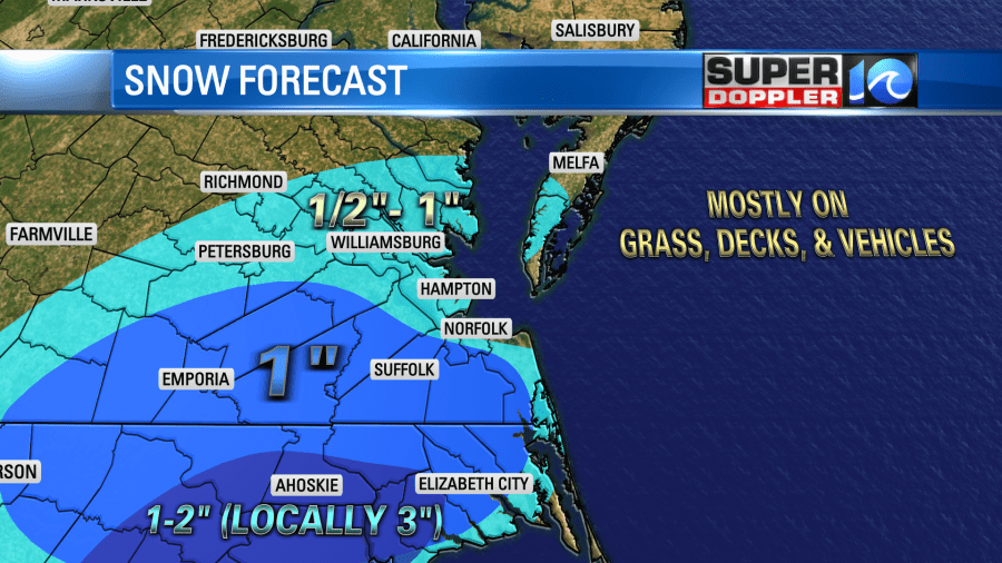
Remember…locations near the shore will probably have melting as the bay temperatures are in the 40s. So a wind off the water will likely keep temps up there. While this won’t be a big system to impact our region, the timing of it could make tomorrow’s commute very tough.
Behind this system we will be cold and dry Thursday afternoon through Saturday. High temps will only be in the upper 30s to low 40s. Low temps will be in the 20s. It might even get down to the teens inland Friday morning. There might be another wintry mix Sunday morning before that changes to rain, but we have plenty of time to update you on that.
Meteorologist: Jeremy Wheeler


