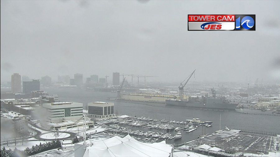
It was a snow blitz this morning. We had widespread snow for a time, and it was pretty heavy and wet.
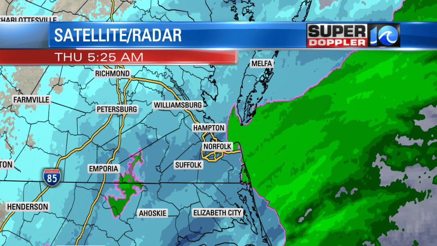
This persistent/heavy snow overcame surface temperatures that were above freezing along with a mild ground. So snow did stick to the grass and decks as expected, but then it started to stick to some of the roads for a while as well. Luckily the mild ground started to melt the snow on the roads and walks as the precipitation became lighter between 7 and 9 a.m.
The snow started wrapping up between 8 and 9 a.m. Low pressure was heading out to sea, but it was strengthening.
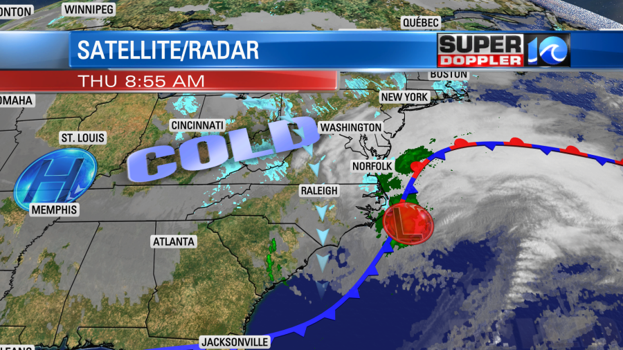
The low will push farther out to sea today. The wind will rev up behind it. They will run at 10-20mph with gusts up to 25-35mph out of the north/northwest. There could be a few gusts to 40mph near the shore.

We’ll have clearing skies, but temps will only rise into the upper 30s this afternoon. Wind chills will be in the 20s.
For snow totals… so far we’ve picked up about 1-1.5″ over the Northern Neck, Middle Peninsula, Peninsula, and Eastern Shore. Most of that was on the grass and decks. We had about 1-2″ from some inland locations into northern Suffolk and Portsmouth. However, it was more in the 2-3″ range for the Rest of the Southside. Here are some of the snow reports so far:

It stayed as a mix for a while along the Outer Banks, but some inland locations in North Carolina had a solid 2-3″. This goes fairly well with the snow forecast from this morning.
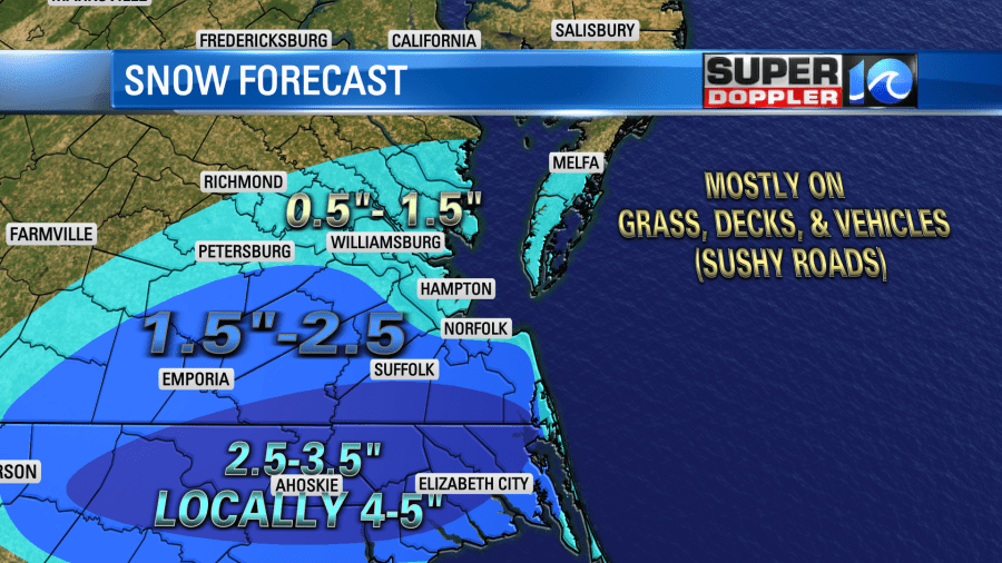
However, it was much more than the going forecast from the last couple of days. I’ll say that we definitely underdid the forecast for the Southside and parts of North Carolina, but most of the models had very light amounts up until this morning. Two days ago about 2 or 3 of the models even had zero snow for the area. However, the GFS model was the big winner this time. (Even over the Euro). It had the amounts forecast pretty well over the last couple of days. I think it caught on to the higher amount of moisture in the region, and it may have caught on to the heavier nature of the precipitation this morning.
High pressure will build in tonight. We’ll have mostly clear skies. Low temps will drop down into the low-mid 20s. Winds will be out of the north at 10-15mph with gusts to 25mph. This will create wind chills in the teens and single digits. Some of the melted snow will re-freeze tonight. So there will be patchy black ice tomorrow morning. The strong wind today will likely dry out a lot of the area. Hopefully that will limit the icy areas tomorrow morning.
Tomorrow high pressure will build in stronger. We’ll have lots of sunshine, but the breeze will still be up a bit out of the north/northwest. High temps will only be in the upper 30s. We’ll be cold and dry on Saturday. Then we’ll have another weather system move in on Sunday. There will be a wintry mix at first. Then it will change to rain showers. High temps will climb to near 50. We’ll have more on that later today and over the next couple of days.
Meteorologist: Jeremy Wheeler