
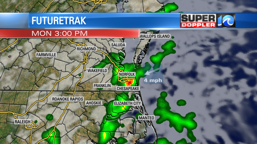
The only time a meteorologist uses the term “washout” is when the weather will not be a washout. If we’re being honest, I’m not entirely sure why. Maybe we don’t want people to be deterred by the rain, still having the ability to enjoy the day. Or maybe it’s because it rarely rains from sun up to sun down. Either way, today will not be a washout.
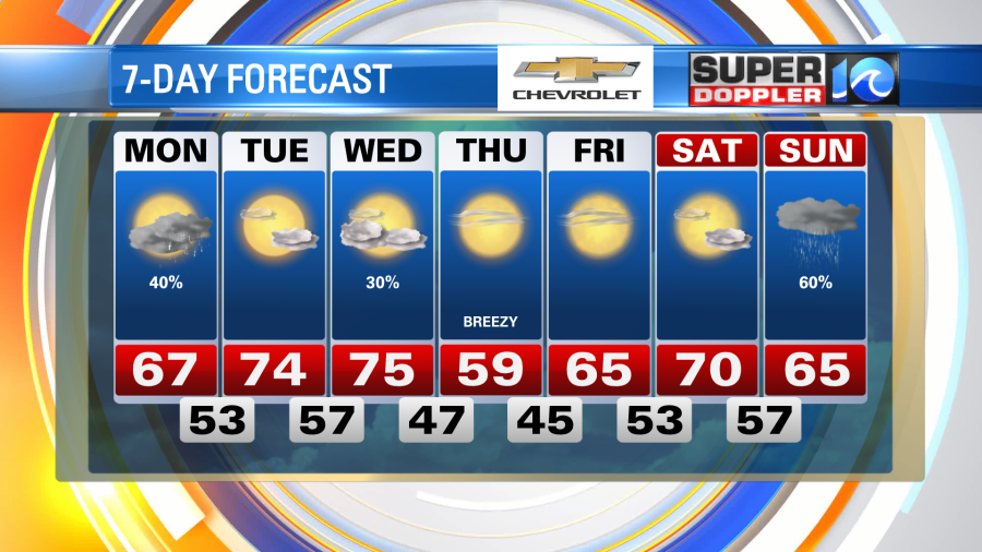
We’ve got some showers in the forecast this afternoon, so the first half of the day will remain dry. Especially this morning, where a bright sunrise gives way to plenty of blue sky. However, by about midday the clouds thicken up from the west before the showers work into the area. Temperatures by then should be in the 60s, which will be our highs for the day.
The showers will be scattered in nature and will take us into the afternoon hours. It’s then, around the afternoon commute, that some downpours and a few thunderstorms are possible. We do have a level 1 (out of 5) risk for severe weather, meaning that some of these showers may just pack a punch. By sunset these will be moving offshore and we’ll get some clearing.
Clearing skies expected tonight with temperatures down into the low 50s, a few 40s inland again. A southwest breeze on Tuesday, in partnership with plenty of sun, will boost our high temperatures into the low to mid 70s. We’ll then likely do that again on Wednesday, potentially even warmer. A cold front then slides by later on Wednesday, not much rain (a few showers) is associated with this, but we’ll get a push of cooler air by Thursday.
After today’s round of precipitation, the rest of the week is looking pretty good.
Stay stoked! – Meteorologist Steve Fundaro


