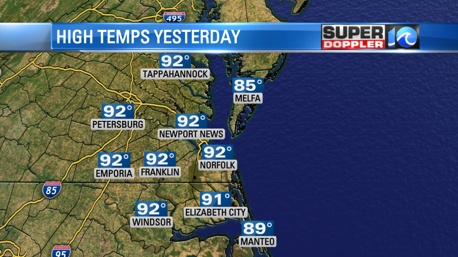
It was tough in the sun yesterday as temperatures rose to the low 90s, and the heat indices reached up to around 100 degrees.
Today we basically have the same weather pattern that we had yesterday. High pressure is offshore. A cold front is slowly sinking through the Ohio River Valley.
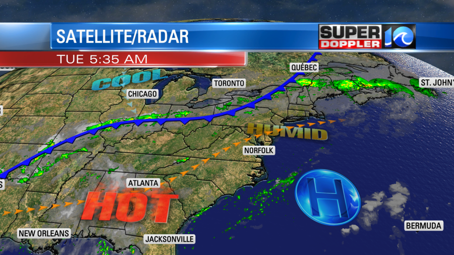
There’s a stronger and faster cold front up in the Canada that will drop down and push through our region along with the other front. That will happen Wednesday evening into Thursday. Until then….we bake.
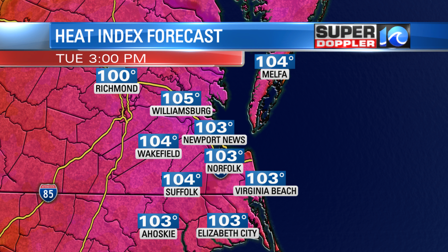
High temps today will rise to the mid 90s. The heat index will be between 99 and 104 degrees.
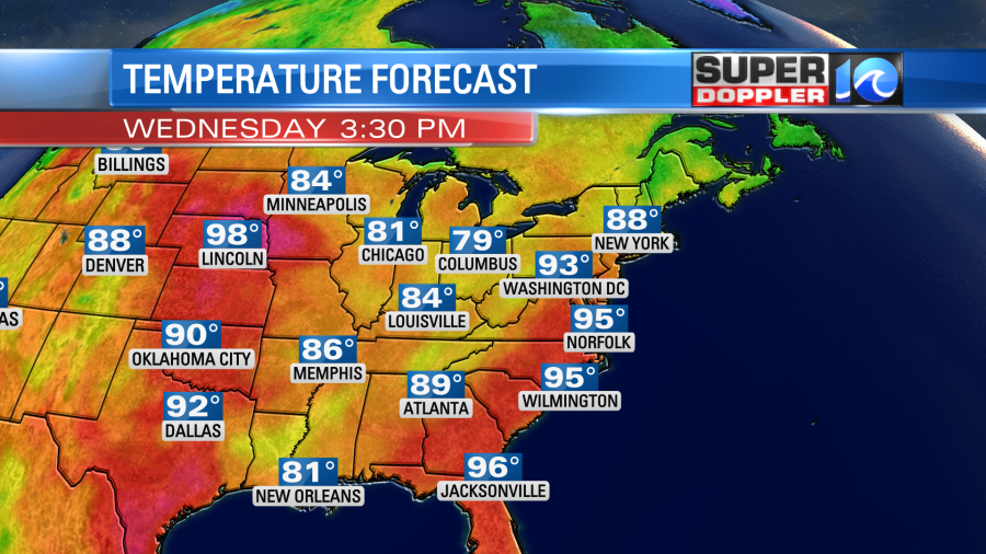
We’ll be mostly sunny then partly cloudy. There will only be some isolated showers and storms this afternoon. We’ll still be in the hot zone tomorrow as both fronts start their decent to the south. High temps will be back in the mid 90s.
We’ll have increasing clouds with a few showers and storms in the afternoon. The heat index will rise to over 100 again. As the fronts finally approach in the evening there will be a big cluster of showers and storms dropping to the south.
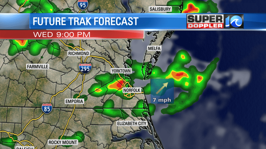
Some of these could contain some heavy downpours and gusty winds. So check back for updates on the severe potential.
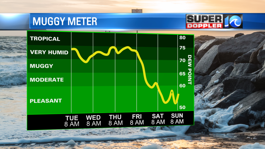
We’ll cool down on Thursday into the 80s, but we won’t dry out yet. We’ll have quite a bit of clouds with some scattered rain showers and a few storms. We will finally dry out Friday into the weekend as dew points drop to the 50s. High temps will be in the low 80s or even near 80 degrees. Nice!
The models are still advertising an excellent weather for the whole weekend. I can’t wait.
We are still watching that feature in the eastern Atlantic. As of the mid-morning the chance for formation had gone down in the long term.
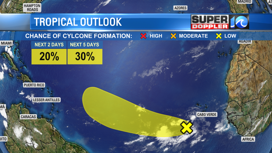
We will continue to monitor this over the next few days regardless.
Meteorologist: Jeremy Wheeler