A tricky forecast through Tuesday. A front will drop in and waver northward and southward through that time frame. To the north of the front, it’ll be in the 50s to near 60…and to the south of the front, temperatures could top out in the 70s!

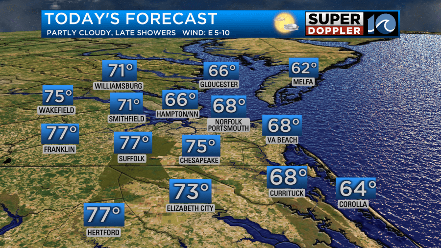
Terrific weather continues for the first part of Easter Sunday. Highs will be in the upper 60s to near 70, with a few more clouds especially late in the day. Late in the day, some showers and storms will roll into the area. Most of these will come after 4pm.
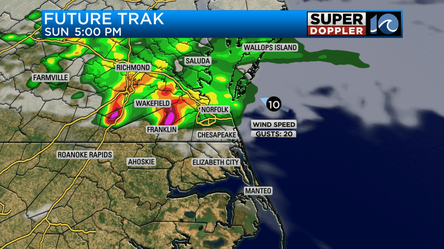
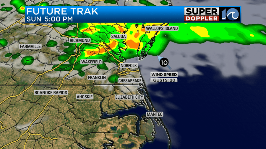
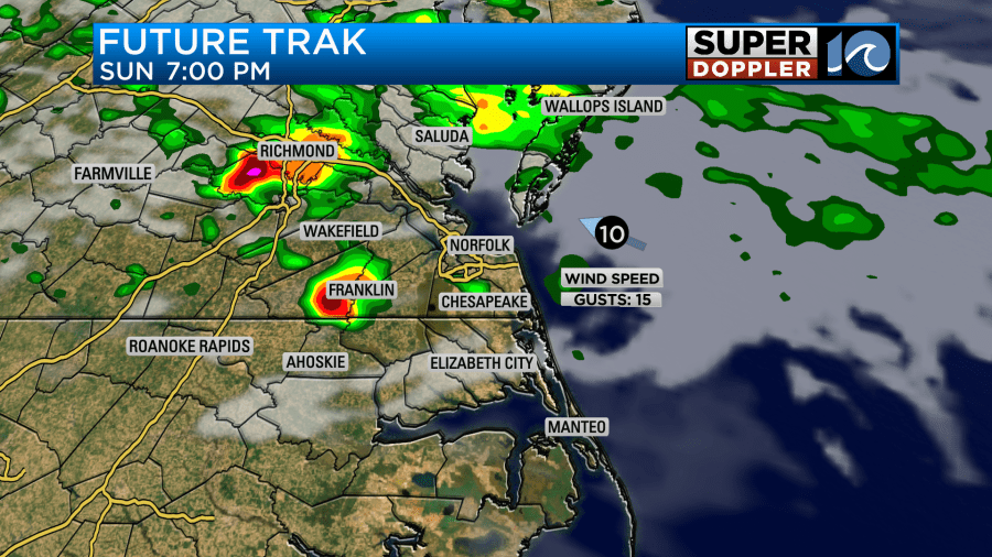
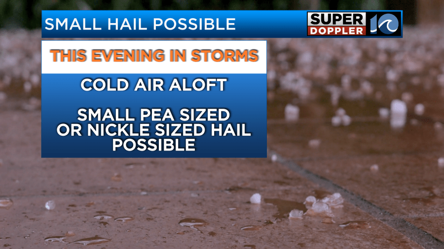
Below I’ve posted images of 3 of our main weather models we look at. You’ll notice, there’s a lot of similarities between them, but some have the storms a little further south and stronger (as they’re in the warmer air). One has storms a little later. Generally, let’s put a 4-9pm window on the storm potential. A few could have some small hail with them as they move in if they tap into that warmer air. Have our WAVY Weather app just in case an alert is issued!
More clouds and a few scattered showers and storms return to the forecast for late Monday. Highs will be near 80.
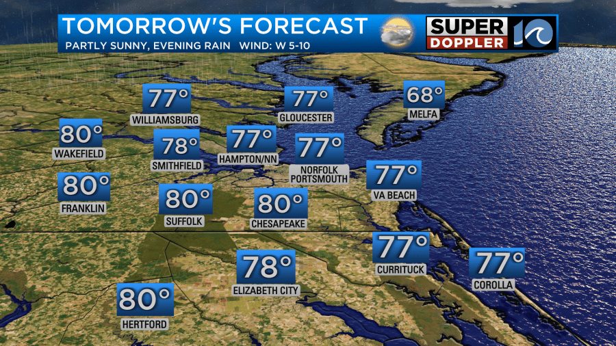
A few more showers, and maybe a t-storm will be possible Tuesday as temperatures remain in the 70s. A cold front moves into the region Wednesday with widespread rain. That cold front will bring an end to the 70s with temperatures Thursday falling back into the mid to upper 50s.
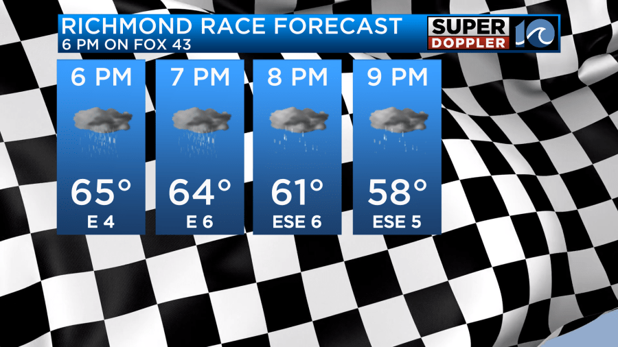
If you’re heading to the Richmond NASCAR race, you may have to contend with some rain too.
Hope you have a great Easter!
Meteorologist Ricky Matthews
Follow Ricky on Facebook and Twitter


