Overnight we had some scattered light showers and sprinkles over the region.
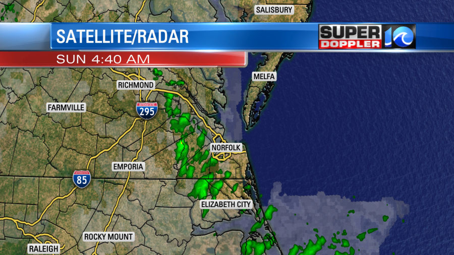
They didn’t add up to much, but they did wet the ground a bit. It only added up to a trace or a hundredth of an inch. Today we have a stationary front that is turning into a very slow moving warm front. High pressure is offshore.
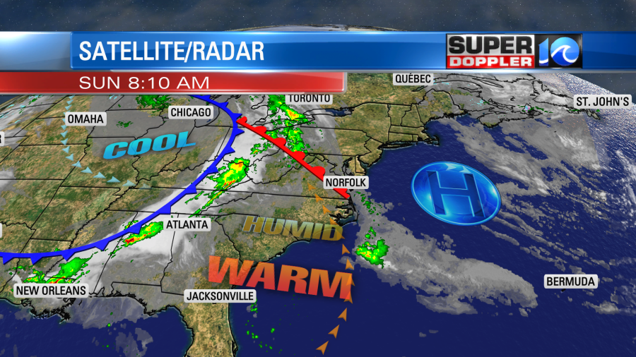
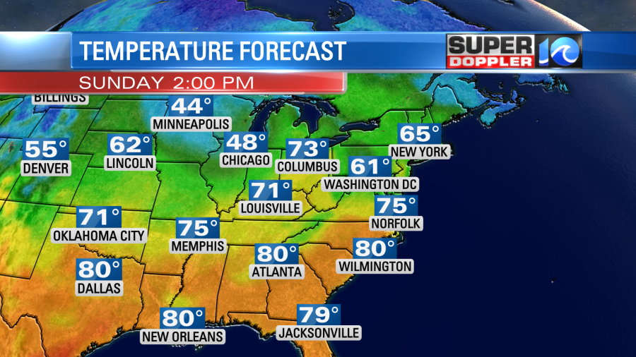
The slow-moving front will create some isolated/spotty showers during the daytime. Most of them should be light. Otherwise, we’ll have a mix of sun and clouds during the day. We will warm up a little bit. High temps will be in the mid 70s.
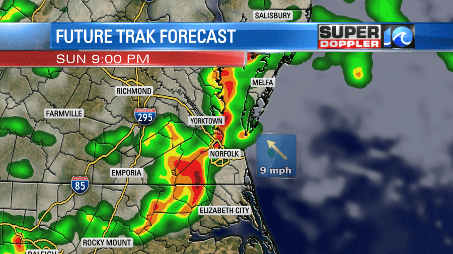
Other than the spotty showers it should be nice out for a long stretch. However, by the evening a cluster of thunderstorms are expected to move in from the west. Some of these storms could put down some heavy rain. There could be a few strong gusts of wind, but the chance for severe is low. This is due to a lack of upper level wind support. However, there will be some instability.
The storms will turn into some scattered light showers overnight. Lows will be in the low 60s.
We’ll be partly cloudy tomorrow. There will be some isolated showers later in the day. The warm front will move to our north. So high temps will rise to the low 80s. However, a cool front will move in from the west by the evening. So this will bring us a few scattered showers again with some isolated thunderstorms.
We’ll have a mix of sun and clouds on Tuesday with a few rain showers possible. Highs will be in the 70s. Then we’ll have higher chances for rain later in the week with more high temperatures in the 70s.
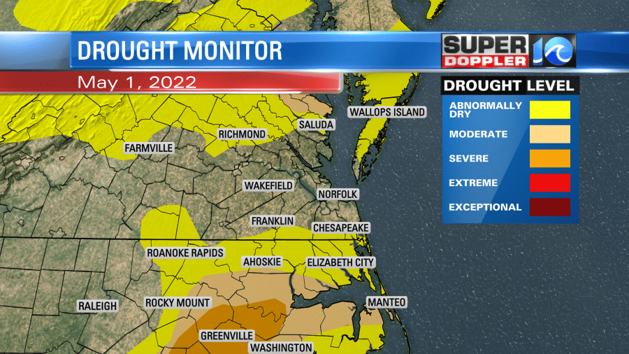
More and more of our region is in a drought.
Luckily we are going to have a few wet days ahead. We could see a half inch of rain between today and tonight (mostly tonight) with a little more possible tomorrow.
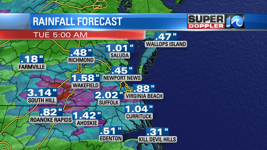
Then I’m hoping we start to get caught up later this week as the rain chances go up again. We’ll see.
Meteorologist: Jeremy Wheeler


