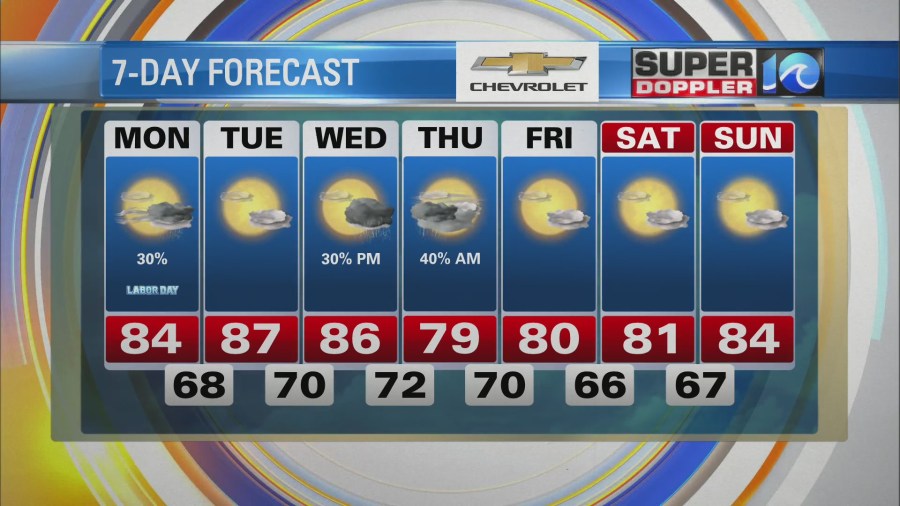
I wish I could keep the great weather going from the last couple of days. Today will be a decent day, but there will be a few rain showers. They will be coming in along with a cool front.
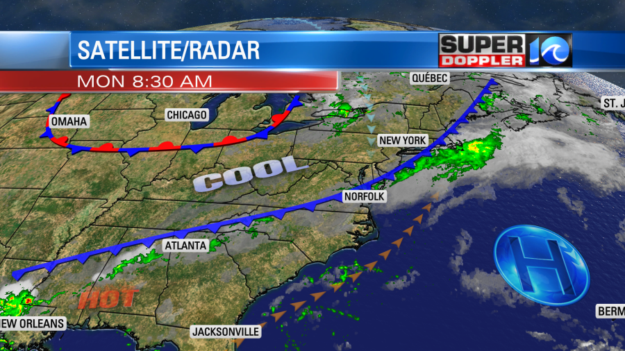
The front will slowly sink to the south through the day. Winds will turn to out of the north. It’s not going to be a washout, but a few showers will roll through the region.
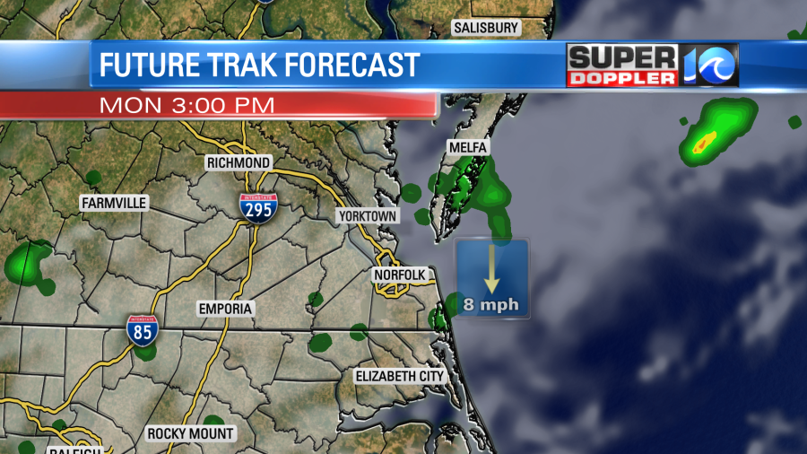
Clouds will increase this afternoon. High temps will be held down into the low-mid 80s. Humidity will be moderate. The cool down will be brief though. Tomorrow we’ll heat up to the upper 80s again. We’ll be partly cloudy with only a stray shower in the region. The weather looks ok for the kids heading back to school. Then we’ll have increasing clouds on Wednesday with some p.m. showers and storms. This will be ahead of the next cold front.
We’ll be in the mid-upper 80s on Wednesday, but we’ll drop to the upper 70s on Thursday. The rain will continue into Thursday morning, but we should dry out by Thursday afternoon. Then we’ll be dry and mild next weekend.

It’s still busy in the tropics, but nothing is threatening the East Coast. Hurricane Larry is out over the middle of the Atlantic.
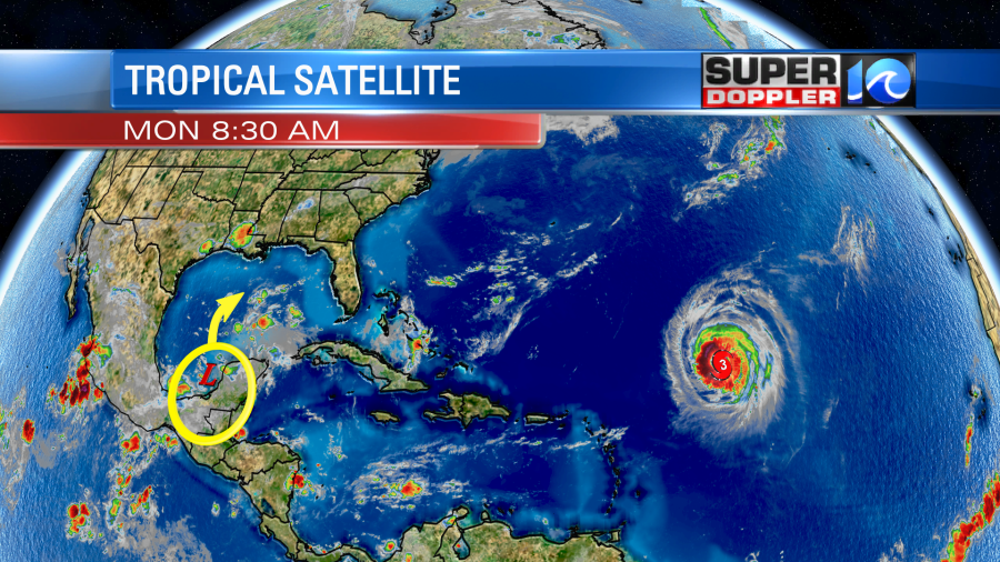
It is a major hurricane. It’s a category 3 with sustained winds around 120 mph. It is forecast to move northwest towards Bermuda. Then it is expected to turn north and stay to the east of the island. It should weaken a bit through that time. Afterward it will track north, then northeast.
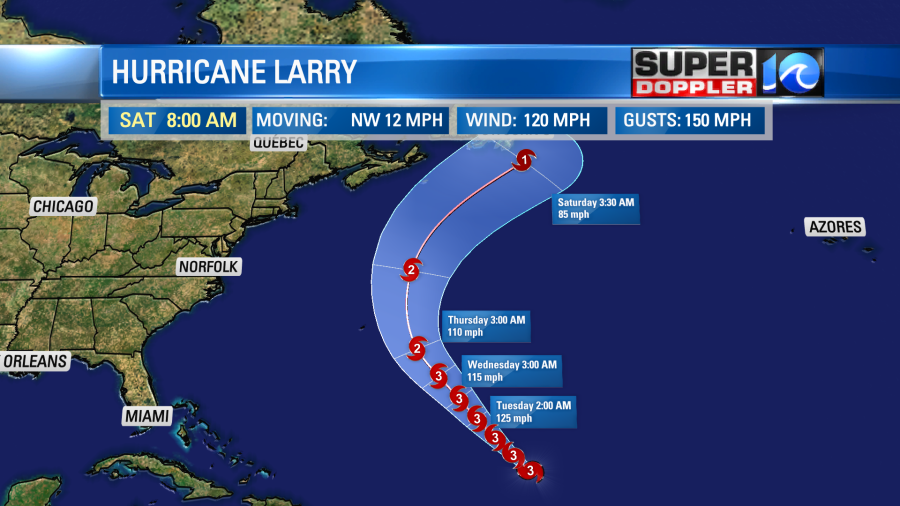
Even if Larry stays east of Bermuda I think they will still get some storm surge from the hurricane. It could also impact Newfoundland as a category 1 hurricane. Waves/swells will travel from the storm to the U.S. East Coast. Tomorrow we may already have a moderate to high threat for rip currents. It could stay high through Friday. We’ll see. It might be some great surf though for the experienced surfers.
There is also a weak disturbance near the Bay of Campeche.
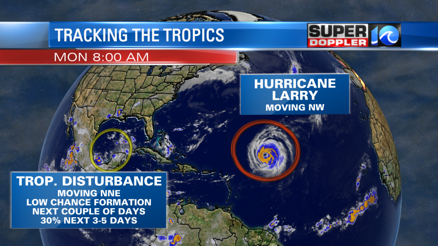
This is forecast to move generally northward. It could get organized in 3-4 days. However, some of the more recent models have the system meandering and falling apart over the Gulf Of Mexico.
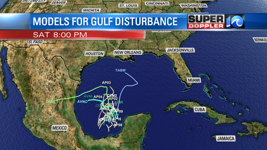
We’ll see about that. The upper level winds will become a little more favorable for development in a couple of days. Plus, the Gulf waters are also pretty warm. Let’s hope and pray that it stays away from Louisiana and Mississippi.
Meteorologist: Jeremy Wheeler
