Today started off pretty nice. We had a lot of sunshine over the region with cool temps and a light breeze.
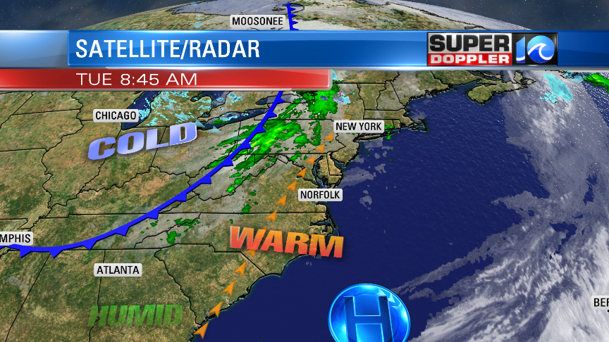
As we go through the day, we’ll warm up quite a bit. High temps will rise to the mid 70s. However, that comes at a small price. There will be a few showers and thunderstorms this afternoon, and a couple of the storms could have some strong/gusty winds. We already have a wind increasing out of the southwest. High pressure is to our southeast. A cold front is over the Appalachian Mountains moving east.
Temps will heat up as we go into the afternoon, but the humidity shouldn’t be too bad. In fact… this morning dew points were only in the 40s.
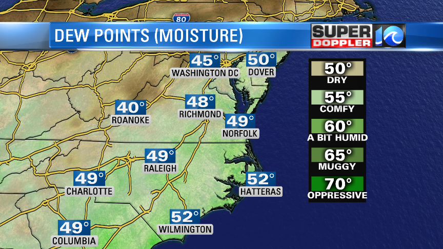
They will rise to the 50s today. However, you typically need dew points at least in the upper 50s to low 60s to get strong thunderstorms. They may make it to the upper 50s today, but we’ll see. There are some decent upper level winds (wind shear). Also, we’ll already have strong gusty winds along the ground before any storms form. They will gust up to 30mph out of the southwest over most of the region. So I think any strong storms will be pretty isolated this afternoon due to this setup. Here is what Future Trak shows for that time:
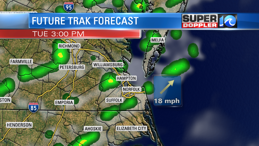
Most of the region is under a marginal risk for severe weather. Again, mainly for some strong gusty winds and isolated heavy rain showers.
By tonight the front will drop to our south. After an evening shower or storm, we’ll dry out. Low temps will drop to the 40s. Tomorrow we’ll be dry and cooler. High temps will be in the lower 60s with lots of sun through the entire day. It will be the only totally dry day this week.
On Thursday we’ll have a lot of moisture returning. Plus, we’ll have an area of low pressure moving in from the west. This will be from later Thursday into Friday morning. This will bring us a lot of rain into the region. Possibly a few thunderstorms as well. High temps will warm upper 60s on Thursday. We’ll dry out Friday afternoon with highs in the 70s. I’ll post about the weekend forecast in tomorrow’s weather blog.
Meteorologist: Jeremy Wheeler